Category:Broxburn, East Lothian
Jump to navigation
Jump to search
village in East Lothian, Scotland, UK .jpg) | |||||
| Upload media | |||||
| Instance of | |||||
|---|---|---|---|---|---|
| Location |
| ||||
 | |||||
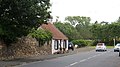
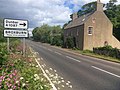
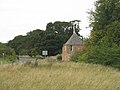
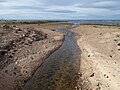
English: Broxburn is a hamlet consisting of a handful of scattered houses which serve the Broxmouth estate in East Lothian, Scotland. It is named after the creek upon which it stands, the Brox Burn. It lies about south-east of Dunbar. On the Brox Burn is Brand's Mill, dating from mediaeval times. The Battle of Dunbar, on 3 September 1650, took place on the foothills directly south, halfway between Brand's Mill and the hamlet of Little Pinkerton.
Media in category "Broxburn, East Lothian"
The following 28 files are in this category, out of 28 total.
-
 A1 Lay-by near Broxburn - geograph.org.uk - 5523154.jpg 1,024 × 683; 250 KB
-
 A1087 at Broxburn - geograph.org.uk - 5829352.jpg 640 × 426; 84 KB
-
 Approaching the A1 at Broxburn - geograph.org.uk - 2696615.jpg 1,600 × 1,367; 401 KB
-
 Brandsmill road-end near Broxburn, East Lothian - geograph.org.uk - 1850072.jpg 2,560 × 1,920; 3.38 MB
-

-

-
 Broxburn (geograph 4118535).jpg 640 × 360; 210 KB
-
 Cemetery, Broxburn - geograph.org.uk - 3007861.jpg 640 × 480; 96 KB
-
 East Coast Main Line, Broxburn - geograph.org.uk - 2423073.jpg 640 × 480; 311 KB
-
 East Lothian Architecture , Dormers At Broxburn - geograph.org.uk - 3561892.jpg 1,600 × 1,200; 353 KB
-

-

-
 East Lothian Bridges , ECML Bridge 92 near Broxburn (Dunbar) - geograph.org.uk - 2084470.jpg 2,560 × 1,920; 3.33 MB
-
 House at Broxburn (geograph 3996330).jpg 2,592 × 1,936; 1.71 MB
-
 Lodge at Broxburn - geograph.org.uk - 5886763.jpg 3,264 × 2,448; 4.3 MB
-
 Mouth of the Brox Burn - geograph.org.uk - 4876130.jpg 640 × 480; 311 KB
-
 Road junction in Broxburn - geograph.org.uk - 5189491.jpg 4,000 × 3,000; 3.18 MB
-
 Road Junction, Broxburn - geograph.org.uk - 4403464.jpg 1,066 × 800; 185 KB
-
 Roadside rubble, Broxburn - geograph.org.uk - 4859414.jpg 1,024 × 683; 318 KB
-
 Rural East Lothian , Dunbar Cemetery, Broxburn - geograph.org.uk - 3561715.jpg 1,600 × 1,200; 408 KB
-
 Rural East Lothian , Dunbar Cemetery, Broxburn - geograph.org.uk - 3561723.jpg 1,600 × 1,200; 443 KB
-
 Rural East Lothian , Dunbar Cemetery, Broxburn - geograph.org.uk - 3561734.jpg 1,200 × 1,600; 526 KB
-
 Rural East Lothian , Dunbar Cemetery, Broxburn - geograph.org.uk - 3561739.jpg 1,600 × 1,200; 414 KB
-

-

-
 Shoreline by Dunbar Links - geograph.org.uk - 4876128.jpg 640 × 480; 264 KB
-
 Signpost to Dunbar at Broxburn - geograph.org.uk - 3996399.jpg 1,936 × 2,592; 1.77 MB
-
 The Brox Burn - geograph.org.uk - 1201747.jpg 640 × 427; 132 KB


.jpg)


_(2)_-_geograph.org.uk_-_2084477.jpg)
_-_geograph.org.uk_-_2084470.jpg)


