Category:Brouwerstraat 12, Blokzijl
Jump to navigation
Jump to search
| Object location | | View all coordinates using: OpenStreetMap |
|---|
 | |||||
| Upload media | |||||
| Instance of |
| ||||
|---|---|---|---|---|---|
| Location | Blokzijl, Overijssel, Netherlands | ||||
| Street address |
| ||||
| Located on street |
| ||||
| Heritage designation |
| ||||
 | |||||
|
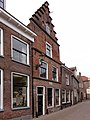
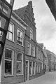
This is a category about rijksmonument number 10449
|
| Address |
|
Media in category "Brouwerstraat 12, Blokzijl"
The following 3 files are in this category, out of 3 total.
-
 Brouwerstraat 12 Blokzijl.jpg 2,736 × 3,648; 817 KB
-
 Voorgevel - Blokzijl - 20036442 - RCE.jpg 804 × 1,200; 198 KB
-
 Voorgevel - Blokzijl - 20036443 - RCE.jpg 802 × 1,200; 170 KB

