Category:Broughton Poggs
Jump to navigation
Jump to search
village in United Kingdom  | |||||
| Upload media | |||||
| Instance of | |||||
|---|---|---|---|---|---|
| Location | Filkins and Broughton Poggs, West Oxfordshire, Oxfordshire, South East England, England | ||||
| official website | |||||
 | |||||
English: Broughton Poggs is a small village in the civil parish of Filkins and Broughton Poggs in West Oxfordshire. Broughton Poggs is southwest of Carterton.
Subcategories
This category has the following 2 subcategories, out of 2 total.
B
- Broughton Poggs War Memorial (1 F)
P
Media in category "Broughton Poggs"
The following 17 files are in this category, out of 17 total.
-
 An unconverted barn - geograph.org.uk - 304614.jpg 640 × 480; 76 KB
-
 Bridleway to Holwell - geograph.org.uk - 304569.jpg 640 × 480; 124 KB
-
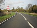 The A361 nearing Filkins - geograph.org.uk - 1606578.jpg 640 × 480; 62 KB
-
 Broughton Poggs Mill - geograph.org.uk - 304622.jpg 640 × 480; 103 KB
-
 The Five Alls, Filkins - geograph.org.uk - 147040.jpg 640 × 480; 83 KB
-
 Unmarked county boundary - geograph.org.uk - 304896.jpg 640 × 480; 96 KB
-
 Bridleway to Broadwell - geograph.org.uk - 304566.jpg 640 × 480; 124 KB
-
 Cotswold silhouette - geograph.org.uk - 294850.jpg 427 × 640; 90 KB
-
 Cottages and lane, east end of Filkins - geograph.org.uk - 304578.jpg 640 × 480; 107 KB
-
 Cottages by the Old Burford Road - geograph.org.uk - 304890.jpg 640 × 480; 121 KB
-
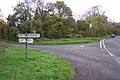 Crossroads on B4425 near Westwell - geograph.org.uk - 278546.jpg 640 × 427; 100 KB
-
 Entrance to Downs Farm, Westwell - geograph.org.uk - 278552.jpg 640 × 427; 129 KB
-
 Filkins Farm - geograph.org.uk - 304601.jpg 640 × 480; 77 KB
-
 Furzey Hall Farm Filkins Lechlade - geograph.org.uk - 311429.jpg 640 × 480; 133 KB
-

-
 Remains of a corn crop - geograph.org.uk - 304591.jpg 640 × 480; 136 KB
-
 Track opposite Filkins Farm - geograph.org.uk - 304597.jpg 640 × 480; 99 KB


