Category:Broughton, Wrexham
Jump to navigation
Jump to search
Cymraeg: Cymuned ym mwrdeisdref sirol Wrecsam yw Brychdyn (Saesneg: Broughton). Mae'n gorchuddio ardal o 469 hectar rhwng Gwersyllt a Brymbo. Roedd poblogaeth o 6,498 yn ystod cyfrifiad 2001. Mae'r gymuned yn cynnwys pentrefi Moss, Pentre Brychdyn, Brynteg, Brychdyn Newydd, Glanrafon a Caego. Daeth yn ardal diwydiannol yn ystod yr 19eg ganrif, gyda cloddio glo yn mynd ymlaen oamgylch y gymuned. Mae'r cloddio wedi dod i ben rwan, ac mae nifer o'r cyn byllau glo wedi cael eu troi'n ran o barc gwledig Dyffryn Moss.
English: Broughton is a local government community, the lowest tier of local government, part of Wrexham County Borough in Wales. It has an area of 469 hectares and had a population of 6,498 in the 2001 census, increasing to 7,454 at the 2011 Census.

community in Wrexham County Borough, Wales, UK  | |||||
| Upload media | |||||
| Pronunciation audio | |||||
|---|---|---|---|---|---|
| Instance of | |||||
| Location | Wrexham County Borough, Wales | ||||
| Population |
| ||||
| Area |
| ||||
 | |||||
Media in category "Broughton, Wrexham"
The following 73 files are in this category, out of 73 total.
-
 A couple of hectares of wild countryside - geograph.org.uk - 4978650.jpg 4,608 × 3,456; 5.97 MB
-
 A mix of new and older houses in Caego - geograph.org.uk - 4984993.jpg 4,608 × 3,456; 5.82 MB
-
 A roadside area of wild ground - geograph.org.uk - 4984908.jpg 3,264 × 2,448; 3.73 MB
-
 A483 at the bridge over the B5430 - geograph.org.uk - 2250303.jpg 640 × 480; 53 KB
-
 A483 looking north - geograph.org.uk - 3291407.jpg 640 × 480; 45 KB
-

-
 A483 near Wrexham Technology Park - geograph.org.uk - 5503535.jpg 640 × 427; 349 KB
-
 A483, Wrexham - geograph.org.uk - 5503538.jpg 640 × 480; 362 KB
-

-

-
-

-
 Brick houses, Broughton Road, Lodge near Wrexham - geograph.org.uk - 6228491.jpg 1,292 × 1,600; 399 KB
-
 Broughton Hall, New Broughton - geograph.org.uk - 5131698.jpg 800 × 522; 104 KB
-
 Broughton Road house, Lodge - geograph.org.uk - 6228567.jpg 1,268 × 1,060; 342 KB
-
 Broughton Road houses in Lodge near Wrexham - geograph.org.uk - 6228471.jpg 1,500 × 1,600; 414 KB
-
 Broughton Road houses, Moss near Wrexham - geograph.org.uk - 5854076.jpg 1,024 × 951; 124 KB
-
 Broughton Road houses, Moss near Wrexham - geograph.org.uk - 5854441.jpg 1,024 × 896; 162 KB
-
 Bryn Seion Chapel - geograph.org.uk - 6017690.jpg 4,000 × 3,000; 2.27 MB
-
 Burial ground, Capel Seion - geograph.org.uk - 6017694.jpg 4,000 × 3,000; 2.86 MB
-

-
 Cefn Road near Wrexham - geograph.org.uk - 5232736.jpg 800 × 664; 87 KB
-

-
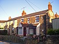
 Cottages on the High Street, Pentre Broughton - geograph.org.uk - 6017719.jpg 4,000 × 3,000; 2.4 MB
-
 Disused railway bridge on the B5101 - geograph.org.uk - 6017732.jpg 3,738 × 2,662; 3.07 MB
-
 End of the 30 zone in New Broughton - geograph.org.uk - 5131965.jpg 800 × 627; 112 KB
-

-
 Ferndale Garden Centre near Wrexham - geograph.org.uk - 5131878.jpg 800 × 651; 131 KB
-
 Fork in the road, Lodge near Wrexham - geograph.org.uk - 6228467.jpg 1,600 × 1,326; 393 KB
-

-
 Gatewen Hall, Wrexham - geograph.org.uk - 1613110.jpg 640 × 427; 68 KB
-
 Gravestones at St Paul's Churchyard, Pentre Broughton - geograph.org.uk - 6017685.jpg 4,000 × 3,000; 2.91 MB
-
 Green field in Lodge near Wrexham - geograph.org.uk - 6228528.jpg 1,600 × 1,059; 362 KB
-
 Hall in Lodge near Wrexham - geograph.org.uk - 6228413.jpg 1,600 × 1,315; 506 KB
-
 Houses on a road called Green Meadows - geograph.org.uk - 4984931.jpg 4,608 × 3,456; 5.97 MB
-
 Ideal Motors, Broughton Road, Lodge - geograph.org.uk - 6228586.jpg 1,410 × 1,209; 403 KB
-
 Jossiwan House, Broughton Road, Lodge near Brynteg - geograph.org.uk - 6228547.jpg 1,600 × 1,087; 381 KB
-

-
 Kent Road bus stop near Moss - geograph.org.uk - 5232746.jpg 800 × 560; 135 KB
-
 Kent Road houses, Moss near Wrexham - geograph.org.uk - 5853939.jpg 2,696 × 1,989; 1.46 MB
-
 Local but now closed blacksmith and farrier - geograph.org.uk - 4978638.jpg 3,264 × 2,448; 3.74 MB
-
 Lodge village boundary sign - geograph.org.uk - 6228607.jpg 1,600 × 1,211; 492 KB
-
 Lower Mill Farm - geograph.org.uk - 4984951.jpg 4,608 × 3,456; 5.69 MB
-
 Moss Valley Golf Course - geograph.org.uk - 2808820.jpg 640 × 480; 70 KB
-
 Mossvalley boating.jpg 1,280 × 960; 95 KB
-
 O2 Telecoms mast at Moss - geograph.org.uk - 6017706.jpg 4,000 × 3,000; 2.55 MB
-
 Old gravestones at Caersalem burial ground - geograph.org.uk - 6021762.jpg 4,000 × 3,000; 2.69 MB
-
 Old railway cycle track - geograph.org.uk - 4985077.jpg 3,264 × 2,448; 3.61 MB
-
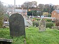
 Overgrown graveyard - geograph.org.uk - 6017696.jpg 4,000 × 3,000; 2.89 MB
-

-
 Plas Power Colliery bing - geograph.org.uk - 4978584.jpg 4,608 × 3,456; 5.94 MB
-

-
 Row of houses, New Broughton - geograph.org.uk - 5131972.jpg 798 × 800; 158 KB
-
 Saray Kebab House, Brynteg - geograph.org.uk - 6017715.jpg 4,000 × 3,000; 2.43 MB
-
 Seven-bar field gate, Broughton Road, Lodge near Wrexham - geograph.org.uk - 6228516.jpg 1,600 × 1,325; 393 KB
-
 Several relatively new houses - geograph.org.uk - 4984961.jpg 4,608 × 3,456; 5.69 MB
-

-
 Start of the 30 zone in New Broughton - geograph.org.uk - 5131961.jpg 800 × 572; 112 KB
-

-
 Street scene in Moss - geograph.org.uk - 3747186.jpg 3,648 × 2,736; 4.26 MB
-
 The all new Gatewen Village - geograph.org.uk - 4985088.jpg 3,264 × 2,448; 3.42 MB
-
 The Cross Foxes - geograph.org.uk - 6017729.jpg 3,871 × 2,903; 2.62 MB
-
 The Poplars cottages, Southsea, Wrexham - geograph.org.uk - 2729321.jpg 1,280 × 960; 1,017 KB
-

-
 Uplifted railway used as a cycle track and footpath - geograph.org.uk - 4985062.jpg 3,264 × 2,448; 3.72 MB
-
 View across to Moss and the transmitter - geograph.org.uk - 3748223.jpg 3,648 × 2,736; 4.65 MB
-

-
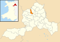 Wales Wrexham Community Broughton map.svg 512 × 362; 495 KB
-
-
 Warning sign - horse riders, Broughton Road, Lodge - geograph.org.uk - 6228596.jpg 1,600 × 1,298; 419 KB
-
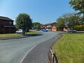
 Welcome to the Broughton Community - geograph.org.uk - 5131632.jpg 800 × 613; 136 KB
-

-


