Category:Broughton, Ryedale
Jump to navigation
Jump to search
village and civil parish in Ryedale, North Yorkshire, UK  | |||||
| Upload media | |||||
| Instance of | |||||
|---|---|---|---|---|---|
| Location | Ryedale, North Yorkshire, Yorkshire and the Humber, England | ||||
| Population |
| ||||
 | |||||
English: Broughton is a village and civil parish in the Ryedale district of North Yorkshire, north west of Malton. According to the 2001 census the parish had a population of 233.
Media in category "Broughton, Ryedale"
The following 73 files are in this category, out of 73 total.
-
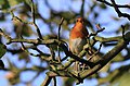 A cheery robin - geograph.org.uk - 4204584.jpg 1,024 × 674; 323 KB
-
 A64 Westbound - geograph.org.uk - 3482493.jpg 640 × 427; 94 KB
-
 All weather gallop at Musley Bank Stables - geograph.org.uk - 4082690.jpg 1,600 × 1,200; 599 KB
-
 Arable planting - geograph.org.uk - 2664051.jpg 1,024 × 768; 172 KB
-
 Balloon flight over line of oaks - geograph.org.uk - 3873288.jpg 2,000 × 1,500; 2.62 MB
-
 Benchmark on a wooden gatepost beside Braygate Street - geograph.org.uk - 4082697.jpg 1,600 × 1,200; 750 KB
-
 Black barn - geograph.org.uk - 2436742.jpg 2,048 × 1,468; 477 KB
-
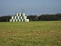 Blue bales - geograph.org.uk - 2664021.jpg 1,024 × 768; 290 KB
-
 Braygate Street - geograph.org.uk - 3482488.jpg 640 × 427; 152 KB
-
 Bridleway heading east near Broughton - geograph.org.uk - 2441017.jpg 1,600 × 1,200; 778 KB
-
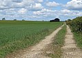
 Bridleway to Broughton - geograph.org.uk - 2663962.jpg 1,024 × 768; 266 KB
-
 Bridleway to Musley Bank - geograph.org.uk - 2663726.jpg 1,024 × 768; 459 KB
-
 Broughton Braygate - geograph.org.uk - 5916738.jpg 2,048 × 1,536; 713 KB
-
 Broughton Green Lane - geograph.org.uk - 2664046.jpg 1,024 × 768; 225 KB
-
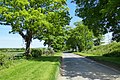
 Broughton Lane - geograph.org.uk - 3295715.jpg 1,024 × 768; 325 KB
-
 Broughton Lane - geograph.org.uk - 4082702.jpg 1,600 × 1,200; 736 KB
-
 Broughton Lane - geograph.org.uk - 6605609.jpg 640 × 480; 151 KB
-
 Broughton Lane view - geograph.org.uk - 5916737.jpg 2,048 × 1,536; 919 KB
-
 Broughton Lane, bridleway - geograph.org.uk - 3295727.jpg 781 × 1,024; 316 KB
-
 Broughton Road B1257, Broughton - geograph.org.uk - 6612541.jpg 4,857 × 3,239; 2.94 MB
-
 Broughton, Ryedale.jpg 640 × 480; 87 KB
-
 Cattle grazing in Flowery Bank - geograph.org.uk - 2664012.jpg 1,024 × 704; 304 KB
-

-
 Disused silage tower - geograph.org.uk - 2663729.jpg 800 × 600; 172 KB
-
 Elizabeth II postbox on the B1257, Broughton - geograph.org.uk - 6612535.jpg 4,360 × 3,372; 3.69 MB
-
-
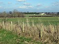
 Farm buildings, Breedycroft Lane - geograph.org.uk - 2664040.jpg 1,024 × 728; 201 KB
-
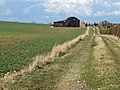 Farm track with black barn - geograph.org.uk - 3873283.jpg 2,000 × 1,500; 2.85 MB
-
 Farmland off Broughton Lane - geograph.org.uk - 3873297.jpg 2,000 × 1,500; 2.67 MB
-
 Fence line, looking towards Long Plantation - geograph.org.uk - 2663970.jpg 1,024 × 768; 327 KB
-
 Fields near Broughton - geograph.org.uk - 4163519.jpg 1,600 × 1,200; 694 KB
-
 Footpath by recently drilled field - geograph.org.uk - 4204588.jpg 1,024 × 683; 476 KB
-
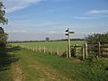 Footpath junction, Broughton Lane - geograph.org.uk - 2663994.jpg 1,024 × 768; 214 KB
-
 Gallops at Broughton Braygate - geograph.org.uk - 5924152.jpg 4,320 × 3,240; 1.86 MB
-
 Gated entrance to Broughton Green Lane - geograph.org.uk - 2664034.jpg 1,024 × 768; 294 KB
-
 Grass field and plantation, Broughton Moor - geograph.org.uk - 6164991.jpg 1,024 × 758; 222 KB
-
 Grass field and plantation, Broughton Moor - geograph.org.uk - 6164998.jpg 1,024 × 705; 136 KB
-
 Grassland at Broughton Braygate - geograph.org.uk - 5924160.jpg 4,320 × 2,525; 1.9 MB
-
 Harvest in by Long Plantation - geograph.org.uk - 3605736.jpg 1,024 × 1,024; 424 KB
-
 Head and shoulders above the rest - geograph.org.uk - 2957207.jpg 1,024 × 768; 338 KB
-
 Horse racing gallops, Braygate Street - geograph.org.uk - 2453067.jpg 1,600 × 839; 175 KB
-
 Line of oaks - geograph.org.uk - 2436747.jpg 2,048 × 1,536; 663 KB
-
 Lone tree near Plantation Farm - geograph.org.uk - 2664005.jpg 1,024 × 768; 320 KB
-
 Maiden Greve Balk - geograph.org.uk - 3662913.jpg 1,600 × 1,200; 1 MB
-
 Mare and Foal - geograph.org.uk - 1053109.jpg 640 × 480; 134 KB
-
 Minor road into Broughton - geograph.org.uk - 2441013.jpg 1,600 × 1,200; 448 KB
-
 Moor Lane - geograph.org.uk - 6164936.jpg 1,024 × 768; 318 KB
-
 Moor Lane - geograph.org.uk - 6165256.jpg 1,024 × 768; 217 KB
-
 Moorland view over Long Plantation - geograph.org.uk - 2436730.jpg 2,048 × 1,377; 326 KB
-
 Musley Bank Stables, Malton - geograph.org.uk - 4082684.jpg 1,600 × 1,200; 735 KB
-
 New Training Gallops Broughton Braygate - geograph.org.uk - 2095292.jpg 4,000 × 3,000; 2.83 MB
-
 Plantation Farm - geograph.org.uk - 2664142.jpg 800 × 523; 246 KB
-
 Poppy field near Long Plantation - geograph.org.uk - 3534272.jpg 1,600 × 1,111; 740 KB
-
 Power lines crossing a wheat field - geograph.org.uk - 3015618.jpg 1,024 × 768; 212 KB
-
 Preparation for the next crop - geograph.org.uk - 3607223.jpg 1,600 × 1,200; 673 KB
-
 Root crop - geograph.org.uk - 2663952.jpg 1,024 × 752; 356 KB
-
 Three fields from Braygate Street - geograph.org.uk - 2957214.jpg 1,024 × 768; 329 KB
-
 Track from training gallops down to Musley Bank - geograph.org.uk - 2095240.jpg 4,000 × 3,000; 2.97 MB
-
 Track on Broughton Moor - geograph.org.uk - 6163663.jpg 1,024 × 768; 321 KB
-
 Track to a barn, Broughton Moor - geograph.org.uk - 6163672.jpg 1,024 × 768; 240 KB
-
 Track to Woodhouse Farm - geograph.org.uk - 2453060.jpg 1,600 × 1,200; 460 KB
-
 Training gallops - geograph.org.uk - 2436740.jpg 2,048 × 1,536; 563 KB
-
 Training on the gallops - geograph.org.uk - 2436748.jpg 800 × 556; 82 KB
-
 Two sets of gates, Moor Lane - geograph.org.uk - 6164922.jpg 1,024 × 768; 267 KB
-
 Walkers in Long Plantation - geograph.org.uk - 2664139.jpg 566 × 800; 264 KB
-
 Well fed and watered - geograph.org.uk - 3295720.jpg 1,024 × 685; 552 KB
-
 Well-used bridleway - geograph.org.uk - 3873291.jpg 2,000 × 1,500; 2.74 MB
-
 Wheat field - geograph.org.uk - 6165017.jpg 1,024 × 735; 196 KB
-
 Wheat field and plantation near Hazel House - geograph.org.uk - 6164946.jpg 1,024 × 768; 235 KB
-
 Wheat field on Broughton Moor - geograph.org.uk - 6163668.jpg 1,024 × 768; 161 KB
-
 Wheat field, Broughton Moor - geograph.org.uk - 6165008.jpg 1,024 × 768; 223 KB
-
 Winter cereal cropfield - geograph.org.uk - 2663983.jpg 1,024 × 660; 222 KB
-
 Young wheat off Braygate Street - geograph.org.uk - 2436703.jpg 2,048 × 1,390; 494 KB


