Category:Brouch graveyard cross with 1868 chronogram
Jump to navigation
Jump to search
| Object location | | View all coordinates using: OpenStreetMap |
|---|
Media in category "Brouch graveyard cross with 1868 chronogram"
The following 2 files are in this category, out of 2 total.
-
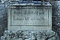 Kierfecht, Bruch (Wecker), Chronogramm.jpg 2,062 × 1,376; 2.03 MB
-
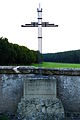 Kierfecht, Bruch (Wecker), Kruzifix mat Chronogramm.jpg 3,935 × 5,896; 9.26 MB
,_Chronogramm.jpg)
,_Kruzifix_mat_Chronogramm.jpg)