Category:Broomlee Lough
Jump to navigation
Jump to search
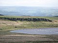
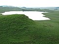
English: Broomlee Lough is a lough in the civil parish of Bardon Mill, in the county of Northumberland, England.
lake in the United Kingdom  | |||||
| Upload media | |||||
| Instance of | |||||
|---|---|---|---|---|---|
| Location | Northumberland, North East England, England | ||||
| Elevation above sea level |
| ||||
| Basin country | |||||
 | |||||
Media in category "Broomlee Lough"
The following 24 files are in this category, out of 24 total.
-
 Broomlee Lough (west) - geograph.org.uk - 2106242.jpg 640 × 480; 78 KB
-
 Broomlee Lough - geograph.org.uk - 1020178.jpg 640 × 480; 87 KB
-
 Broomlee Lough - geograph.org.uk - 2106234.jpg 640 × 480; 85 KB
-
 Broomlee Lough - geograph.org.uk - 2106318.jpg 640 × 480; 66 KB
-
 Broomlee Lough - geograph.org.uk - 3856879.jpg 1,024 × 768; 91 KB
-
 Broomlee Lough - geograph.org.uk - 3900728.jpg 1,024 × 768; 177 KB
-
 Broomlee Lough - geograph.org.uk - 4119561.jpg 4,319 × 2,056; 3.46 MB
-
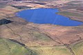 Broomlee Lough aerial.jpg 3,872 × 2,592; 7.48 MB
-

-
 Broomlee Lough from Sewingshields Crags - geograph.org.uk - 3119736.jpg 1,600 × 1,064; 288 KB
-
 Broomlee lough on Ridley common. - geograph.org.uk - 4152016.jpg 640 × 376; 36 KB
-

-
 Cattle grazing near Broomlee Lough - geograph.org.uk - 381847.jpg 640 × 480; 89 KB
-
 Dove Crag above Broomlee Lough - geograph.org.uk - 1440011.jpg 640 × 480; 65 KB
-
 Hadrian's Wall on Cuddy's Crags - geograph.org.uk - 1061918.jpg 640 × 480; 71 KB
-
 Hadrian's Wall Path on Hotbank Crags - geograph.org.uk - 1410594.jpg 640 × 480; 90 KB
-
 Hill 302 and Broomlee Lough - geograph.org.uk - 474328.jpg 640 × 480; 74 KB
-
 Housesteads Roman Fort and Broomlee Lough aerial.jpg 3,660 × 2,508; 6.29 MB
-
 Looking across Ridley Common to Broomlee Lough - geograph.org.uk - 3100613.jpg 4,198 × 2,799; 2.47 MB
-
 Moorland south of Queen's Crags - geograph.org.uk - 1439939.jpg 640 × 480; 75 KB
-
 Moorland southwest of Queen's Crags - geograph.org.uk - 1439926.jpg 640 × 480; 79 KB
-
 Roman Wall above Hotbank Crags - geograph.org.uk - 95597.jpg 640 × 480; 67 KB
-
 Sewingshields Crags - geograph.org.uk - 1061921.jpg 640 × 480; 84 KB
-

_-_geograph.org.uk_-_2106242.jpg)


