Category:Brookeborough
Jump to navigation
Jump to search
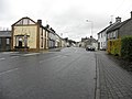
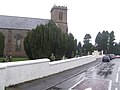
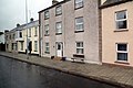
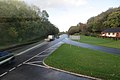
English: Brookeborough , is a village in County Fermanagh, Northern Ireland. It lies between Enniskillen and Belfast just off the A4 trunk road, approximately five miles from the County Tyrone boundary.
village in County Fermanagh, Northern Ireland, UK  | |||||
| Upload media | |||||
| Instance of | |||||
|---|---|---|---|---|---|
| Location | Northern Ireland | ||||
 | |||||
Subcategories
This category has only the following subcategory.
B
Media in category "Brookeborough"
The following 70 files are in this category, out of 70 total.
-

-
 Ardens Sed Virens Plaque - geograph.org.uk - 3224760.jpg 640 × 480; 40 KB
-
 B515 Main Street, Brookeborough - geograph.org.uk - 3224613.jpg 640 × 480; 45 KB
-
 B515, Brookeborough - geograph.org.uk - 3224671.jpg 640 × 480; 43 KB
-
 Boer War memorial, Brookeborough - geograph.org.uk - 3224681.jpg 1,920 × 2,560; 1.13 MB
-
 Boer War memorial, Brookeborough - geograph.org.uk - 3224733.jpg 640 × 480; 44 KB
-
 Breandrum Townland - geograph.org.uk - 920376.jpg 640 × 479; 56 KB
-
 Breandrum Townland - geograph.org.uk - 920379.jpg 640 × 479; 62 KB
-
 Brookeborough church - geograph.org.uk - 612561.jpg 640 × 480; 66 KB
-
 Brookeborough Co Fermanagh - geograph.org.uk - 3723572.jpg 4,000 × 2,664; 5 MB
-
 Brookeborough Co Fermanagh - geograph.org.uk - 3724694.jpg 4,000 × 2,664; 2.51 MB
-
 Brookeborough Hall, Brookeborough - geograph.org.uk - 3224749.jpg 640 × 480; 35 KB
-
 Brookeborough Orange Hall - geograph.org.uk - 3224742.jpg 640 × 480; 42 KB
-

-
 Brookeborough, County Fermanagh - geograph.org.uk - 912426.jpg 640 × 479; 50 KB
-

-
 Clock, Brookeborough Railway Station - geograph.org.uk - 3224568.jpg 640 × 480; 34 KB
-
 Clock, Lady Brooke Memorial Hall - geograph.org.uk - 3224726.jpg 640 × 480; 42 KB
-
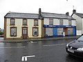
 Derelict building, Brookeborough - geograph.org.uk - 3224663.jpg 640 × 480; 44 KB
-
 Derelict buildings, Brookeborough - geograph.org.uk - 3224617.jpg 640 × 480; 50 KB
-
 Drumee Townland - geograph.org.uk - 920465.jpg 640 × 479; 56 KB
-
 Entrance gates at Moneyneddy - geograph.org.uk - 912372.jpg 640 × 479; 62 KB
-

-
 Former goods shed, Brookeborough - geograph.org.uk - 3224777.jpg 640 × 480; 51 KB
-

-
 House at Cooltrane - geograph.org.uk - 912374.jpg 640 × 479; 45 KB
-
-
 Killykeeran Townland - geograph.org.uk - 920412.jpg 640 × 479; 76 KB
-
 Liscosker Townland - geograph.org.uk - 920506.jpg 640 × 479; 51 KB
-
 Liscosker Townland - geograph.org.uk - 920509.jpg 640 × 479; 61 KB
-
 Lucy's Larder, Brookeborough - geograph.org.uk - 3224644.jpg 640 × 480; 40 KB
-
 Main Street, Brookeborough - geograph.org.uk - 3224621.jpg 640 × 480; 51 KB
-
 Main Street, Brookeborough - geograph.org.uk - 3224649.jpg 640 × 480; 59 KB
-
 Main Street, Brookeborough - geograph.org.uk - 3224771.jpg 640 × 480; 50 KB
-
 McClung Hardware, Brookeborough - geograph.org.uk - 3224596.jpg 640 × 480; 45 KB
-
 Memorial, Brookeborough - geograph.org.uk - 912430.jpg 479 × 640; 72 KB
-
 Monmurry, Brookeborough - geograph.org.uk - 912459.jpg 640 × 479; 74 KB
-
 Name plaque, Brookeborough Hall - geograph.org.uk - 3224765.jpg 1,920 × 2,560; 916 KB
-
 Near Brookeborough - geograph.org.uk - 3993711.jpg 4,000 × 2,664; 4.67 MB
-
 Northwick house, Brookeborough - geograph.org.uk - 3224685.jpg 640 × 480; 51 KB
-
 Notice board, Brookeborough Railway Station - geograph.org.uk - 3224573.jpg 1,920 × 2,560; 1.06 MB
-
 Plaque, Brookeborough Hall - geograph.org.uk - 3224704.jpg 1,920 × 2,560; 1.11 MB
-

-
 Potatoes should be dug without delay (8472155195).jpg 2,000 × 1,523; 1.26 MB
-
 Public toilets, Brookeborough - geograph.org.uk - 3224636.jpg 640 × 480; 46 KB
-
 Pump, Brookeborough - geograph.org.uk - 5407565.jpg 2,560 × 1,920; 2.07 MB
-

-
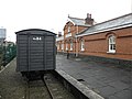
 Railway Station, Brookeborough - geograph.org.uk - 3224560.jpg 640 × 480; 37 KB
-
 Railway Station, Brookeborough - geograph.org.uk - 3224564.jpg 640 × 480; 50 KB
-
 Railway Station, Brookeborough - geograph.org.uk - 3224588.jpg 640 × 480; 48 KB
-

-
 RJ Gallagher, Butcher, Brookeborough - geograph.org.uk - 3224739.jpg 640 × 480; 50 KB
-
 Road at Monmurry - geograph.org.uk - 912461.jpg 640 × 479; 85 KB
-
 Road Junction, Tirenny - geograph.org.uk - 912473.jpg 640 × 289; 47 KB
-
 Roads at Brookeborough - geograph.org.uk - 3224607.jpg 640 × 480; 42 KB
-
 Scott's Bar, Brookeborough - geograph.org.uk - 3224744.jpg 640 × 480; 43 KB
-
 Site of Brookeborough Primary School - geograph.org.uk - 3224657.jpg 640 × 480; 101 KB
-
 Skeoge, near Brookeborough - geograph.org.uk - 912421.jpg 640 × 479; 61 KB
-
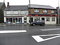
 SPAR, Brookeborough - geograph.org.uk - 3224746.jpg 640 × 480; 49 KB
-
 St Mary's RC Church, Brookeborough - geograph.org.uk - 1818390.jpg 640 × 480; 39 KB
-
 Stone seat, Brookeborough - geograph.org.uk - 3224602.jpg 640 × 480; 61 KB
-
 Tempo - Brookeborough Credit Union - geograph.org.uk - 3224674.jpg 640 × 480; 41 KB
-

-

-
 Thomas Hanna ^ Co, Brookeborough - geograph.org.uk - 3224665.jpg 640 × 480; 44 KB
-
 Tina's Touch, Brookeborough - geograph.org.uk - 3224741.jpg 640 × 480; 46 KB
-
 Tractor, Brookeborough - geograph.org.uk - 3224629.jpg 640 × 480; 54 KB
-
 Village houses, Brookeborough - geograph.org.uk - 3224639.jpg 640 × 480; 62 KB
-
 Wesleyan Chapel, Brookeborough - geograph.org.uk - 912424.jpg 640 × 479; 45 KB
-
 Brookeborough primary school - geograph.org.uk - 612563.jpg 640 × 480; 63 KB


.jpg)


