Category:Brokenborough
Jump to navigation
Jump to search
English: Brokenborough is a village and civil parish about 1.5 miles (2.4 Km) northwest of Malmesbury, Wiltshire, England.
Nederlands: Brokenborough is een dorp (village) en civil parish in de unitary authority Wiltshire, in het Engelse graafschap Wiltshire. De civil parish telt.
village and civil parish northwest of Malmesbury, Wiltshire, United Kingdom _(geograph_4085852).jpg) | |||||
| Upload media | |||||
| Instance of | |||||
|---|---|---|---|---|---|
| Location | Wiltshire, South West England, England | ||||
| Population |
| ||||
 | |||||
Subcategories
This category has the following 3 subcategories, out of 3 total.
B
W
- Whatley Manor (1 F)
Media in category "Brokenborough"
The following 95 files are in this category, out of 95 total.
-
 "Credit Crunch" mural, near Backbridge - geograph.org.uk - 5069177.jpg 4,000 × 3,000; 4.71 MB
-
 Access road to Quobwell Farm - geograph.org.uk - 5869523.jpg 1,600 × 1,333; 680 KB
-
 Ashlands Court - geograph.org.uk - 2842016.jpg 2,592 × 1,944; 2.53 MB
-
 B road between Malmesbury and Easton Grey - geograph.org.uk - 3274377.jpg 4,000 × 3,000; 2.82 MB
-
 B4040 towards Easton Grey - geograph.org.uk - 6246730.jpg 800 × 600; 101 KB
-
 B4040 towards Easton Grey - geograph.org.uk - 6246799.jpg 800 × 600; 113 KB
-
 B4040, Whitewalls - geograph.org.uk - 6246809.jpg 800 × 591; 217 KB
-
 Boakley Cliff - geograph.org.uk - 5069228.jpg 4,000 × 3,000; 4.82 MB
-
 Bridge on the Fosse Way - geograph.org.uk - 6146640.jpg 1,024 × 680; 298 KB
-
 Bridleway at Brokenborough - geograph.org.uk - 5996118.jpg 1,024 × 683; 298 KB
-
 Bridleway from Brokenborough - geograph.org.uk - 5069207.jpg 4,000 × 3,000; 4.96 MB
-
 Bridleway to Brokenborough - geograph.org.uk - 862020.jpg 426 × 640; 118 KB
-
 Brokenborough church - geograph.org.uk - 5996115.jpg 1,024 × 768; 231 KB
-

-
 Cotswold Lion Sheep - geograph.org.uk - 5996076.jpg 1,024 × 768; 272 KB
-
 Cotswold Lion Sheep - geograph.org.uk - 5996091.jpg 1,024 × 768; 255 KB
-
 Cotswold Lion Sheep - geograph.org.uk - 5996107.jpg 1,024 × 768; 255 KB
-
 Cottage, Brokenborough - geograph.org.uk - 5014206.jpg 1,752 × 1,157; 1.71 MB
-
 Cottages at Sunset Hill - geograph.org.uk - 5997645.jpg 1,024 × 768; 194 KB
-
 Cottages by the road junction - geograph.org.uk - 1747316.jpg 640 × 348; 49 KB
-
 Entering the county of Gloucestershire - geograph.org.uk - 5996130.jpg 1,024 × 683; 201 KB
-
 Entrance to Long Newnton airfield - geograph.org.uk - 4796349.jpg 800 × 531; 95 KB
-
 Entrance to the Old Airfield - geograph.org.uk - 5997649.jpg 1,024 × 768; 268 KB
-
 Farm headland track - geograph.org.uk - 5997654.jpg 1,024 × 768; 270 KB
-
 Farmland beside Roman Road, Whitewalls - geograph.org.uk - 6246802.jpg 800 × 600; 106 KB
-
 Field and hedgerow - geograph.org.uk - 6246796.jpg 800 × 600; 117 KB
-
 Field beside the Fosse Way - geograph.org.uk - 6148344.jpg 1,024 × 680; 184 KB
-
 Field entrance near Bob Hills - geograph.org.uk - 6246731.jpg 800 × 600; 125 KB
-
 Fields east of the Fosse Way - geograph.org.uk - 2505265.jpg 2,592 × 1,944; 1.49 MB
-
 Fields near Bishoper Farm - geograph.org.uk - 2842033.jpg 2,592 × 1,944; 2.26 MB
-
 Footpath crossing a field of winter cereals - geograph.org.uk - 5997670.jpg 1,024 × 768; 287 KB
-
 Footpath to Crudwell - geograph.org.uk - 5997662.jpg 1,024 × 768; 291 KB
-
 Footpath west of Malmesbury along the hedgerow - geograph.org.uk - 2334861.jpg 1,500 × 1,000; 212 KB
-
 Ford on the Fosse Way - geograph.org.uk - 6146631.jpg 1,024 × 680; 276 KB
-
 Ford on the Fosse Way - geograph.org.uk - 6146634.jpg 1,024 × 680; 291 KB
-
 Former Ford at Brokenborough - geograph.org.uk - 4891276.jpg 1,600 × 1,067; 2.23 MB
-
 Former Long Newnton Airfield - geograph.org.uk - 4796362.jpg 800 × 531; 100 KB
-
 Former Long Newnton airfield - geograph.org.uk - 4796380.jpg 800 × 531; 134 KB
-
 Former WWII building - geograph.org.uk - 4796376.jpg 1,024 × 680; 321 KB
-
 Fosse Way ford - geograph.org.uk - 2479291.jpg 3,648 × 2,736; 3.27 MB
-
 Gate to field south of Brokenborough - geograph.org.uk - 1747136.jpg 640 × 480; 99 KB
-
 Gates of Twatley Manor - geograph.org.uk - 1747041.jpg 640 × 480; 100 KB
-
 Minor road from Shipton Moyne to Malmesbury - geograph.org.uk - 5069274.jpg 4,000 × 3,000; 4.9 MB
-
 Minor road near Bob Hills - geograph.org.uk - 6246736.jpg 800 × 600; 121 KB
-
 Minor road towards Shipton Moyne - geograph.org.uk - 6246737.jpg 800 × 600; 118 KB
-
 New plantation near Ashlands Court - geograph.org.uk - 2842000.jpg 2,592 × 1,944; 2.03 MB
-
 Outbuilding at Park Lane Farm - geograph.org.uk - 2737661.jpg 1,024 × 683; 190 KB
-
 Post Office Cottage, Brokenborough - geograph.org.uk - 1383819.jpg 640 × 480; 152 KB
-
 Postbox near Brokenborough - geograph.org.uk - 1383782.jpg 480 × 640; 205 KB
-
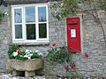 Postbox, Brokenborough - geograph.org.uk - 1383826.jpg 640 × 481; 169 KB
-
 Quobwell Cottages, near Malmesbury - geograph.org.uk - 3274365.jpg 3,948 × 2,904; 6.48 MB
-
 Road to Brokenborough - geograph.org.uk - 1747134.jpg 640 × 480; 87 KB
-
 Sign for the Red Bull Inn - geograph.org.uk - 6246741.jpg 624 × 800; 89 KB
-

-

-

-

-

-

-

-

-

-

-

-

-
 Sunset Hill cottages - geograph.org.uk - 320555.jpg 640 × 480; 55 KB
-
 Telephone box, Brokenborough - geograph.org.uk - 1384113.jpg 640 × 481; 143 KB
-
 The Fosse Way - geograph.org.uk - 2486438.jpg 2,592 × 1,944; 2.21 MB
-
 The Fosse Way - geograph.org.uk - 2486448.jpg 2,592 × 1,944; 1.73 MB
-
 The Fosse Way - geograph.org.uk - 2841992.jpg 2,592 × 1,944; 1.63 MB
-
 The Fosse Way - geograph.org.uk - 4796344.jpg 800 × 531; 154 KB
-
 The Fosse Way - geograph.org.uk - 4796366.jpg 800 × 531; 125 KB
-
 The Fosse Way - geograph.org.uk - 4797103.jpg 800 × 531; 183 KB
-
 The Fosse Way - geograph.org.uk - 6246805.jpg 800 × 527; 228 KB
-
 The Fosse Way near Brokenborough - geograph.org.uk - 6148342.jpg 1,024 × 680; 273 KB
-
 The Fosse Way, Long Newnton - geograph.org.uk - 4796347.jpg 800 × 531; 127 KB
-
 The Horse Guards - geograph.org.uk - 5069340.jpg 4,000 × 3,000; 4.76 MB
-
 The Red Bull Inn - geograph.org.uk - 4827589.jpg 640 × 480; 48 KB
-
 The Red Bull Inn - geograph.org.uk - 6246740.jpg 800 × 532; 99 KB
-
 Track off the B4040 - geograph.org.uk - 6246728.jpg 800 × 600; 140 KB
-

-
 Turning for Shipton Moyne - geograph.org.uk - 1747027.jpg 640 × 480; 92 KB
-
 Twatley Cottages - geograph.org.uk - 6246636.jpg 800 × 541; 93 KB
-
 Upper Fosse Farm - geograph.org.uk - 6602619.jpg 3,000 × 2,250; 5.63 MB
-
 Wheat field near Malmesbury - geograph.org.uk - 861789.jpg 640 × 426; 103 KB
-
 Wildflowers beside the Fosse Way - geograph.org.uk - 6149417.jpg 680 × 1,024; 187 KB
-
 Arable field with isolated trees - geograph.org.uk - 340751.jpg 640 × 480; 65 KB
-
 Ashlands Court - geograph.org.uk - 320599.jpg 640 × 480; 80 KB
-
 Farm near Brokenborough - geograph.org.uk - 302848.jpg 640 × 480; 67 KB
-
 Gilboa farm - geograph.org.uk - 320560.jpg 640 × 480; 88 KB
-
 Griffiths Barn farm - geograph.org.uk - 314791.jpg 640 × 480; 62 KB
-
 Pasture next to the River Avon - geograph.org.uk - 340767.jpg 640 × 480; 105 KB
-
 Quobwell farm - geograph.org.uk - 320552.jpg 640 × 480; 98 KB
-
 Three-storey house near Back Bridge. - geograph.org.uk - 302850.jpg 640 × 480; 106 KB
-
 Twatley Cottages - geograph.org.uk - 294023.jpg 640 × 427; 88 KB


_-_geograph.org.uk_-_4094351.jpg)

_-_geograph.org.uk_-_4094382.jpg)
_-_geograph.org.uk_-_4094386.jpg)
_-_geograph.org.uk_-_4094387.jpg)
_-_geograph.org.uk_-_4094396.jpg)
_-_geograph.org.uk_-_4094401.jpg)
_-_geograph.org.uk_-_4094403.jpg)


