Category:Brockhampton (near Ross-on-Wye)
Jump to navigation
Jump to search
village and civil parish south of Hereford in Herefordshire, England  Eglwys yr Holl Saint, Brockhampton | |||||
| Upload media | |||||
| Instance of | |||||
|---|---|---|---|---|---|
| Location | Herefordshire, West Midlands, England | ||||
| Population |
| ||||
| Different from | |||||
 | |||||
English: Brockhampton is a village and civil parish in Herefordshire, England. The village is near the River Wye, south west of Ledbury. The Wye Valley Walk passes through Brockhampton. The parish forms part of the Old Gore Ward of Herefordshire Council.
Cymraeg: Pentref yn Swydd Henffordd, Gorllewin Canolbarth Lloegr, Lloegr ydy Brockhampton (near Ross-on-Wye). (→Brockhampton-by-Ross)
Polski: Brockhampton – wieś i civil parish w Anglii, w hrabstwie Herefordshire. Leży 13 km na południowy wschód od miasta Hereford i 178 km na zachód od Londynu. W 2011 roku civil parish liczyła 229 mieszkańców. Brockhampton jest wspomniana w Domesday Book (1086) jako Caplefore. (→Brockhampton-by-Ross)

Subcategories
This category has the following 3 subcategories, out of 3 total.
Media in category "Brockhampton (near Ross-on-Wye)"
The following 200 files are in this category, out of 272 total.
(previous page) (next page)-

-

-
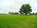
 A vicious hill - geograph.org.uk - 6600384.jpg 480 × 640; 104 KB
-
 Access road to Brockhampton Cricket Club - geograph.org.uk - 4760994.jpg 800 × 590; 186 KB
-
 Access road to Brockhampton Cricket Club - geograph.org.uk - 5034807.jpg 800 × 600; 220 KB
-
 An arable square, 1 - geograph.org.uk - 5973581.jpg 640 × 360; 90 KB
-
 An arable square, 2 - geograph.org.uk - 5973601.jpg 640 × 360; 135 KB
-
 An attractive corner in Brockhampton - geograph.org.uk - 1185755.jpg 640 × 480; 140 KB
-
 Approaching Fawley Court - geograph.org.uk - 3423857.jpg 1,024 × 768; 187 KB
-
 Arable land at Brockhampton - geograph.org.uk - 3521589.jpg 1,024 × 680; 320 KB
-
 Barn at Camp Farm - geograph.org.uk - 5948700.jpg 4,896 × 3,264; 5.86 MB
-
 Barn conversion at Brockhampton - geograph.org.uk - 1434637.jpg 640 × 426; 65 KB
-
 Bench at the viewpoint - geograph.org.uk - 3022057.jpg 640 × 480; 142 KB
-
 Black and white cottage, Brockhampton - geograph.org.uk - 5034706.jpg 793 × 800; 244 KB
-
 Blue crop near Capler Camp - geograph.org.uk - 548292.jpg 640 × 480; 107 KB
-
 Brand Oak - geograph.org.uk - 5539274.jpg 1,600 × 1,600; 1.23 MB
-
 Brand Oak - geograph.org.uk - 859192.jpg 640 × 480; 74 KB
-

-
 Brockhampton Court - geograph.org.uk - 548336.jpg 640 × 480; 90 KB
-
 Brockhampton Court Care Home - geograph.org.uk - 1187426.jpg 640 × 480; 134 KB
-
 Brockhampton field between two woods - geograph.org.uk - 5034786.jpg 800 × 560; 118 KB
-
 Brockhampton Llama - geograph.org.uk - 1423445.jpg 640 × 426; 87 KB
-
 Brockhampton Llama - geograph.org.uk - 1423448.jpg 426 × 640; 54 KB
-
 Brockhampton Offices - geograph.org.uk - 4677468.jpg 800 × 618; 140 KB
-
 Brockhampton Parish Hall - geograph.org.uk - 3022043.jpg 640 × 480; 87 KB
-
 Brockhampton Parish Hall - geograph.org.uk - 4677263.jpg 800 × 580; 107 KB
-
 Brockhampton Parish Hall built 1921 - geograph.org.uk - 1434641.jpg 640 × 426; 64 KB
-
 Brockhampton Parish Hall car park - geograph.org.uk - 4677318.jpg 800 × 496; 91 KB
-
 Brockhampton Parish Hall sign - geograph.org.uk - 1185780.jpg 640 × 480; 54 KB
-
 Brockhampton Village Hall - geograph.org.uk - 1311577.jpg 640 × 426; 76 KB
-
 Brockhampton village notice board - geograph.org.uk - 859199.jpg 640 × 480; 123 KB
-
 BT phonebox on a Brockhampton corner - geograph.org.uk - 4760941.jpg 800 × 612; 139 KB
-
 Bull and cows in the field - geograph.org.uk - 3616272.jpg 640 × 480; 96 KB
-
 Camp Farm - geograph.org.uk - 548301.jpg 640 × 480; 126 KB
-
 Camp Farm, near Brockhampton - geograph.org.uk - 1307154.jpg 640 × 426; 88 KB
-
 Capler Camp - geograph.org.uk - 5948699.jpg 4,896 × 3,264; 5.83 MB
-
 Capler Wood picnic site - geograph.org.uk - 1434347.jpg 640 × 426; 120 KB
-
 Car park at Brockhampton - geograph.org.uk - 6600373.jpg 640 × 480; 92 KB
-

-

-
 Cattle and Chicken - geograph.org.uk - 5539271.jpg 1,600 × 1,015; 813 KB
-
 Chimney beside the River Wye - geograph.org.uk - 3021593.jpg 640 × 480; 146 KB
-
 Choice of paths, Capler Wood - geograph.org.uk - 1354462.jpg 480 × 640; 110 KB
-
 Collection of old roofing tiles - geograph.org.uk - 1355248.jpg 640 × 480; 204 KB
-
 Conversion work at Ladyridge Farm - geograph.org.uk - 1311568.jpg 640 × 426; 84 KB
-
 Converted barns - geograph.org.uk - 3022029.jpg 640 × 480; 89 KB
-
 Converted farm buildings, Brockhampton - geograph.org.uk - 3522170.jpg 1,024 × 680; 187 KB
-
 Cottage by Brinkley Hill Farm - geograph.org.uk - 6600377.jpg 640 × 480; 86 KB
-
 Cottage in Brockhampton, Herefordshire - geograph.org.uk - 3021914.jpg 640 × 480; 110 KB
-
 Cottage named Parks Pitch, Brockhampton - geograph.org.uk - 4760951.jpg 800 × 603; 114 KB
-
 Country road near King's Caple - geograph.org.uk - 5464911.jpg 640 × 480; 194 KB
-

-
 Cricket ground this way - geograph.org.uk - 1355342.jpg 640 × 480; 139 KB
-

-
 Cricket ground tractor, Brockhampton - geograph.org.uk - 4761085.jpg 800 × 549; 146 KB
-
 Cricket pavilion clock, Brockhampton - geograph.org.uk - 4761171.jpg 798 × 800; 219 KB
-
 Cricket pavilion, Brockhampton - geograph.org.uk - 4761118.jpg 800 × 610; 154 KB
-

-
 Cropfield at Ladyridge - geograph.org.uk - 1185788.jpg 640 × 433; 107 KB
-
 Dappled shade at Capler Wood - geograph.org.uk - 547557.jpg 640 × 480; 150 KB
-

-

-
 Engraved wooden post in Brockhampton - geograph.org.uk - 4761208.jpg 565 × 800; 161 KB
-
 Enjoying the cricket match, Brockhampton - geograph.org.uk - 1355397.jpg 640 × 461; 124 KB
-
 Facilities at Brockhampton Cricket Club - geograph.org.uk - 1355510.jpg 640 × 466; 109 KB
-
 Farm buildings, Ladyridge Farm - geograph.org.uk - 6600394.jpg 640 × 480; 68 KB
-
 Farm track and wheat field - geograph.org.uk - 3589359.jpg 3,696 × 2,448; 2.32 MB
-
 Farm track near Brockhampton - geograph.org.uk - 1185638.jpg 480 × 640; 115 KB
-
 Farmland above Carey Wood - geograph.org.uk - 3724761.jpg 2,592 × 1,944; 1.39 MB
-
 Farmland at Brinkley Hill Farm - geograph.org.uk - 3724754.jpg 2,592 × 1,944; 1.61 MB
-
 Farmland at Dockhill Well Farm - geograph.org.uk - 3724713.jpg 2,592 × 1,944; 1.47 MB
-
 Farmland at Warlocks - geograph.org.uk - 3724775.jpg 2,592 × 1,944; 1.58 MB
-
 Farmland near Ballingham - geograph.org.uk - 5882415.jpg 1,024 × 683; 261 KB
-
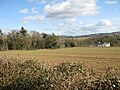
 Farmland near Brockhampton - geograph.org.uk - 3521596.jpg 1,024 × 680; 238 KB
-
 Farmland near Fawley Chapel - geograph.org.uk - 6029662.jpg 4,896 × 3,264; 4.57 MB
-
 Farmland near Fawley Chapel - geograph.org.uk - 6029668.jpg 4,896 × 3,264; 1.61 MB
-
 Farmland near Fawley Cross - geograph.org.uk - 2761460.jpg 1,024 × 680; 198 KB
-
 Field boundary - geograph.org.uk - 1186025.jpg 640 × 480; 175 KB
-
 Field edge path - geograph.org.uk - 3616278.jpg 640 × 480; 74 KB
-
 Field edge path - geograph.org.uk - 3616286.jpg 640 × 480; 67 KB
-
 Field near Fawley Court - geograph.org.uk - 6600084.jpg 640 × 480; 82 KB
-
 Field near Maythorn Farm, Brockhampton - geograph.org.uk - 5034629.jpg 800 × 493; 140 KB
-
 Field on Brinkley Hill - geograph.org.uk - 4241583.jpg 2,592 × 1,944; 1.61 MB
-
 Fluffy bulrushes - geograph.org.uk - 1187471.jpg 435 × 640; 151 KB
-
 Footpath into Capler Wood - geograph.org.uk - 6475263.jpg 1,600 × 1,200; 451 KB
-
 Footpath junction on the valley floor - geograph.org.uk - 1187321.jpg 451 × 640; 121 KB
-
 Footpath through parkland - geograph.org.uk - 859195.jpg 640 × 480; 100 KB
-
 Former school, Brockhampton - geograph.org.uk - 1185803.jpg 640 × 480; 167 KB
-
 Freshly felled trees near Brockhampton - geograph.org.uk - 548318.jpg 640 × 480; 108 KB
-
 Gate and field above Carey Wood - geograph.org.uk - 6600365.jpg 640 × 480; 111 KB
-
 Gated entrance to Brockhampton Court - geograph.org.uk - 1187423.jpg 640 × 480; 123 KB
-
 George V postbox - geograph.org.uk - 1187576.jpg 480 × 640; 125 KB
-
 Give way 50 yards ahead, Brockhampton - geograph.org.uk - 4677503.jpg 800 × 665; 129 KB
-
 Grassy bank - geograph.org.uk - 1187434.jpg 640 × 480; 151 KB
-
 Hidden building - geograph.org.uk - 6038577.jpg 1,024 × 768; 365 KB
-
 House in Falcon near Brockhampton - geograph.org.uk - 4676355.jpg 651 × 800; 170 KB
-
 House on a hilltop - geograph.org.uk - 1187315.jpg 640 × 455; 83 KB
-
 Houses on Brinkley Hill - geograph.org.uk - 1185955.jpg 640 × 480; 158 KB
-
 Howzat^ Bowled out at Brockhampton - geograph.org.uk - 1355364.jpg 640 × 347; 71 KB
-
 In Capler Wood - geograph.org.uk - 1354444.jpg 640 × 480; 167 KB
-
 Inquisitive llamas - geograph.org.uk - 1185728.jpg 640 × 454; 124 KB
-
 Into a green valley - geograph.org.uk - 1187303.jpg 640 × 480; 131 KB
-
 Into the valley - geograph.org.uk - 1423452.jpg 640 × 426; 96 KB
-
 Is this my best side^ - geograph.org.uk - 1185717.jpg 480 × 640; 58 KB
-
 Junction in Brockhampton - geograph.org.uk - 4761219.jpg 800 × 593; 113 KB
-

-
 Ladyridge - geograph.org.uk - 1185827.jpg 640 × 480; 120 KB
-

-
 Ladyridge Farm Guest House, Brockhampton - geograph.org.uk - 4677206.jpg 800 × 546; 117 KB
-
 Ladyridge from Brinkley Hill - geograph.org.uk - 1185928.jpg 640 × 480; 105 KB
-
 Ladyridge, Brinkley Hill - geograph.org.uk - 2153341.jpg 800 × 600; 423 KB
-
 Lane junction, Brockhampton - geograph.org.uk - 3796495.jpg 4,320 × 3,240; 2.91 MB
-
 Lane NNW from Ladyridge, Brockhampton - geograph.org.uk - 4677491.jpg 800 × 600; 155 KB
-
 Lane to Brockhampton - geograph.org.uk - 1449967.jpg 480 × 640; 230 KB
-
 Lane to Camp Farm - geograph.org.uk - 548304.jpg 480 × 640; 86 KB
-
 Lane to Fawley Chapel - geograph.org.uk - 919064.jpg 640 × 480; 227 KB
-
 Large field, Brockhampton - geograph.org.uk - 4677425.jpg 800 × 605; 151 KB
-
 Livestock at Brockhampton - geograph.org.uk - 5539111.jpg 1,600 × 901; 724 KB
-
 Lodge at Brockhampton - geograph.org.uk - 1311592.jpg 640 × 426; 100 KB
-
 Looking west from Fawley Lane - geograph.org.uk - 951316.jpg 640 × 480; 102 KB
-
 Maples and road near Fawley Court - geograph.org.uk - 4155590.jpg 800 × 520; 124 KB
-
 Maythorn Farm building, Brockhampton - geograph.org.uk - 4675966.jpg 800 × 588; 161 KB
-
 Maythorn Farmhouse, Brockhampton - geograph.org.uk - 5034623.jpg 800 × 643; 142 KB
-
 Much Fawley Farm - geograph.org.uk - 6029666.jpg 4,896 × 3,264; 3.57 MB
-
 Muddy path - geograph.org.uk - 3754213.jpg 800 × 450; 252 KB
-
 New gates - geograph.org.uk - 3523875.jpg 1,024 × 680; 231 KB
-

-
 No view of the river - geograph.org.uk - 6600400.jpg 640 × 480; 111 KB
-
 Notices by Ornate Lodge (Brockhampton-by-Ross) - geograph.org.uk - 5862710.jpg 3,648 × 2,736; 4.88 MB
-
 Oaks at Brockhampton - geograph.org.uk - 1355514.jpg 480 × 640; 117 KB
-
 Oat crop, Brockhampton - geograph.org.uk - 1354396.jpg 640 × 452; 153 KB
-
 Oil seed rape field near Capler Camp - geograph.org.uk - 1307144.jpg 640 × 426; 128 KB
-
 Oil seed rape near Capler Camp - geograph.org.uk - 1307141.jpg 640 × 426; 141 KB
-
 Old Barn - geograph.org.uk - 1902177.jpg 3,008 × 2,000; 1.48 MB
-
 Old barn at Camp Farm - geograph.org.uk - 3616291.jpg 640 × 480; 91 KB
-

-
 Old pavilion - geograph.org.uk - 1187629.jpg 640 × 480; 145 KB
-
 On Golden Pond - geograph.org.uk - 3754487.jpg 800 × 450; 309 KB
-
 Openreach up aloft - geograph.org.uk - 6600403.jpg 480 × 640; 92 KB
-
 Ordnance Survey Cut Mark - geograph.org.uk - 3942371.jpg 480 × 640; 127 KB
-
 Ordnance Survey Cut Mark - geograph.org.uk - 3942377.jpg 480 × 640; 136 KB
-
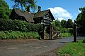
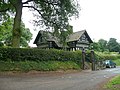
 Ornate Lodge (Brockhampton-by-Ross) - geograph.org.uk - 5861844.jpg 2,048 × 1,360; 1.33 MB
-
 Ornate Lodge (Brockhampton-by-Ross) - geograph.org.uk - 5861980.jpg 2,048 × 1,360; 1.43 MB
-
 Ornate lodge - geograph.org.uk - 859204.jpg 640 × 480; 113 KB
-

-
 Part of the Herefordshire Wye - geograph.org.uk - 3021567.jpg 640 × 480; 87 KB
-
 Part of the Wye Valley Walk - geograph.org.uk - 3021616.jpg 640 × 480; 84 KB
-
 Part of the Wye Valley Walk - geograph.org.uk - 3021642.jpg 640 × 480; 122 KB
-
 Part of the Wye Valley Walk - geograph.org.uk - 3021645.jpg 640 × 480; 130 KB
-
 Partly-harvested land at Brockhampton - geograph.org.uk - 1449968.jpg 640 × 480; 263 KB
-
 Passing Camp Farm entrance - geograph.org.uk - 1355288.jpg 640 × 480; 146 KB
-
 Path and lane junction - geograph.org.uk - 3021610.jpg 640 × 480; 87 KB
-
 Pear Trees - geograph.org.uk - 3589355.jpg 3,696 × 2,448; 2.28 MB
-
 Phonebox and postbox, Brockhampton - geograph.org.uk - 4760942.jpg 729 × 800; 133 KB
-
 Pipe replacement - geograph.org.uk - 1187386.jpg 640 × 480; 117 KB
-
 Poppies in the sunshine - geograph.org.uk - 3021637.jpg 640 × 480; 85 KB
-
 Poppy belt in wheat field - geograph.org.uk - 1355522.jpg 474 × 640; 157 KB
-
 Position of Victorian postbox - geograph.org.uk - 1187408.jpg 640 × 480; 144 KB
-
 Pre season at the cricket club - geograph.org.uk - 1187624.jpg 640 × 480; 134 KB
-
 Public footpath at Brockhampton - geograph.org.uk - 3724728.jpg 2,592 × 1,944; 1.57 MB
-
 Public footpath sign, Brockhampton - geograph.org.uk - 5034774.jpg 800 × 772; 192 KB
-

-
 Redbrick cottages beside the road - geograph.org.uk - 3021605.jpg 640 × 480; 96 KB
-
 Remains of railway bridge over the River Wye - geograph.org.uk - 5253987.jpg 2,560 × 1,920; 2.9 MB
-
 Renovations at Ladyridge Farm - geograph.org.uk - 1185774.jpg 640 × 480; 77 KB
-
 Road climbs out of the valley - geograph.org.uk - 1187309.jpg 640 × 480; 135 KB
-
 Road closed near Plastre Tump - geograph.org.uk - 1187301.jpg 640 × 480; 146 KB
-

-
 Road NNW from crossroads, Brockhampton - geograph.org.uk - 4677450.jpg 800 × 697; 125 KB
-
 Road out of Brockhampton - geograph.org.uk - 4675998.jpg 800 × 791; 258 KB
-

-
 Road to Fawley Cross - geograph.org.uk - 919069.jpg 640 × 480; 138 KB
-

-

-
 Russian dock, fruits - geograph.org.uk - 1354537.jpg 640 × 448; 88 KB
-
 Seabournes Farm - geograph.org.uk - 3754221.jpg 800 × 450; 219 KB
-
 Seabournes Farm, 2019 - geograph.org.uk - 6026354.jpg 1,600 × 901; 653 KB
-
 Section of set aside at Furlongs - geograph.org.uk - 3616284.jpg 640 × 480; 102 KB
-
 Sheep pasture east of Seabournes, 1 - geograph.org.uk - 6026355.jpg 1,600 × 901; 656 KB
-
 Sheep pasture east of Seabournes, 2 - geograph.org.uk - 6026356.jpg 1,600 × 901; 672 KB
-
 Small belt of woodland - geograph.org.uk - 1187273.jpg 640 × 480; 134 KB
-
 Small stream at Totnor, near Brockhampton - geograph.org.uk - 4241601.jpg 2,534 × 1,886; 1.28 MB
-
 Small wood near Maythorn Farm - geograph.org.uk - 1187487.jpg 640 × 480; 111 KB
-
 Solidly built cottages, Ladyridge - geograph.org.uk - 1185796.jpg 640 × 480; 131 KB
-
 South Herefordshire field, Brockhampton - geograph.org.uk - 5034752.jpg 800 × 572; 172 KB
-
 Start of footpath near Brand Oak - geograph.org.uk - 548306.jpg 640 × 480; 91 KB
-

-
 Sunlit house in Falcon near Brockhampton - geograph.org.uk - 4676359.jpg 640 × 623; 127 KB
-
 Talking tactics - geograph.org.uk - 1355501.jpg 640 × 378; 86 KB
-
 Telephone box and postbox, Brand Oak - geograph.org.uk - 1187585.jpg 640 × 480; 88 KB
-
 The Apple Store Gallery - geograph.org.uk - 548347.jpg 640 × 480; 90 KB
-
 The lane to How Caple - geograph.org.uk - 3724743.jpg 2,592 × 1,944; 1.02 MB
-
 The Parks, Brockhampton Cricket Club - geograph.org.uk - 1355384.jpg 640 × 473; 91 KB
-
 The Stables, Brockhampton - geograph.org.uk - 4761074.jpg 800 × 745; 163 KB
-
 The Wye Valley - geograph.org.uk - 1308722.jpg 640 × 426; 98 KB
-
 The Wye valley - geograph.org.uk - 5882406.jpg 1,024 × 683; 297 KB
-
 The Wye Valley from Capler Wood - geograph.org.uk - 2967524.jpg 1,350 × 898; 245 KB
-
 The Wye Valley Walk - geograph.org.uk - 2153334.jpg 800 × 600; 385 KB
-

-
 Tipi's beside the River Wye - geograph.org.uk - 3021596.jpg 640 × 480; 86 KB


_-_geograph.org.uk_-_5862710.jpg)


_-_geograph.org.uk_-_5861844.jpg)
_-_geograph.org.uk_-_5861980.jpg)


&filefrom=Tipi%27s+beside+the+Wye+-+geograph.org.uk+-+3021598.jpg#mw-category-media)