Category:Brinsworth
Jump to navigation
Jump to search
English: Brinsworth is a village and civil parish in the Metropolitan Borough of Rotherham, in South Yorkshire, England. It is situated close to the River Rother between Rotherham (to the north-east) and Sheffield (to the south-west). At the time of the 2001 census it had a population of 8,950.
Nederlands: Brinsworth is een dorp (village) en civil parish in het bestuurlijke gebied Rotherham, in het Engelse graafschap South Yorkshire. De civil parish telt
village in United Kingdom  | |||||
| Upload media | |||||
| Instance of | |||||
|---|---|---|---|---|---|
| Location | Rotherham, South Yorkshire, Yorkshire and the Humber, England | ||||
| Population |
| ||||
 | |||||
Media in category "Brinsworth"
The following 64 files are in this category, out of 64 total.
-
 "The Yorkshire Terrier" public house, Brinsworth - geograph.org.uk - 2620621.jpg 2,394 × 1,796; 874 KB
-
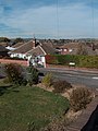
 A631 heading west - geograph.org.uk - 2808620.jpg 640 × 480; 41 KB
-
 Approaching M1 Junction 33 on Sheffield Parkway - geograph.org.uk - 2620595.jpg 1,975 × 1,482; 471 KB
-
 Aurora Sports Club, Bawtry Road, Brinsworth - geograph.org.uk - 1832119.jpg 3,000 × 2,250; 6.79 MB
-
 B6066 heading north - geograph.org.uk - 2808590.jpg 640 × 480; 69 KB
-
 Brinsworth - Yorkshire Terrier.jpg 640 × 480; 94 KB
-
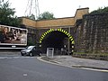 Brinsworth Railway Bridge - geograph.org.uk - 1420566.jpg 640 × 480; 77 KB
-
 Broadway - Not New York City - Brinsworth, Rotherham - geograph.org.uk - 2620609.jpg 1,952 × 2,608; 1.21 MB
-
 Effingham Street - geograph.org.uk - 464188.jpg 640 × 480; 102 KB
-
 Electricity pylons and the M1 - geograph.org.uk - 2233833.jpg 768 × 1,024; 110 KB
-
 Ellis Street, Brinsworth - geograph.org.uk - 2620615.jpg 2,608 × 1,952; 1.23 MB
-
 Framed by the towers of Tinsley. - geograph.org.uk - 546152.jpg 580 × 640; 82 KB
-
 Gas Production Site - geograph.org.uk - 121676.jpg 640 × 427; 79 KB
-
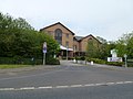 Holiday Inn, West Bawtry Road - geograph.org.uk - 3466290.jpg 640 × 480; 62 KB
-
 House on Quarry Close, Brinsworth - geograph.org.uk - 3200738.jpg 2,801 × 3,921; 3.34 MB
-
 Jubilee Cottages - geograph.org.uk - 2808619.jpg 640 × 480; 40 KB
-
 Low Bridge on the A631 - geograph.org.uk - 3577862.jpg 800 × 533; 116 KB
-
 M1 exit slip at Junction 33 - geograph.org.uk - 4279775.jpg 640 × 480; 59 KB
-
 M1 northbound at junction 33 - geograph.org.uk - 3805371.jpg 1,200 × 1,002; 229 KB
-
 M1 northbound at junction 33 - geograph.org.uk - 3805376.jpg 1,200 × 900; 272 KB
-
 M1 northbound towards junction 34 - geograph.org.uk - 3805364.jpg 1,200 × 900; 245 KB
-
 M1 south of Rotherham - geograph.org.uk - 5654329.jpg 3,264 × 1,832; 561 KB
-
 M1 southbound near Brinsworth - geograph.org.uk - 4279769.jpg 640 × 481; 36 KB
-
 M1 southbound nears Junction 33 - geograph.org.uk - 4279772.jpg 640 × 481; 37 KB
-
 Milepost on the A631 at Brinsworth - geograph.org.uk - 3200732.jpg 3,072 × 4,608; 3.32 MB
-
 Milestone, Brinsworth.jpg 1,200 × 1,600; 378 KB
-
 Motorway bridge over the B6066 - geograph.org.uk - 2808588.jpg 640 × 480; 65 KB
-
 Northbound M1 at Catcliffe - geograph.org.uk - 4838517.jpg 640 × 480; 372 KB
-
 Northbound M1 near to Catcliffe - geograph.org.uk - 4838522.jpg 640 × 427; 303 KB
-

-
 Northbound M1, Brinsworth - geograph.org.uk - 4838526.jpg 640 × 427; 293 KB
-
 Quarry Close, Brinsworth - geograph.org.uk - 3200736.jpg 640 × 427; 62 KB
-
 River Rother flood plain - geograph.org.uk - 2233843.jpg 1,024 × 768; 197 KB
-
 Road closed ahead from August 2007 - geograph.org.uk - 729142.jpg 640 × 379; 61 KB
-
 Shop on Bawtry Road - geograph.org.uk - 2808614.jpg 640 × 480; 69 KB
-
 St Andrews Walk, Brinsworth - geograph.org.uk - 3200720.jpg 3,072 × 4,608; 3.05 MB
-
 Steps leading to All Saints Church - geograph.org.uk - 464193.jpg 480 × 640; 88 KB
-
 The Fairways - geograph.org.uk - 2808623.jpg 640 × 480; 52 KB
-

-
 The M1 northbound towards junction 34 - geograph.org.uk - 3805362.jpg 1,200 × 900; 277 KB
-
 The roundabout at junction 33 M1 motorway - geograph.org.uk - 3188002.jpg 1,024 × 638; 143 KB
-

-
 Whitecroft Crescent, Brinsworth - geograph.org.uk - 2620612.jpg 2,608 × 1,952; 1.49 MB
-
 Whitehall Lane under the M1 - geograph.org.uk - 1420565.jpg 640 × 480; 53 KB
-
 Bridges over River Don on Bessemer Way - geograph.org.uk - 610167.jpg 640 × 480; 113 KB
-

-

-
 Duncan Street, Brinsworth - geograph.org.uk - 1416722.jpg 640 × 438; 75 KB
-
 Forge Island swing bridge - geograph.org.uk - 1436529.jpg 640 × 480; 80 KB
-
 Golf course crossing on Grange Lane - geograph.org.uk - 729148.jpg 640 × 480; 86 KB
-
 Halfpenny Bridge - geograph.org.uk - 610254.jpg 640 × 339; 55 KB
-
 Halfpenny Bridge over the River Don - geograph.org.uk - 610258.jpg 640 × 505; 67 KB
-

-
 Ladle as sculpture on Grange Lane - geograph.org.uk - 729131.jpg 640 × 346; 47 KB
-
 Moorgate. - geograph.org.uk - 464206.jpg 480 × 640; 80 KB
-
 Next stop Sheffield - geograph.org.uk - 610171.jpg 238 × 640; 51 KB
-
 No Bull - geograph.org.uk - 610195.jpg 640 × 480; 69 KB
-

-
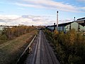 Railway to Rotherham - geograph.org.uk - 610177.jpg 640 × 480; 87 KB
-
 River Don near Rotherham - geograph.org.uk - 610179.jpg 640 × 480; 93 KB
-

-

-

-


_-_geograph.org.uk_-_4838514.jpg)


