Category:Brighton Lake, Royal Tunbridge Wells
Jump to navigation
Jump to search
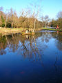
English: Brighton Lake, a man-made lake excavated in 1858 named for the nearby road which was at the time called Brighton Road.
Media in category "Brighton Lake, Royal Tunbridge Wells"
The following 14 files are in this category, out of 14 total.
-
 Brighton Lake - geograph.org.uk - 3871465.jpg 640 × 430; 121 KB
-
 Brighton Lake - geograph.org.uk - 3871469.jpg 640 × 430; 112 KB
-
 Brighton Lake - geograph.org.uk - 4013758.jpg 640 × 430; 102 KB
-
 Brighton Lake - geograph.org.uk - 4013761.jpg 640 × 430; 104 KB
-
 Brighton Lake - geograph.org.uk - 5845270.jpg 1,024 × 681; 305 KB
-
 Brighton Lake - geograph.org.uk - 6528738.jpg 1,024 × 684; 226 KB
-
 Brighton Lake - geograph.org.uk - 6528743.jpg 1,024 × 684; 214 KB
-
 Brighton Lake - geograph.org.uk - 695971.jpg 479 × 640; 105 KB
-
 Brighton Lake by Eridge Rd - geograph.org.uk - 1104302.jpg 640 × 430; 106 KB
-
 Chalybeate spring, Brighton Lake - geograph.org.uk - 4013759.jpg 640 × 430; 92 KB
-
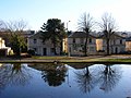 Houses, Eridge Road - geograph.org.uk - 695986.jpg 640 × 479; 106 KB
-
 Pond, Tunbridge Wells Common - geograph.org.uk - 5299983.jpg 640 × 426; 90 KB
-
 Pond, Tunbridge Wells Common - geograph.org.uk - 5299989.jpg 640 × 426; 90 KB
-
 Pond, Tunbridge Wells Common - geograph.org.uk - 5582598.jpg 640 × 426; 97 KB


