Category:Brigg
Jump to navigation
Jump to search
Svenska: Denna kategori är för orten, för fartygstypen, se Category:Brigs (ship).
market town in North Lincolnshire, England  | |||||
| Upload media | |||||
| Instance of | |||||
|---|---|---|---|---|---|
| Location | North Lincolnshire, Lincolnshire, Yorkshire and the Humber, England | ||||
| Population |
| ||||
| Different from | |||||
| Said to be the same as | Brigg (Wikimedia duplicated page, civil parish) | ||||
| official website | |||||
 | |||||
Subcategories
This category has the following 11 subcategories, out of 11 total.
B
- Bridges in Brigg (8 F)
- Brigg War Memorial (6 F)
C
- Clubs and societies in Brigg (2 F)
E
H
M
S
T
- Trees in Brigg (7 F)
Media in category "Brigg"
The following 200 files are in this category, out of 333 total.
(previous page) (next page)-
 1977 Street Party at Horstead Avenue, Brigg - geograph.org.uk - 3882500.jpg 844 × 1,024; 184 KB
-
 9 Market Place, Brigg - geograph.org.uk - 4204377.jpg 686 × 1,326; 649 KB
-
 A bridge meant to be seen, Brigg - geograph.org.uk - 3275729.jpg 1,024 × 768; 140 KB
-
 A misty M180 eastbound - geograph.org.uk - 3792182.jpg 1,600 × 978; 234 KB
-
 A pump fit for the purpose - geograph.org.uk - 3212990.jpg 427 × 640; 102 KB
-
 A view of "The Angel", Brigg - geograph.org.uk - 5295033.jpg 3,521 × 5,029; 3.62 MB
-
 A18 Bridge over New River Ancholme - geograph.org.uk - 178085.jpg 640 × 480; 112 KB
-
 Access blocked near Brigg station - geograph.org.uk - 3276094.jpg 1,024 × 768; 193 KB
-
 Access from the station to the town, Brigg - geograph.org.uk - 3275543.jpg 1,024 × 768; 134 KB
-
 Access road for industrial estate, Brigg - geograph.org.uk - 2529039.jpg 1,600 × 1,200; 597 KB
-

-
 Ancholme Internal Drainage Board Facility - geograph.org.uk - 181416.jpg 640 × 480; 134 KB
-
 Angler on the bank of the Old River Ancholme - geograph.org.uk - 3275623.jpg 1,024 × 768; 135 KB
-

-

-
 Artificial hill, Brigg Millennium Green - geograph.org.uk - 3276038.jpg 1,024 × 768; 142 KB
-

-
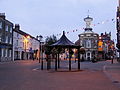
 Bandstand, Brigg market place - geograph.org.uk - 3275702.jpg 1,024 × 768; 128 KB
-
 Bell's Mill - geograph.org.uk - 2494832.jpg 768 × 1,024; 121 KB
-
 Bigby High Road (A1084) heading east out of Brigg - geograph.org.uk - 2529042.jpg 1,600 × 1,200; 442 KB
-
 Bigby Road from the level crossing - geograph.org.uk - 3848919.jpg 640 × 427; 67 KB
-
 Bigby Road level crossing - geograph.org.uk - 3848920.jpg 640 × 427; 63 KB
-

-
 Bigby Street, Brigg - geograph.org.uk - 4198307.jpg 1,600 × 1,169; 1.53 MB
-
 Boat lift, Island Carr, Brigg - geograph.org.uk - 6085555.jpg 1,024 × 768; 152 KB
-
 Boats moored on Old River Ancholme at Brigg - geograph.org.uk - 5073027.jpg 3,038 × 1,664; 2.79 MB
-
 Boats on Old River Ancholme at Brigg - geograph.org.uk - 5073020.jpg 2,521 × 1,352; 2.56 MB
-
 Bramble Way, Brigg - geograph.org.uk - 5293849.jpg 5,067 × 3,801; 4.85 MB
-
 Bridge over the Ancholme - geograph.org.uk - 2454544.jpg 640 × 454; 84 KB
-
 Bridge Street, Brigg - geograph.org.uk - 3275687.jpg 1,024 × 768; 131 KB
-
 Bridge Street, Brigg - geograph.org.uk - 3310186.jpg 1,500 × 1,120; 1.29 MB
-
 Bridge Street, Brigg - geograph.org.uk - 5072980.jpg 3,072 × 1,728; 1.1 MB
-
 Bridge Street, Brigg - geograph.org.uk - 829283.jpg 478 × 640; 84 KB
-

-
 Little Butchery, Brigg - geograph.org.uk - 1672364.jpg 1,500 × 1,125; 1.2 MB
-
 Brigg - Albert House - geograph.org.uk - 1860421.jpg 1,600 × 1,200; 481 KB
-
 Brigg - Angel on Heritage Centre - geograph.org.uk - 6334662.jpg 2,920 × 5,184; 3.25 MB
-
 Brigg - Bell's Corn Mill - geograph.org.uk - 1860428.jpg 1,200 × 1,600; 457 KB
-
 Brigg - New River Ancholme - geograph.org.uk - 5244283.jpg 640 × 556; 182 KB
-
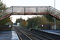
 Brigg - station footbridge - geograph.org.uk - 1860438.jpg 1,600 × 1,200; 499 KB
-
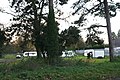 Brigg caravan field - geograph.org.uk - 3211731.jpg 640 × 427; 115 KB
-
 Brigg Cemetery - geograph.org.uk - 2528316.jpg 1,600 × 1,200; 530 KB
-
 Brigg Chicken Market - geograph.org.uk - 3211715.jpg 640 × 427; 72 KB
-
 Brigg Children's Centre, Brigg - geograph.org.uk - 5717171.jpg 1,600 × 1,065; 549 KB
-
 Brigg fire station - geograph.org.uk - 2024671.jpg 640 × 427; 239 KB
-
 Brigg Fire Station - geograph.org.uk - 231171.jpg 640 × 529; 145 KB
-
 Brigg fringes - geograph.org.uk - 2608413.jpg 1,024 × 768; 157 KB
-
 Brigg Kebab and Pizza House - geograph.org.uk - 2454538.jpg 640 × 480; 68 KB
-
 Brigg Leisure Centre - geograph.org.uk - 591521.jpg 640 × 427; 60 KB
-
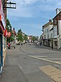
 Brigg main pedestrian precinct - geograph.org.uk - 2454547.jpg 640 × 480; 77 KB
-
 Brigg Market Place - geograph.org.uk - 2168306.jpg 800 × 600; 248 KB
-
 Brigg Market Place - geograph.org.uk - 2211556.jpg 1,024 × 768; 145 KB
-
 Brigg market place, Bridge Street - geograph.org.uk - 3212811.jpg 640 × 427; 104 KB
-
 Brigg market place, Bridge Street - geograph.org.uk - 3212815.jpg 640 × 427; 74 KB
-
 Brigg Marketplace.jpg 3,264 × 2,448; 1.57 MB
-
 Brigg Police Station - geograph.org.uk - 5717173.jpg 1,600 × 1,065; 602 KB
-
 Brigg Power Station (aerial) - geograph.org.uk - 3116976.jpg 640 × 427; 64 KB
-
-
 Brigg railway signal box - geograph.org.uk - 4699898.jpg 1,024 × 676; 110 KB
-
 Brigg Road - geograph.org.uk - 181440.jpg 640 × 480; 97 KB
-
 Brigg signal box and level crossing - geograph.org.uk - 3175018.jpg 640 × 480; 87 KB
-
 Brigg station, on a wet December afternoon - geograph.org.uk - 3275532.jpg 1,024 × 768; 136 KB
-
 Brigg Town Hall - geograph.org.uk - 6334663.jpg 5,184 × 2,920; 4.62 MB
-
 Brigg's bandstand - geograph.org.uk - 4337498.jpg 1,024 × 768; 232 KB
-
 Brown ^ Co. Auction Rooms - geograph.org.uk - 2176056.jpg 1,280 × 945; 989 KB
-
 Cadney Road - geograph.org.uk - 517874.jpg 425 × 640; 143 KB
-
 Cadney Road railway bridge - geograph.org.uk - 1585600.jpg 640 × 426; 96 KB
-
 Car park on Old Courts Road - geograph.org.uk - 861612.jpg 640 × 480; 167 KB
-
 Carr Farm access bridge over M180 - geograph.org.uk - 3521053.jpg 640 × 381; 69 KB
-
 Carr Island, Brigg - geograph.org.uk - 1132915.jpg 640 × 358; 55 KB
-
 Carr Lane - geograph.org.uk - 178008.jpg 640 × 480; 147 KB
-
 Cemetery Chapels - geograph.org.uk - 3501721.jpg 640 × 427; 91 KB
-
 Cemetery entrance lodge - geograph.org.uk - 3212793.jpg 640 × 427; 113 KB
-
 Chapel in Brigg Cemetery - geograph.org.uk - 2428894.jpg 2,256 × 1,496; 745 KB
-
 Church of St John the Evangelist, Brigg - geograph.org.uk - 6303290.jpg 1,024 × 768; 118 KB
-
 Clock Tower ^ Weather Vane, Brigg Town Hall - geograph.org.uk - 4197777.jpg 1,200 × 1,600; 1.01 MB
-
 College Yard - geograph.org.uk - 3378129.jpg 640 × 427; 106 KB
-
 College Yard, Brigg - geograph.org.uk - 3310708.jpg 1,200 × 1,600; 1.17 MB
-
 Council Offices, Bigby Street, Brigg - geograph.org.uk - 377230.jpg 640 × 385; 121 KB
-
 Council Offices, Brigg - geograph.org.uk - 2528320.jpg 1,600 × 1,200; 408 KB
-
 County Bridge to Market Place - geograph.org.uk - 3379099.jpg 640 × 427; 91 KB
-
 Courtyard houses, Brigg - geograph.org.uk - 3275575.jpg 1,024 × 768; 116 KB
-
 Crowds in Wrawby Street, Brigg.jpg 2,112 × 2,816; 1.62 MB
-
 Cut Mark, Brigg, St John's Church - geograph.org.uk - 3492388.jpg 640 × 480; 96 KB
-
 Cycle path alongside the Old River Ancholme - geograph.org.uk - 6085565.jpg 1,024 × 768; 227 KB
-
 Cycle track beside the A18 - geograph.org.uk - 2528315.jpg 1,600 × 1,200; 646 KB
-
 DDR Tobacco. Brigg Navy Cut . 1989 (3121409707).jpg 2,436 × 1,770; 331 KB
-
 Dedicatory Plaque - Brigg Grammar School - geograph.org.uk - 2283803.jpg 1,028 × 1,280; 1.27 MB
-
 Derelict House - geograph.org.uk - 2494825.jpg 1,024 × 768; 166 KB
-
 Diverted footpath to Pepperdale - geograph.org.uk - 3009380.jpg 1,024 × 768; 284 KB
-
 Doorway, Sir John Nelthorpe School, Brigg - geograph.org.uk - 2244301.jpg 818 × 1,280; 1.19 MB
-
 Drain east of Brigg - geograph.org.uk - 4960422.jpg 1,024 × 768; 173 KB
-
 Dying gladiator in Brigg - geograph.org.uk - 5293737.jpg 5,076 × 3,772; 3.66 MB
-
 E II R Postbox - Brocklesby Ox, Brigg - geograph.org.uk - 1123601.jpg 640 × 583; 362 KB
-
 Early nineteenth century houses in Bigby Street - geograph.org.uk - 4768877.jpg 1,024 × 768; 135 KB
-
 Eastfield, Brigg - geograph.org.uk - 4768874.jpg 1,024 × 768; 159 KB
-
 Elwes Street - geograph.org.uk - 5017293.jpg 800 × 600; 199 KB
-
 Elwes Street at Bigby Street, Brigg - geograph.org.uk - 5650694.jpg 1,600 × 1,064; 441 KB
-
 Elwes Street, Brigg - geograph.org.uk - 5650670.jpg 1,600 × 1,064; 816 KB
-
 Elwes Street, Brigg - geograph.org.uk - 5650676.jpg 1,600 × 1,064; 702 KB
-
 Elwes Street, Brigg - geograph.org.uk - 5650679.jpg 1,600 × 1,064; 641 KB
-
 Elwes Street, Brigg - geograph.org.uk - 5650691.jpg 1,600 × 1,064; 559 KB
-
 Elwes Street, Brigg - geograph.org.uk - 6303293.jpg 1,024 × 768; 347 KB
-
 Entering Brigg - geograph.org.uk - 3919166.jpg 640 × 480; 51 KB
-

-
 Entrance to builders supply yard Brigg - geograph.org.uk - 4713024.jpg 1,024 × 604; 114 KB
-
 Ex Snooker Club - geograph.org.uk - 794344.jpg 595 × 640; 109 KB
-
 Excahange Coach House Inn, Brigg - geograph.org.uk - 5687289.jpg 5,376 × 3,024; 2.87 MB
-
 Exchange Court, Brigg, from the south - geograph.org.uk - 3276061.jpg 1,024 × 768; 114 KB
-
 Exchange Place, Brigg - geograph.org.uk - 1762814.jpg 750 × 1,000; 542 KB
-
 Exchange Place, Brigg - geograph.org.uk - 3309930.jpg 1,120 × 1,500; 1.18 MB
-
 Exchange Place, Brigg - geograph.org.uk - 861662.jpg 480 × 640; 180 KB
-
 Farm access bridge over M180 motorway near Brigg - geograph.org.uk - 4635415.jpg 1,024 × 626; 101 KB
-
 Farmland near Brigg - geograph.org.uk - 2528313.jpg 1,600 × 1,200; 683 KB
-

-
 Feeding the Ducks from County Bridge, Brigg - geograph.org.uk - 2244281.jpg 1,280 × 1,061; 1.33 MB
-
 Field with Horses - geograph.org.uk - 1123520.jpg 640 × 426; 311 KB
-
 Fire Station on Barnard Avenue, Brigg - geograph.org.uk - 5809970.jpg 1,600 × 1,065; 461 KB
-
 Flats on Ancholme Gardens, Brigg - geograph.org.uk - 5650681.jpg 1,600 × 1,064; 577 KB
-
 Flytipping on Grammar School Lane, Brigg - geograph.org.uk - 5717150.jpg 1,065 × 1,600; 732 KB
-

-
 Footbridge over a drain - geograph.org.uk - 4960269.jpg 1,024 × 768; 152 KB
-
 Footpath through a wheatfield - geograph.org.uk - 4960273.jpg 1,024 × 768; 170 KB
-
 Footpath to Atherton Way - geograph.org.uk - 6085356.jpg 1,024 × 768; 213 KB
-
 Footpath to the town centre - geograph.org.uk - 2494850.jpg 1,024 × 768; 177 KB
-
 Footpath to Wrawby and Kettleby - geograph.org.uk - 4960286.jpg 1,024 × 768; 180 KB
-

-
 Fuel station in Bridge Street, Brigg - geograph.org.uk - 4752062.jpg 640 × 480; 76 KB
-
 Garden Street, Brigg - geograph.org.uk - 2498774.jpg 1,024 × 768; 205 KB
-
 Glanford Bridge - geograph.org.uk - 6085281.jpg 1,024 × 768; 183 KB
-
 Grammar School Lane - geograph.org.uk - 2608408.jpg 1,024 × 768; 175 KB
-
 Grammar School Lane Bridge, M180 - geograph.org.uk - 5355753.jpg 640 × 426; 43 KB
-
 Grammar School Lane goes over the M180, Brigg - geograph.org.uk - 5717144.jpg 1,600 × 1,065; 640 KB
-
 Grammar School Lane, Brigg - geograph.org.uk - 5717154.jpg 1,600 × 1,065; 466 KB
-
 Grammar School Lane, Brigg - geograph.org.uk - 5717158.jpg 1,600 × 1,065; 476 KB
-
 Grammar School Lane, Brigg - geograph.org.uk - 5717161.jpg 1,600 × 1,065; 689 KB
-
 Grammar School Road South, Brigg - geograph.org.uk - 2168173.jpg 800 × 600; 270 KB
-
 Grammar School Road, Brigg - geograph.org.uk - 2176038.jpg 1,280 × 1,038; 1.42 MB
-
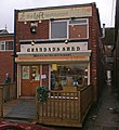 Grandad's Shed - Brigg's Bistro Restaurant - geograph.org.uk - 2504435.jpg 1,280 × 1,393; 1.3 MB
-
 Grazing land, Pingley Farm - geograph.org.uk - 2529049.jpg 1,600 × 1,200; 386 KB
-
 Hardy anglers along the Old River Ancholme - geograph.org.uk - 3275645.jpg 1,024 × 768; 131 KB
-
 Health Place - geograph.org.uk - 3501725.jpg 640 × 427; 78 KB
-

-
 Houses beside Old River Ancholme - geograph.org.uk - 2529033.jpg 640 × 480; 106 KB
-
 Houses on Bigby Street, Brigg - geograph.org.uk - 4198312.jpg 1,381 × 1,600; 1.64 MB
-
 Humberside South.jpg 1,183 × 796; 237 KB
-
 In Brigg town centre looking to Wrawby Street - geograph.org.uk - 5293731.jpg 3,801 × 5,067; 3.49 MB
-
 Industrial units, Brigg - geograph.org.uk - 2529037.jpg 1,600 × 1,200; 520 KB
-
 Island Carr Marina - geograph.org.uk - 178272.jpg 640 × 480; 135 KB
-
 Junction of Cary Lane and A18 - geograph.org.uk - 2454556.jpg 640 × 419; 70 KB
-

-
 Lord Nelson, Market Place, Brigg - geograph.org.uk - 861657.jpg 640 × 480; 180 KB
-
 Lot No. 230 - geograph.org.uk - 542408.jpg 640 × 474; 134 KB
-
 M180 at Marker 34.1 - geograph.org.uk - 3792178.jpg 1,600 × 1,011; 319 KB
-
 M180 Bridge over New River Ancholme - geograph.org.uk - 178093.jpg 640 × 480; 112 KB
-
 M180 heading West - geograph.org.uk - 4789968.jpg 1,024 × 768; 93 KB
-
 M180 Motorway north of Brigg - geograph.org.uk - 5356079.jpg 3,848 × 2,172; 1.88 MB
-

-
 M180 north of Brigg - geograph.org.uk - 2428914.jpg 2,256 × 1,496; 755 KB
-
 Market Day in Brigg - geograph.org.uk - 2354764.jpg 1,280 × 960; 1.15 MB
-
 Market Day in Brigg - geograph.org.uk - 2354785.jpg 1,280 × 1,089; 1.27 MB
-
 Market Place - geograph.org.uk - 3378848.jpg 640 × 427; 94 KB
-
 Market Place, Brigg - geograph.org.uk - 861651.jpg 640 × 480; 194 KB
-
 Market Place, Brigg in 1987 - geograph.org.uk - 2733522.jpg 1,110 × 750; 158 KB
-
 Market Place, Brigg.jpg 640 × 480; 104 KB
-
 Market Stall, Brigg - geograph.org.uk - 1690338.jpg 1,500 × 1,125; 1.36 MB
-
 Medieval emerald ring.jpg 808 × 531; 142 KB
-
 Mill Lane Railway Bridge, Brigg - geograph.org.uk - 1123485.jpg 640 × 418; 346 KB
-
 Mill Lane, Brigg - geograph.org.uk - 1123463.jpg 425 × 640; 99 KB
-
 Mill Lane, Brigg - geograph.org.uk - 1123474.jpg 425 × 640; 95 KB
-
 Mill Lane, Brigg - geograph.org.uk - 1123540.jpg 640 × 411; 298 KB
-
 Mill View Caravan Park, Brigg - geograph.org.uk - 1125653.jpg 640 × 426; 416 KB
-
 Mill View Caravan Park, Brigg - geograph.org.uk - 1125659.jpg 640 × 426; 289 KB
-
 Mooring on the Old River Ancholme - geograph.org.uk - 6085385.jpg 1,024 × 768; 217 KB
-
 Moorings on the Old River Ancholme - geograph.org.uk - 5017301.jpg 800 × 600; 127 KB
-
 Moorings on the Old River Ancholme - geograph.org.uk - 5017305.jpg 800 × 600; 97 KB
-
 Motorway Blight - geograph.org.uk - 164543.jpg 640 × 426; 98 KB
-
 Nelthorpe Arms - geograph.org.uk - 5651076.jpg 1,600 × 1,064; 575 KB
-
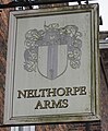 Nelthorpe Arms - geograph.org.uk - 5651078.jpg 1,317 × 1,600; 703 KB
-
 New River Ancholme - geograph.org.uk - 178264.jpg 640 × 480; 115 KB
-
 New River Ancholme near Brigg - geograph.org.uk - 5244280.jpg 640 × 480; 163 KB
-
 No 7 Market Place, Brigg (geograph 6085606).jpg 1,024 × 768; 219 KB
-
 No. 5 Bridge Street, Brigg - geograph.org.uk - 2347773.jpg 1,280 × 1,352; 1.33 MB
-
 Old brick building in Bigby Street - geograph.org.uk - 3213045.jpg 427 × 640; 71 KB
-
 Old Courts Car Park - geograph.org.uk - 713261.jpg 625 × 640; 139 KB
-
 Old Fire Station - geograph.org.uk - 3501745.jpg 640 × 427; 94 KB
-
 Old Mill Road - geograph.org.uk - 13696.jpg 640 × 480; 58 KB
-
 Old River Ancholme - geograph.org.uk - 1194457.jpg 640 × 426; 54 KB
-
 Old River Ancholme - geograph.org.uk - 1585604.jpg 640 × 426; 97 KB
-
 Old River Ancholme - geograph.org.uk - 1585607.jpg 640 × 426; 56 KB
-
 Old River Ancholme - geograph.org.uk - 1585800.jpg 640 × 426; 112 KB
-
 Old River Ancholme - geograph.org.uk - 250519.jpg 480 × 640; 89 KB
-
 Old River Ancholme - geograph.org.uk - 661865.jpg 640 × 478; 97 KB
-
 Old River Ancholme Bridge - geograph.org.uk - 1194452.jpg 640 × 426; 75 KB
-

-

-
 Old River Ancholme, Brigg - geograph.org.uk - 1516561.jpg 640 × 438; 190 KB
-
 Old River Ancholme, Brigg - geograph.org.uk - 2428888.jpg 2,256 × 1,496; 894 KB
-
 Old River Ancholme, Brigg - geograph.org.uk - 2529028.jpg 1,600 × 1,200; 620 KB
-
 Old River Ancholme, Brigg - geograph.org.uk - 3919171.jpg 640 × 480; 66 KB


_heading_east_out_of_Brigg_-_geograph.org.uk_-_2529042.jpg)


_-_geograph.org.uk_-_3116976.jpg)


.jpg)


_(26531825096).jpg)


_Wrawby_Road,_Brigg_-_geograph.org.uk_-_3532089.jpg)


.jpg)


