Category:Bridges in South Yorkshire
Jump to navigation
Jump to search
Ceremonial counties of England: Bedfordshire · Berkshire · Buckinghamshire · Cambridgeshire · Cheshire · Cornwall · Cumbria · Derbyshire · Devon · Dorset · Durham · East Riding of Yorkshire · East Sussex · Essex · Gloucestershire · Greater London · Greater Manchester · Hampshire · Herefordshire · Hertfordshire · Kent · Lancashire · Leicestershire · Lincolnshire · Merseyside · Norfolk · North Yorkshire · Northamptonshire · Northumberland · Nottinghamshire · Oxfordshire · Rutland · Shropshire · Somerset · South Yorkshire · Staffordshire · Suffolk · Surrey · Tyne and Wear · Warwickshire · West Midlands · West Sussex · West Yorkshire · Wiltshire · Worcestershire
City-counties: Bristol · City of London
Former historic counties: Huntingdonshire · Westmorland · Yorkshire
Other former counties:
City-counties: Bristol · City of London
Former historic counties: Huntingdonshire · Westmorland · Yorkshire
Other former counties:
Wikimedia category | |||||
| Upload media | |||||
| Instance of | |||||
|---|---|---|---|---|---|
| Category combines topics | |||||
| South Yorkshire | |||||
county of England, UK      | |||||
| Instance of |
| ||||
| Location | Yorkshire and the Humber, England | ||||
| Capital | |||||
| Inception |
| ||||
| Population |
| ||||
| Area |
| ||||
| Different from | |||||
| official website | |||||
 | |||||
Subcategories
This category has the following 12 subcategories, out of 12 total.
Media in category "Bridges in South Yorkshire"
The following 138 files are in this category, out of 138 total.
-
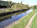 Aqueduct on Sheffield Canal - geograph.org.uk - 57507.jpg 640 × 479; 119 KB
-

-
 Bridge at the head of Broomhead Reservoir - geograph.org.uk - 720812.jpg 640 × 426; 110 KB
-
 Bridge near Hirst Priory - geograph.org.uk - 240662.jpg 640 × 427; 91 KB
-
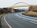 Bridge over A6195 - geograph.org.uk - 117745.jpg 640 × 480; 78 KB
-
 Bridge over Agden Dike - geograph.org.uk - 863896.jpg 640 × 480; 159 KB
-
 Bridge over Harden Clough - geograph.org.uk - 848411.jpg 640 × 415; 117 KB
-
 Bridge over North Engine Drain - geograph.org.uk - 140535.jpg 640 × 480; 120 KB
-
 Bridge over River Don - geograph.org.uk - 18745.jpg 640 × 480; 147 KB
-

-
 Bridge over the Beck - geograph.org.uk - 4465422.jpg 1,024 × 683; 338 KB
-
 Bridge over The River Dearne - geograph.org.uk - 380212.jpg 640 × 480; 145 KB
-
 Bridge over the Trans Pennine Trail - geograph.org.uk - 1531497.jpg 640 × 480; 130 KB
-
 Bridge Street Bridge, Rotherham - geograph.org.uk - 4197859.jpg 1,600 × 1,064; 570 KB
-
 Brodsworth Hall gardens (9087).jpg 4,288 × 2,848; 6.42 MB
-
 Burbage Bridge spanning the A6187 - geograph.org.uk - 687693.jpg 640 × 480; 120 KB
-
 Cable stayed bridge mast - geograph.org.uk - 683413.jpg 482 × 640; 61 KB
-
 Captioned "Swinton Bridge" and what looks like "River Berne" (3750180380).jpg 1,000 × 1,000; 148 KB
-
 CarleCotes (Brook Bridge) - geograph.org.uk - 18972.jpg 640 × 480; 89 KB
-

-
 Cinder Hill Bridge - geograph.org.uk - 833984.jpg 640 × 480; 117 KB
-
 County Bridge - geograph.org.uk - 145405.jpg 640 × 480; 162 KB
-
 Dearne Bridge - geograph.org.uk - 197470.jpg 640 × 480; 99 KB
-
 Ewden Bridge - geograph.org.uk - 122731.jpg 640 × 480; 220 KB
-
 Five Weirs Walk - geograph.org.uk - 110287.jpg 640 × 480; 95 KB
-
 Kilnhurst bridge over the River Don - geograph.org.uk - 692023.jpg 640 × 439; 162 KB
-
 Made in the Eagle foundry Sheffield - geograph.org.uk - 723991.jpg 409 × 640; 86 KB
-
 Millennium Bridge, Trans Pennine Trail - geograph.org.uk - 135485.jpg 640 × 480; 106 KB
-
 Motorway M1 Yorkshire 2007-08-13.jpg 2,592 × 1,743; 1.03 MB
-
 Narrow bridge over the A1 motorway - geograph.org.uk - 764670.jpg 640 × 480; 71 KB
-
 New Bridge Old Bridge Footbridge - geograph.org.uk - 206486.jpg 640 × 480; 92 KB
-
 Oldhay Brook. - geograph.org.uk - 143329.jpg 640 × 481; 172 KB
-
 Oughtibridge - geograph.org.uk - 638896.jpg 640 × 599; 115 KB
-
 Oughtibridge Weir - geograph.org.uk - 132898.jpg 640 × 480; 171 KB
-
 Pastures Road Bridge - geograph.org.uk - 926109.jpg 640 × 427; 100 KB
-
 Pillars of steel - geograph.org.uk - 684216.jpg 640 × 512; 96 KB
-

-
 River Don bridge at Sprotbrough and Cusworth, South Yorkshire.jpg 640 × 430; 130 KB
-
 RiverRotherJoinsRiverDon.jpg 2,272 × 1,704; 859 KB
-
 RiverSheafJoinsDonAtSheffield038.jpg 2,272 × 1,704; 883 KB
-
 Road bridge over the River Dearne. - geograph.org.uk - 557363.jpg 640 × 386; 104 KB
-
 Rossington Bridge - geograph.org.uk - 210447.jpg 640 × 480; 82 KB
-
 Rotherham - Bridge Street Bridge over Don Navigation.jpg 2,272 × 1,704; 3.07 MB
-
 Serpentine Bridge, Wentworth Castle - geograph.org.uk - 152588.jpg 640 × 480; 97 KB
-
 Sheffield - Bailey Bridge.jpg 2,272 × 1,704; 1.04 MB
-
 Site of former railway bridge (geograph 5162762).jpg 1,024 × 768; 148 KB
-
 Sprotbrough Bridge - geograph.org.uk - 116982.jpg 640 × 480; 103 KB
-
 Steel Bridge - geograph.org.uk - 206167.jpg 640 × 480; 93 KB
-
 Stocksbridge - Leisure Centre from Steel Works.jpg 2,232 × 1,652; 2.31 MB
-

-
 Swinton - Burton Ings Bridge (Geograph-2381582-by-Dave-Bevis).jpg 1,600 × 1,182; 665 KB
-

-

-
 The East Upper Burbridge bridge - geograph.org.uk - 733523.jpg 640 × 480; 100 KB
-
 The parapet of Gunthwaite Bridge - geograph.org.uk - 1056877.jpg 453 × 640; 88 KB
-
 The Trans-Pennine Trail - geograph.org.uk - 135462.jpg 480 × 640; 119 KB
-
 Topham Ferry Bridge - geograph.org.uk - 1332878.jpg 640 × 480; 83 KB
-
 Torne Bridge - geograph.org.uk - 502588.jpg 640 × 480; 118 KB
-
 Trans Pennine Trail M1 Bridge - geograph.org.uk - 889104.jpg 640 × 480; 91 KB
-
 Trans Pennine Trail West. from Penistone - geograph.org.uk - 480272.jpg 640 × 475; 162 KB
-
 Upper Burbage - Bridge View - geograph.org.uk - 750398.jpg 640 × 480; 80 KB
-
 Upper Burbage Bridge - geograph.org.uk - 1757967.jpg 640 × 480; 65 KB
-
 Who stole the bridge^ - geograph.org.uk - 553863.jpg 640 × 338; 55 KB
-
 A Bridge with track over Harden Clough - geograph.org.uk - 595710.jpg 640 × 480; 121 KB
-
 A1 motorway over Springwell Lane - geograph.org.uk - 586151.jpg 640 × 480; 89 KB
-
 Arch bridge over River Don - geograph.org.uk - 560902.jpg 640 × 480; 139 KB
-
 Archer Road Bridge - geograph.org.uk - 356485.jpg 640 × 480; 111 KB
-
 Bailey bridge - geograph.org.uk - 589106.jpg 640 × 480; 96 KB
-
 Bascule bridge at dawn - geograph.org.uk - 588904.jpg 640 × 480; 61 KB
-

-
 Bentley Moor Bridge - geograph.org.uk - 299816.jpg 640 × 480; 112 KB
-

-
 Blue bridge at Wath upon Dearne. - geograph.org.uk - 523280.jpg 574 × 477; 55 KB
-
 Bridge across the M1 to Wales - geograph.org.uk - 605524.jpg 640 × 373; 37 KB
-

-
 Bridge into Fishlake - geograph.org.uk - 512233.jpg 640 × 480; 65 KB
-

-

-
-
 Bridge over Little Don river. - geograph.org.uk - 497436.jpg 640 × 480; 156 KB
-

-

-
 Bridge over River Dearne. - geograph.org.uk - 527888.jpg 640 × 480; 92 KB
-
 Bridge over River Don into Meadowhall - geograph.org.uk - 569559.jpg 640 × 388; 90 KB
-
 Bridge over the Don. - geograph.org.uk - 784134.jpg 640 × 430; 76 KB
-
 Bridge over the Trans Pennine Trail. - geograph.org.uk - 543448.jpg 640 × 480; 183 KB
-
 Bridge over the Trans Pennine Trail. - geograph.org.uk - 543495.jpg 640 × 480; 174 KB
-
 Bridge over Trans Pennine Trail. - geograph.org.uk - 536064.jpg 640 × 430; 143 KB
-

-
 Bridge, Crookland Wood - geograph.org.uk - 535384.jpg 640 × 480; 124 KB
-
 Bridges over River Don on Bessemer Way - geograph.org.uk - 610167.jpg 640 × 480; 113 KB
-
 Bridges over the M1 going North. - geograph.org.uk - 545040.jpg 640 × 250; 51 KB
-
 Brook House Bridge - geograph.org.uk - 596719.jpg 640 × 480; 122 KB
-
 Brookhouse Bridge with frosted walls - geograph.org.uk - 635439.jpg 640 × 480; 109 KB
-
 Brown Bailey Bridge - geograph.org.uk - 547713.jpg 640 × 480; 108 KB
-
 Burying Lane crossing Harley Dike - geograph.org.uk - 1431545.jpg 640 × 480; 110 KB
-

-
 Cutthroat Bridge - geograph.org.uk - 589355.jpg 640 × 427; 285 KB
-
 Danger weak bridge. - geograph.org.uk - 539886.jpg 640 × 344; 99 KB
-

-

-
-

-
 Downtown Chapeltown - geograph.org.uk - 552819.jpg 640 × 613; 140 KB
-
 Dragon Bridge - geograph.org.uk - 718649.jpg 640 × 480; 115 KB
-
 Dragon Bridge ^ 2 - geograph.org.uk - 718714.jpg 640 × 480; 110 KB
-
 Graffiti bridge. - geograph.org.uk - 548792.jpg 640 × 480; 189 KB
-
 Halfpenny Bridge - geograph.org.uk - 610254.jpg 640 × 339; 55 KB
-
 Halfpenny Bridge over the River Don - geograph.org.uk - 610258.jpg 640 × 505; 67 KB
-

-

-
 Hillfoot Bridge, Neepsend, Sheffield - geograph.org.uk - 1122560.jpg 640 × 480; 97 KB
-

-
 Kettlebridge Road, Attercliffe - geograph.org.uk - 347565.jpg 640 × 428; 81 KB
-
 Lady Pitt's Bridge - geograph.org.uk - 656401.jpg 640 × 480; 68 KB
-
 Looking east to Brookhouse Bridge - geograph.org.uk - 647910.jpg 640 × 480; 122 KB
-
 M1 motorway bridges - geograph.org.uk - 582514.jpg 640 × 481; 73 KB
-
 Millennium Bridge - geograph.org.uk - 264460.jpg 640 × 354; 39 KB
-
 Mind your head - geograph.org.uk - 590776.jpg 640 × 394; 83 KB
-
 Path up to Constable Road bridge - geograph.org.uk - 356580.jpg 640 × 480; 138 KB
-
 Preserved Bailey Bridge over River Don - geograph.org.uk - 383055.jpg 640 × 427; 129 KB
-
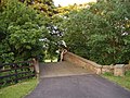
 Private road to Frickley Hall. - geograph.org.uk - 530489.jpg 640 × 470; 96 KB
-
 Queen Street, Mexborough - geograph.org.uk - 535703.jpg 640 × 480; 57 KB
-
 Rail bridge over River Don. - geograph.org.uk - 536069.jpg 640 × 430; 103 KB
-
 Rozzo Boys - geograph.org.uk - 502598.jpg 640 × 480; 84 KB
-
 Rutland Road Bridge - geograph.org.uk - 979796.jpg 480 × 640; 160 KB
-
 Stairfoot. - geograph.org.uk - 502470.jpg 640 × 480; 127 KB
-
 Supporting the motorways - geograph.org.uk - 586147.jpg 640 × 399; 78 KB
-

-

-
 The Bridge on Houndkirk Moor - geograph.org.uk - 454063.jpg 480 × 640; 117 KB
-

-
 Thickwoods Lane Bridge - geograph.org.uk - 399247.jpg 640 × 480; 123 KB
-
 Thrybergh Bridge - geograph.org.uk - 635166.jpg 640 × 480; 89 KB
-
 Thrybergh Bridge - geograph.org.uk - 635167.jpg 640 × 480; 139 KB
-
 Tinsley viaduct and its twin towers - geograph.org.uk - 569561.jpg 640 × 458; 61 KB
-
 Transpennine trail near Killamarsh - geograph.org.uk - 54367.jpg 640 × 479; 118 KB
-
 Waterworks Bridge - geograph.org.uk - 117045.jpg 640 × 480; 112 KB


.jpg)


.jpg)
_-_geograph.org.uk_-_18972.jpg)


.jpg)


.jpg)
_packhorse_bridge_over_the_River_Dearne_-_geograph.org.uk_-_1917206.jpg)


