Category:Bridges in Newport, Wales
Jump to navigation
Jump to search
Wikimedia category | |||||
| Upload media | |||||
| Instance of | |||||
|---|---|---|---|---|---|
| Category combines topics | |||||
| Newport | |||||
city in south east Wales, United Kingdom   | |||||
| Instance of | |||||
| Part of |
| ||||
| Location | Newport, Wales | ||||
| Located in or next to body of water | |||||
| Population |
| ||||
| Area |
| ||||
| official website | |||||
 | |||||
Subcategories
This category has the following 11 subcategories, out of 11 total.
C
- City Bridge, Newport (17 F)
E
- Ebbw Railway Viaduct (9 F)
F
G
- George Street Bridge, Newport (25 F)
H
N
- Newport Town Bridge (29 F)
- Newport Transporter Bridge (160 F)
P
- Pensarn Bridge, Rogerstone (3 F)
R
Media in category "Bridges in Newport, Wales"
The following 73 files are in this category, out of 73 total.
-

-
 Across Caerleon Bridge - geograph.org.uk - 1594538.jpg 640 × 361; 64 KB
-
-
 Between two bridges - geograph.org.uk - 1439793.jpg 640 × 480; 70 KB
-
 Bishton, 5' 6" headroom - geograph.org.uk - 696035.jpg 640 × 480; 77 KB
-
 Bridge near Pound-wern Cottage.jpg 5,184 × 3,456; 10.95 MB
-
 Bridge over a little stream running down to the Usk - geograph.org.uk - 1709335.jpg 3,296 × 2,472; 1.81 MB
-
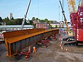 Bridge Street bridge reconstruction (9) (geograph 5123070).jpg 640 × 480; 156 KB
-
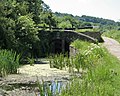
 Bridge, Great Newra - geograph.org.uk - 148673.jpg 640 × 426; 127 KB
-
 British Steel pipelines - geograph.org.uk - 969890.jpg 640 × 427; 161 KB
-
 Caerleon Bridge - geograph.org.uk - 1591120.jpg 640 × 408; 85 KB
-
 Canal and Bettws Lane bridge - geograph.org.uk - 697443.jpg 640 × 480; 134 KB
-
 Canal bridge next to Ty-ffynnon lock - geograph.org.uk - 1569828.jpg 640 × 480; 103 KB
-
 Canal bridge No. 4 - geograph.org.uk - 678875.jpg 640 × 480; 149 KB
-
 Canal bridge No. 7 - geograph.org.uk - 678660.jpg 640 × 480; 187 KB
-
 Canal bridge No. 8 - geograph.org.uk - 678684.jpg 640 × 480; 189 KB
-
 Cardiff Road bridge reconstruction (11) (geograph 4802332).jpg 640 × 480; 173 KB
-
 Clarence Place Bridge at low tide - geograph.org.uk - 965572.jpg 480 × 640; 76 KB
-
 Crindau Bridge in Winter - geograph.org.uk - 1760141.jpg 1,200 × 1,600; 483 KB
-

-
 Disused canal bridge, Crindau, Newport - geograph.org.uk - 1611115.jpg 640 × 480; 110 KB
-

-
 Footbridge across the main line - geograph.org.uk - 1441420.jpg 640 × 480; 124 KB
-
 Four bridges across the Usk, Newport.jpg 640 × 381; 57 KB
-

-
 Glebelands, Newport - geograph.org.uk - 1505326.jpg 640 × 383; 70 KB
-
 Groes Road canal bridge - geograph.org.uk - 678651.jpg 640 × 480; 176 KB
-
-
 Hollybush canal bridge, Malpas - geograph.org.uk - 1622068.jpg 640 × 480; 123 KB
-
 Humpback bridge to Glebelands - geograph.org.uk - 1443157.jpg 640 × 480; 94 KB
-
 Langstone Court Road bridge - geograph.org.uk - 1583069.jpg 640 × 480; 76 KB
-
 Lighthouse Road replacement bridge (geograph 3499777).jpg 4,000 × 3,000; 4.15 MB
-
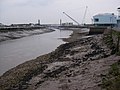
 Liswerry Pill Reen, Newport - geograph.org.uk - 1580815.jpg 640 × 480; 137 KB
-
 Maesglas Road bridge reconstruction(11) (geograph 5128357).jpg 640 × 480; 175 KB
-
 Maesglas Road bridge reconstruction(2) (geograph 5110266).jpg 640 × 480; 188 KB
-
 Michaelstone Bridge - geograph.org.uk - 736345.jpg 639 × 479; 192 KB
-
 Michaelstone Bridge, looking south - geograph.org.uk - 1043324.jpg 640 × 480; 103 KB
-
 Monmouthshire and Brecon Canal (2) - geograph.org.uk - 1806096.jpg 4,000 × 3,000; 2.94 MB
-
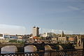 Newport from the train.JPG 4,272 × 2,848; 3.31 MB
-
 Newport MMB 08 River Usk.jpg 2,400 × 1,600; 1.51 MB
-
 Newport, bridge shadow crosses river - geograph.org.uk - 695988.jpg 480 × 640; 45 KB
-
 Newport, view over the Usk - geograph.org.uk - 696010.jpg 640 × 480; 69 KB
-

-

-
 Pillmawr Road bridge across A4042 - geograph.org.uk - 1451157.jpg 640 × 480; 84 KB
-
 Pillmawr Road Bridge in Winter - geograph.org.uk - 1707126.jpg 1,600 × 1,200; 398 KB
-
 Pont Ebbw - Ebbw Bridge - geograph.org.uk - 618007.jpg 640 × 481; 161 KB
-
 Pontoon Bridge, Newport Levels - geograph.org.uk - 1032574.jpg 640 × 457; 178 KB
-
 Railway bridge, Marshfield - geograph.org.uk - 1550222.jpg 640 × 378; 60 KB
-
 Reconstructed Green Lane railway bridge (geograph 5758526).jpg 5,184 × 3,888; 5.05 MB
-
 Reen and bridge next to B4239 - geograph.org.uk - 203604.jpg 640 × 480; 126 KB
-
 River Ebbw - geograph.org.uk - 518302.jpg 640 × 480; 297 KB
-

-

-
 Rogerstone Bypass railway bridge - geograph.org.uk - 1607838.jpg 640 × 480; 119 KB
-
 Soho Street railway bridge,Newport - geograph.org.uk - 1561679.jpg 640 × 480; 103 KB
-
 Soho Street railway bridge,Newport - geograph.org.uk - 1561690.jpg 640 × 403; 94 KB
-

-
 Spytty Pill - geograph.org.uk - 1483325.jpg 640 × 480; 147 KB
-
 Spytty Road railway bridge - geograph.org.uk - 1580839.jpg 640 × 388; 70 KB
-

-

-

-
 The entrance to Newport Golf Club - geograph.org.uk - 678673.jpg 640 × 480; 176 KB
-
 The Twenty Ten Bridge, Celtic Manor Resort.jpg 640 × 480; 51 KB
-

-
 Twenty Ten Golf Course bridge - geograph.org.uk - 1776212.jpg 640 × 408; 74 KB
-

-
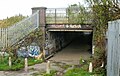
 Under the M4 to Stockton Close - geograph.org.uk - 1432243.jpg 640 × 434; 59 KB
-
 View down Town Reach - geograph.org.uk - 965577.jpg 640 × 480; 85 KB
-
 View from Gwasted Bridge.jpg 5,184 × 3,456; 11.39 MB
-
 Wellies needed to pass under this bridge - geograph.org.uk - 1755662.jpg 640 × 480; 101 KB
-
 Wharf Road Warehouse, Newport - geograph.org.uk - 1620472.jpg 640 × 480; 61 KB
_-_geograph.org.uk_-_1315636.jpg)


_(geograph_5123070).jpg)


_(geograph_4802332).jpg)


.jpg)

_(geograph_5128357).jpg)
_(geograph_5110266).jpg)


_-_geograph.org.uk_-_1806096.jpg)


.jpg)


