Category:Bridges in Long Eaton
Jump to navigation
Jump to search
Bridges in Long Eaton, Borough of Erewash, Derbyshire, England.
Subcategories
This category has the following 5 subcategories, out of 5 total.
B
- Bridge 4, Erewash Canal (15 F)
C
- Cockayne's Bridge, Derby Canal (23 F)
D
- Derby Road bridge, Long Eaton (12 F)
T
- Tamworth Road bridge, Long Eaton (24 F)
Media in category "Bridges in Long Eaton"
The following 35 files are in this category, out of 35 total.
-
 Bailey Bridge - geograph.org.uk - 1366109.jpg 640 × 479; 94 KB
-
 Bridge Arches - geograph.org.uk - 755988.jpg 427 × 640; 195 KB
-
 Bridge carrying a railway line over Meadow Lane - geograph.org.uk - 4722200.jpg 2,000 × 1,500; 280 KB
-
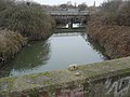
 Bridge over the Erewash - geograph.org.uk - 1110962.jpg 640 × 480; 170 KB
-
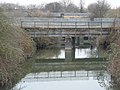
 Bridge over the River Erewash - geograph.org.uk - 1366111.jpg 640 × 479; 137 KB
-
 Bridge Over the Trent - geograph.org.uk - 923228.jpg 640 × 480; 75 KB
-
 Bridges over the Erewash - geograph.org.uk - 1110941.jpg 640 × 480; 190 KB
-
 Bridges over the Erewash - geograph.org.uk - 1110958.jpg 640 × 480; 155 KB
-
 Cranfleet Canal, Long Eaton, Derbys. - geograph.org.uk - 3340996.jpg 3,530 × 2,617; 1.73 MB
-
 Farmers Bridge over the Canal - geograph.org.uk - 1090554.jpg 640 × 480; 161 KB
-
 Farmers Bridge Reflection - geograph.org.uk - 1090618.jpg 640 × 480; 162 KB
-
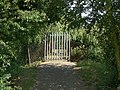
 Footbridge barrier - geograph.org.uk - 752025.jpg 640 × 427; 165 KB
-
 Footbridge over the barge canal - geograph.org.uk - 1357332.jpg 640 × 479; 109 KB
-
 Footbridge over the barge canal - geograph.org.uk - 1357336.jpg 640 × 479; 155 KB
-
 Footbridge over the Erewash Canal - geograph.org.uk - 1094233.jpg 640 × 426; 117 KB
-
 Footbridge over the Erewash Canal - geograph.org.uk - 638832.jpg 640 × 427; 80 KB
-
 Footbridge Ramp - geograph.org.uk - 1101479.jpg 640 × 417; 108 KB
-
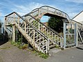
 Footbridge steps - geograph.org.uk - 751846.jpg 640 × 426; 269 KB
-
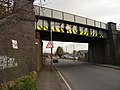
 Long Eaton Railway Bridge - geograph.org.uk - 1078207.jpg 640 × 480; 65 KB
-

-
 Mended Footbridge - geograph.org.uk - 1204374.jpg 480 × 640; 167 KB
-
 No access over the Bridge - geograph.org.uk - 1090621.jpg 640 × 480; 171 KB
-
 Nutbrook Trail, Erewash and footbridge - geograph.org.uk - 754974.jpg 640 × 415; 260 KB
-
 Rail bridge over the Erewash - geograph.org.uk - 754948.jpg 640 × 427; 247 KB
-
 Railway Bridge in Long Eaton - geograph.org.uk - 3400749.jpg 3,860 × 2,804; 1.85 MB
-
-
 School Footbridge Steps - geograph.org.uk - 786062.jpg 640 × 414; 158 KB
-
 Small Footbridge over Golden Brook - geograph.org.uk - 1185124.jpg 480 × 640; 172 KB
-
 Station Road footbridge - geograph.org.uk - 3131689.jpg 640 × 480; 130 KB
-
 Station Road footbridge has gone - geograph.org.uk - 5373530.jpg 1,280 × 720; 95 KB
-
 Station Road footbridge under wraps - geograph.org.uk - 5363080.jpg 640 × 360; 68 KB
-
 Tamworth Road, Long Eaton - geograph.org.uk - 1541084.jpg 640 × 428; 99 KB
-
 Trent Lane, Long Eaton, Derbys. - geograph.org.uk - 3340843.jpg 3,644 × 2,641; 1.44 MB
-
 Under the foot bridge - frozen canal - geograph.org.uk - 696172.jpg 627 × 414; 48 KB
-
 Under the Long Eaton School footbridge - geograph.org.uk - 692281.jpg 640 × 409; 257 KB


