Category:Bridges in Flintshire
Jump to navigation
Jump to search
Wikimedia category | |||||
| Upload media | |||||
| Instance of | |||||
|---|---|---|---|---|---|
| Category combines topics | |||||
| Flintshire | |||||
principal area in north-east Wales   | |||||
| Instance of | |||||
| Location | Wales | ||||
| Located in or next to body of water | |||||
| Inception |
| ||||
| Population |
| ||||
| Area |
| ||||
| Replaces | |||||
| Different from | |||||
| official website | |||||
 | |||||
Subcategories
This category has the following 7 subcategories, out of 7 total.
B
- Bridge End bridge, Caergwrle (6 F)
C
- Caergwrle packhorse bridge (10 F)
F
- Flintshire Bridge (23 F)
- Footbridges in Flintshire (22 F)
J
- Jubilee Bridge (Queensferry) (14 F)
O
Media in category "Bridges in Flintshire"
The following 46 files are in this category, out of 46 total.
-
 1951 Vintage - geograph.org.uk - 116774.jpg 640 × 480; 108 KB
-
 A55 North Wales Expressway - geograph.org.uk - 99078.jpg 640 × 480; 53 KB
-
 B5441 Pedestrian bridge 1.JPG 3,648 × 2,736; 3.62 MB
-
 B5441 Pedestrian bridge 2.JPG 3,648 × 2,736; 3.61 MB
-
 B5441 Pedestrian Bridge 3.JPG 3,648 × 2,736; 3.65 MB
-
 B5441 Pedestrian Bridge 4.JPG 3,648 × 2,736; 3.58 MB
-
 Bridge End bridge, Caergwrle (2).JPG 4,608 × 3,456; 3.39 MB
-
 Bridge End bridge, Caergwrle (6).JPG 4,608 × 3,456; 3.44 MB
-
 Bridge over Lead Brook near Oakenholt - geograph.org.uk - 222595.jpg 640 × 480; 151 KB
-
 Bridge over Wepre Brook, Flintshire.jpg 4,608 × 3,456; 3.45 MB
-
 Castle Road railway bridge - geograph.org.uk - 1739556.jpg 640 × 480; 138 KB
-
 Castle Road railway bridge - geograph.org.uk - 1739605.jpg 640 × 480; 96 KB
-
 Chester Road West, Deeside 1.JPG 3,648 × 2,736; 3.66 MB
-
 Disused railway viaduct, Ffrith - geograph.org.uk - 208054.jpg 640 × 480; 148 KB
-
 Ffynnongroyw footbridge - geograph.org.uk - 128335.jpg 640 × 480; 77 KB
-
 Footbridge at Ffynnongroyw - geograph.org.uk - 41412.jpg 640 × 480; 137 KB
-

-

-
 Rail bridge, Chester Road West, Shotton.JPG 3,648 × 2,736; 3.59 MB
-
 Rail bridge, Queensferry 1.JPG 3,648 × 2,736; 3.61 MB
-
 Rail bridge, Queensferry 2.JPG 3,648 × 2,736; 3.58 MB
-
 Redundant Arches - geograph.org.uk - 1550514.jpg 640 × 403; 76 KB
-
 River Dee, Queensferry 1.JPG 3,648 × 2,736; 3.66 MB
-
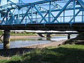
 Road Bridge, Cilcain - DSC06088.JPG 3,648 × 2,736; 3.56 MB
-

-
 The Queensferry Bridges - geograph.org.uk - 410758.jpg 640 × 480; 200 KB
-

-
 Balderton Brook and Old Sandstone Bridge - geograph.org.uk - 345511.jpg 640 × 480; 266 KB
-
 Bridge and lane to Bretton Hall - geograph.org.uk - 1496704.jpg 640 × 480; 191 KB
-
 Bridge at Llong - geograph.org.uk - 384755.jpg 640 × 480; 256 KB
-
 Bridge End Caergwrle - geograph.org.uk - 416449.jpg 640 × 426; 136 KB
-
 Bridge over the River Alun at Llong - geograph.org.uk - 694022.jpg 640 × 480; 91 KB
-
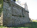
 Bridge over the River Alyn - geograph.org.uk - 308905.jpg 640 × 480; 214 KB
-
 Bridge over the River Alyn - geograph.org.uk - 308951.jpg 640 × 480; 239 KB
-
 Caergwrle's Packhorse Bridge - geograph.org.uk - 377526.jpg 480 × 640; 214 KB
-
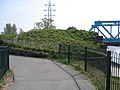 Old Queensferry Bridge Abutment - geograph.org.uk - 409955.jpg 640 × 480; 155 KB
-
 Old Railway Bridge and Car Park - geograph.org.uk - 669023.jpg 640 × 480; 72 KB
-
 Queensferry Bridge - geograph.org.uk - 387751.jpg 640 × 480; 196 KB
-
 Queensferry Old Bridge Abutment - geograph.org.uk - 410257.jpg 480 × 640; 212 KB
-
-
 Stone Bridge over the River Alyn - geograph.org.uk - 313540.jpg 640 × 480; 198 KB
-
 The Modern Queensferry Bridge - geograph.org.uk - 387743.jpg 640 × 480; 130 KB
-
 The Modern Queensferry Road Bridge - geograph.org.uk - 409780.jpg 640 × 480; 46 KB
-
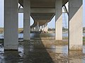
 Under the Flintshire Bridge Approach - geograph.org.uk - 411451.jpg 640 × 480; 65 KB
-
 Under the Flintshire Bridge looking East - geograph.org.uk - 411470.jpg 640 × 480; 126 KB
-
 Under the Queensferry Bridge - geograph.org.uk - 387737.jpg 640 × 480; 133 KB


.JPG)
.JPG)


