Category:Bridges in Brighouse
Jump to navigation
Jump to search
Subcategories
This category has the following 7 subcategories, out of 7 total.
A
- Anchor Bridge, Brighouse (9 F)
B
- Brighouse Basin Bridge (7 F)
- Brighouse Bridge (9 F)
- Brookfoot Bridge (3 F)
C
- Cooper Bridge, Brighouse (10 F)
- Cromwell Lock Bridge (3 F)
- Crowther Bridge (13 F)
Media in category "Bridges in Brighouse"
The following 52 files are in this category, out of 52 total.
-
 A safer way of crossing Clifton Beck - geograph.org.uk - 1006890.jpg 640 × 480; 215 KB
-

-
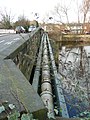
 Benchmark on Bridge MVN2-174 - geograph.org.uk - 6006875.jpg 1,024 × 683; 280 KB
-
 Bridge 10 - geograph.org.uk - 2535745.jpg 800 × 497; 99 KB
-
 Bridge at the end of Wharf Street - geograph.org.uk - 1014521.jpg 640 × 480; 96 KB
-
 Bridge carrying Green Lane over the M62 - geograph.org.uk - 6470694.jpg 2,000 × 1,331; 3.36 MB
-
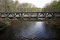
 Bridge over River Calder - geograph.org.uk - 2536113.jpg 800 × 497; 114 KB
-
 Bridge over the canal at Freeman's Lock - geograph.org.uk - 5307309.jpg 2,000 × 1,488; 1.16 MB
-
-

-
 Bridge under railway at Anchor Place - geograph.org.uk - 3363152.jpg 2,000 × 1,467; 1.1 MB
-
 Briggate Bridge from Towpath - geograph.org.uk - 786738.jpg 640 × 480; 79 KB
-
 Briggate Bridge from Towpath - geograph.org.uk - 786741.jpg 640 × 480; 65 KB
-
 Brighouse - geograph.org.uk - 5173.jpg 640 × 480; 95 KB
-

-
 Brighouse bridge 019.jpg 3,648 × 1,596; 1.21 MB
-
 Brighouse Bridge 2 (4117489422).jpg 1,853 × 2,501; 3.54 MB
-

-
 Brighouse Viaduct - geograph.org.uk - 5330134.jpg 3,990 × 3,295; 2.89 MB
-
 Calder and Hebble Brighouse basin.jpg 1,984 × 1,488; 650 KB
-
 Calder and Hebble Navigation - geograph.org.uk - 2265277.jpg 640 × 443; 147 KB
-
 Camms Mill Bridge - geograph.org.uk - 2535735.jpg 800 × 477; 105 KB
-
 Canal Bridge - geograph.org.uk - 2265250.jpg 640 × 608; 192 KB
-

-
 Clifton Road Bridge over Brighouse Beck - geograph.org.uk - 5546888.jpg 2,346 × 3,128; 2.44 MB
-
 Clifton Road Bridge, Clifton - Brighouse - geograph.org.uk - 190630.jpg 640 × 578; 169 KB
-
 Cooper Bridge Road - geograph.org.uk - 6203427.jpg 2,000 × 1,500; 2.95 MB
-
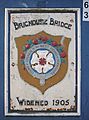
 Dedication Stone - geograph.org.uk - 2846596.jpg 4,000 × 3,000; 4.42 MB
-
 Foot bridge over the River Calder at Cromwell Bottom - geograph.org.uk - 5761097.jpg 1,600 × 1,065; 838 KB
-
 Foot bridge over the River Calder at Cromwell Bottom - geograph.org.uk - 5761100.jpg 1,600 × 1,065; 1,016 KB
-
 Footbridge over Red Beck - geograph.org.uk - 6424970.jpg 2,000 × 1,500; 1.7 MB
-
 Ford on Thornhill Beck Lane, Brighouse - geograph.org.uk - 5890188.jpg 5,184 × 3,456; 5.55 MB
-
 Leeds Road Bridge 22 - geograph.org.uk - 2537438.jpg 800 × 493; 157 KB
-
 Phoenix Bridge, Wakefield Road over Clifton Beck - geograph.org.uk - 6009695.jpg 1,024 × 678; 145 KB
-

-
 Railway Bridge - geograph.org.uk - 2537431.jpg 800 × 550; 142 KB
-

-

-
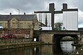
 Repairing Rastrick Bridge, Brighouse - geograph.org.uk - 6518905.jpg 2,000 × 1,541; 988 KB
-
 Retaining wall, Thornhills Beck Lane, Clifton - geograph.org.uk - 6446184.jpg 1,994 × 2,000; 1.75 MB
-

-
 Road bridge over the River Calder at Cromwell Bottom - geograph.org.uk - 5761095.jpg 1,600 × 1,065; 1,020 KB
-
 Road bridge over the River Calder at Cromwell Bottom - geograph.org.uk - 5761101.jpg 1,600 × 1,065; 717 KB
-
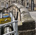
 Road closures at Bridge End, Rastrick - geograph.org.uk - 6518936.jpg 2,000 × 1,501; 1.16 MB
-

-
 The Bridge - geograph.org.uk - 2265256.jpg 640 × 573; 160 KB
-
 The North Cut at Brighouse - geograph.org.uk - 5300218.jpg 3,349 × 2,227; 1.15 MB
-
 Thornhills Beck Lane, Brighouse - geograph.org.uk - 349099.jpg 640 × 472; 120 KB
-
 Under the railway arch, Oak Hill Wood, Brighouse - geograph.org.uk - 6444639.jpg 2,000 × 1,500; 1.5 MB
-

-
 Water main alongside Rastrick Bridge - geograph.org.uk - 3342797.jpg 1,500 × 2,000; 1,004 KB
-
 Woodhouse Lane, Woodhouse Bridge - geograph.org.uk - 6310190.jpg 1,024 × 683; 150 KB


.jpg)


