Category:Bridgemary
Jump to navigation
Jump to search
village in United Kingdom _(2).JPG) | |||||
| Upload media | |||||
| Instance of | |||||
|---|---|---|---|---|---|
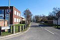
| Location | Gosport, Hampshire, South East England, England | ||||
 | |||||
Subcategories
This category has the following 7 subcategories, out of 7 total.
B
- Bridgemary Family Church (3 F)
- Bridgemary Methodist Church (6 F)
C
- Bridgemary Carnival (6 F)
F
P
- Bridgemary Park (11 F)
S
- St Matthew's Church, Bridgemary (10 F)
Media in category "Bridgemary"
The following 127 files are in this category, out of 127 total.
-
 Agnew Road (1) - geograph.org.uk - 1775421.jpg 640 × 428; 49 KB
-
 Agnew Road (2) - geograph.org.uk - 1775437.jpg 640 × 428; 61 KB
-
 Bedenham Lane - geograph.org.uk - 1763675.jpg 640 × 428; 75 KB
-
 Braemar Road (2) - geograph.org.uk - 1773811.jpg 640 × 428; 55 KB
-
 Braemar Road (3) - geograph.org.uk - 1773834.jpg 640 × 428; 58 KB
-
 Bridge in Gregson Avenue - geograph.org.uk - 1133284.jpg 640 × 480; 48 KB
-
 Bridgemary Road (1) - geograph.org.uk - 1306435.jpg 640 × 480; 49 KB
-

-

-
-

-
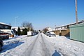
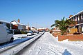
 Bridgemary under snow - Agnew Road - geograph.org.uk - 1707627.jpg 640 × 428; 69 KB
-

-

-

-

-

-

-

-

-
-
-

-

-

-
-

-

-
 Bridgemary under snow - Fraser Road (3) - geograph.org.uk - 1708629.jpg 640 × 428; 119 KB
-

-
-

-
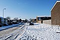
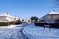
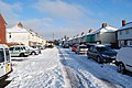
 Bridgemary under snow - Harris Road - geograph.org.uk - 1708637.jpg 640 × 428; 74 KB
-

-

-
-

-

-

-

-

-

-

-

-

-

-

-

-
-

-

-
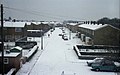
 Bridgemary under snow - Wavell Road - geograph.org.uk - 1707521.jpg 640 × 428; 71 KB
-

-
 Cameron Close (1) - geograph.org.uk - 1773458.jpg 640 × 428; 58 KB
-
 Cameron Close (2) - geograph.org.uk - 1773467.jpg 640 × 428; 59 KB
-
 Cameron Close (3) - geograph.org.uk - 1773476.jpg 640 × 428; 64 KB
-
 Camp Road (1) - geograph.org.uk - 1773489.jpg 640 × 428; 57 KB
-
 Camp Road (2) - geograph.org.uk - 1773498.jpg 640 × 428; 61 KB
-
 Camp Road (3) - geograph.org.uk - 1773508.jpg 640 × 428; 57 KB
-
 Car park for Vector Aerospace - geograph.org.uk - 1763815.jpg 640 × 428; 43 KB
-
 CCTV in Bridgemary (1) - geograph.org.uk - 1445378.jpg 480 × 640; 67 KB
-
 CCTV in Bridgemary (2) - geograph.org.uk - 1445391.jpg 640 × 428; 56 KB
-
 CCTV in Bridgemary (3) - geograph.org.uk - 1445408.jpg 640 × 428; 67 KB
-
 Conifer Grove (1) - geograph.org.uk - 1762724.jpg 640 × 428; 59 KB
-
 Conifer Grove (2) - geograph.org.uk - 1762730.jpg 640 × 428; 50 KB
-
 Conifer Grove (3) - geograph.org.uk - 1762736.jpg 640 × 428; 65 KB
-
 Conifer Grove (4) - geograph.org.uk - 1762740.jpg 640 × 428; 61 KB
-
 Crane in Cunningham Drive - geograph.org.uk - 1433723.jpg 640 × 428; 68 KB
-

-

-
 Flowerbeds in Cunningham Drive (1) - geograph.org.uk - 1271722.jpg 640 × 480; 77 KB
-
 Flowerbeds in Cunningham Drive (2) - geograph.org.uk - 1271741.jpg 640 × 480; 115 KB
-
 Foxbury Lane - geograph.org.uk - 1763799.jpg 640 × 428; 57 KB
-
 Gorselands Way (1) - geograph.org.uk - 2198219.jpg 640 × 428; 71 KB
-
 Gorselands Way (2) - geograph.org.uk - 2198225.jpg 640 × 428; 63 KB
-
 Gorselands Way (3) - geograph.org.uk - 2198228.jpg 640 × 428; 58 KB
-
 Gregson Close (1) - geograph.org.uk - 1763211.jpg 640 × 428; 80 KB
-
 Gregson Close (2) - geograph.org.uk - 1763213.jpg 640 × 428; 60 KB
-
 Hanson Aggregates - geograph.org.uk - 1627180.jpg 640 × 428; 68 KB
-
 Harris Road (1) - geograph.org.uk - 1414156.jpg 640 × 480; 75 KB
-
 Harwood Close - geograph.org.uk - 1762873.jpg 640 × 428; 53 KB
-
 Harwood Road (1) - geograph.org.uk - 1762855.jpg 640 × 428; 53 KB
-
 Harwood Road (2) - geograph.org.uk - 1762864.jpg 640 × 428; 56 KB
-
 Jacob Wells Church - geograph.org.uk - 1205039.jpg 640 × 480; 61 KB
-
 James Close - geograph.org.uk - 1762840.jpg 640 × 428; 65 KB
-
 James Road - geograph.org.uk - 1762835.jpg 640 × 428; 67 KB
-
 Keyes Close - geograph.org.uk - 1763216.jpg 640 × 428; 56 KB
-
 Keyes Road (1) - geograph.org.uk - 1775383.jpg 640 × 428; 59 KB
-
 Keyes Road (2) - geograph.org.uk - 1775396.jpg 640 × 428; 64 KB
-
 Lock-up garages in Horton Road - geograph.org.uk - 1573440.jpg 640 × 480; 78 KB
-
 Lock-up garages in Montgomery Road - geograph.org.uk - 1236857.jpg 640 × 480; 41 KB
-
 Montgomery Road, Bridgemary, Gosport. - geograph.org.uk - 890599.jpg 3,648 × 2,736; 3.75 MB
-
 Morris Close (1) - geograph.org.uk - 1762699.jpg 640 × 428; 61 KB
-
 Morris Close (2) - geograph.org.uk - 1762705.jpg 640 × 428; 79 KB
-
 Nobes Hall, Nobes Avenue, Bridgemary, Gosport (April 2019).JPG 2,800 × 1,600; 1.7 MB
-
 Northway (1) - geograph.org.uk - 1183418.jpg 640 × 480; 57 KB
-
 Northway (2) - geograph.org.uk - 1183434.jpg 640 × 480; 58 KB
-
 Old railway at Tichborne Way bridge - geograph.org.uk - 461985.jpg 640 × 480; 206 KB
-
 Playing fields on edge of Gosport - geograph.org.uk - 75375.jpg 640 × 480; 113 KB
-
 Portal Road (1) - geograph.org.uk - 1763753.jpg 640 × 428; 58 KB
-
 Portal Road (2) - geograph.org.uk - 1763766.jpg 640 × 428; 65 KB
-
 Portal Road (3) - geograph.org.uk - 1763782.jpg 640 × 428; 51 KB
-
 Prideaux-Brune Avenue (1) - geograph.org.uk - 1627148.jpg 640 × 428; 54 KB
-
 Prideaux-Brune Avenue (2) - geograph.org.uk - 1627158.jpg 640 × 428; 50 KB
-
 Prideaux-Brune Avenue (3) - geograph.org.uk - 1627166.jpg 640 × 428; 52 KB
-
 Snowman and igloo in Southway - geograph.org.uk - 1729331.jpg 640 × 428; 92 KB
-
 Southway (1) - geograph.org.uk - 1183456.jpg 640 × 480; 65 KB
-
 Southway (2) - geograph.org.uk - 1183478.jpg 640 × 480; 61 KB
-
 Subway in Bridgemary (1) - geograph.org.uk - 1214460.jpg 640 × 480; 92 KB
-
 Subway in Bridgemary (2) - geograph.org.uk - 1214489.jpg 640 × 480; 53 KB
-
 Subway in Bridgemary (3) - geograph.org.uk - 1214506.jpg 640 × 480; 95 KB
-
 Subway in Bridgemary (4) - geograph.org.uk - 1214523.jpg 640 × 480; 84 KB
-
 Tarius Close - geograph.org.uk - 1773825.jpg 640 × 428; 75 KB
-
 Texaco garage in Fareham Road - geograph.org.uk - 1763219.jpg 3,872 × 2,592; 4.36 MB
-
 Top end of Montgomery Road (1975) - geograph.org.uk - 1739400.jpg 640 × 414; 57 KB
-
 Top end of Montgomery Road (2010) - geograph.org.uk - 1739410.jpg 640 × 431; 64 KB
-
 Topped trees in Brading Avenue - geograph.org.uk - 1226503.jpg 640 × 480; 53 KB
-
 Vian Close (1) - geograph.org.uk - 1762849.jpg 640 × 428; 63 KB
-

-

-
 Withies Road - geograph.org.uk - 2198231.jpg 640 × 428; 62 KB
-

-

-
 Brooker's Lane, Woodcot - geograph.org.uk - 460672.jpg 640 × 480; 70 KB
-
 Chale Close, Bridgemary, Gosport - geograph.org.uk - 460680.jpg 640 × 480; 81 KB
-
 Pond by Carisbrooke Road - geograph.org.uk - 461909.jpg 640 × 480; 149 KB
-
 The North Star, Gosport - geograph.org.uk - 134351.jpg 640 × 513; 82 KB
_-_geograph.org.uk_-_1775421.jpg)
_-_geograph.org.uk_-_1775437.jpg)

_-_geograph.org.uk_-_1773811.jpg)
_-_geograph.org.uk_-_1773834.jpg)

_-_geograph.org.uk_-_1306435.jpg)
_-_Bridge_in_Gregson_Avenue_-_geograph.org.uk_-_1719392.jpg)
_-_Montgomery_Road_(1)_-_geograph.org.uk_-_1719352.jpg)
_-_Montgomery_Road_(2)_-_geograph.org.uk_-_1719376.jpg)


_-_geograph.org.uk_-_1707547.jpg)
_-_geograph.org.uk_-_1708857.jpg)
_-_geograph.org.uk_-_1708874.jpg)
_-_geograph.org.uk_-_1708886.jpg)
_-_geograph.org.uk_-_1719535.jpg)
_-_geograph.org.uk_-_1707556.jpg)
_-_geograph.org.uk_-_1707565.jpg)
_-_geograph.org.uk_-_1707572.jpg)
_-_geograph.org.uk_-_1708582.jpg)
_-_geograph.org.uk_-_1708590.jpg)

_-_geograph.org.uk_-_1707582.jpg)
_-_geograph.org.uk_-_1707591.jpg)

_-_geograph.org.uk_-_1708602.jpg)
_-_geograph.org.uk_-_1708616.jpg)
_-_geograph.org.uk_-_1708629.jpg)


_-_geograph.org.uk_-_1707603.jpg)
_-_geograph.org.uk_-_1707608.jpg)
_-_geograph.org.uk_-_1707621.jpg)

_-_geograph.org.uk_-_1719328.jpg)
_-_geograph.org.uk_-_1719334.jpg)

_-_geograph.org.uk_-_1708670.jpg)
_-_geograph.org.uk_-_1708682.jpg)
_-_geograph.org.uk_-_1728015.jpg)
_-_geograph.org.uk_-_1728038.jpg)
_-_geograph.org.uk_-_1728053.jpg)
_-_geograph.org.uk_-_1708561.jpg)
_-_geograph.org.uk_-_1708570.jpg)


_-_geograph.org.uk_-_2266803.jpg)
_-_geograph.org.uk_-_1773458.jpg)
_-_geograph.org.uk_-_1773467.jpg)
_-_geograph.org.uk_-_1773476.jpg)
_-_geograph.org.uk_-_1773489.jpg)
_-_geograph.org.uk_-_1773498.jpg)
_-_geograph.org.uk_-_1773508.jpg)

_-_geograph.org.uk_-_1445378.jpg)
_-_geograph.org.uk_-_1445391.jpg)
_-_geograph.org.uk_-_1445408.jpg)
_-_geograph.org.uk_-_1762724.jpg)
_-_geograph.org.uk_-_1762730.jpg)
_-_geograph.org.uk_-_1762736.jpg)
_-_geograph.org.uk_-_1762740.jpg)

_-_geograph.org.uk_-_1741348.jpg)
_-_geograph.org.uk_-_1741386.jpg)
_-_geograph.org.uk_-_1271722.jpg)
_-_geograph.org.uk_-_1271741.jpg)

_-_geograph.org.uk_-_2198219.jpg)
_-_geograph.org.uk_-_2198225.jpg)
_-_geograph.org.uk_-_2198228.jpg)
_-_geograph.org.uk_-_1763211.jpg)
_-_geograph.org.uk_-_1763213.jpg)

_-_geograph.org.uk_-_1414156.jpg)

_-_geograph.org.uk_-_1762855.jpg)
_-_geograph.org.uk_-_1762864.jpg)


_-_geograph.org.uk_-_1775383.jpg)
_-_geograph.org.uk_-_1775396.jpg)


_-_geograph.org.uk_-_1762699.jpg)
_-_geograph.org.uk_-_1762705.jpg)
.JPG)
_-_geograph.org.uk_-_1183418.jpg)
_-_geograph.org.uk_-_1183434.jpg)


_-_geograph.org.uk_-_1763753.jpg)
_-_geograph.org.uk_-_1763766.jpg)
_-_geograph.org.uk_-_1763782.jpg)
_-_geograph.org.uk_-_1627148.jpg)
_-_geograph.org.uk_-_1627158.jpg)
_-_geograph.org.uk_-_1627166.jpg)

_-_geograph.org.uk_-_1183456.jpg)
_-_geograph.org.uk_-_1183478.jpg)
_-_geograph.org.uk_-_1214460.jpg)
_-_geograph.org.uk_-_1214489.jpg)
_-_geograph.org.uk_-_1214506.jpg)
_-_geograph.org.uk_-_1214523.jpg)


_-_geograph.org.uk_-_1739400.jpg)
_-_geograph.org.uk_-_1739410.jpg)

_-_geograph.org.uk_-_1762849.jpg)
_-_geograph.org.uk_-_1273293.jpg)
_-_geograph.org.uk_-_1273326.jpg)


