Category:Brickhill
Jump to navigation
Jump to search
settlement and civil parish in Bedfordshire, England, UK  | |||||
| Upload media | |||||
| Instance of |
| ||||
|---|---|---|---|---|---|
| Location | Bedford, Bedfordshire, East of England, England | ||||
| Population |
| ||||
 | |||||
English: Brickhill is a civil parish and electoral ward within northern Bedford in Bedfordshire, England.
Media in category "Brickhill"
The following 48 files are in this category, out of 48 total.
-
 'The Tiger Moth' - geograph.org.uk - 5551278.jpg 3,264 × 2,448; 3.47 MB
-
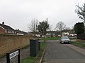
 Avon Walk, Brickhill, Bedford - geograph.org.uk - 1396980.jpg 450 × 600; 129 KB
-
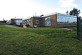
 Beauchamp Middle School - geograph.org.uk - 4157810.jpg 640 × 480; 60 KB
-
 Bedford School hockey ground - geograph.org.uk - 3589650.jpg 1,600 × 1,068; 426 KB
-
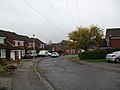
 Bourneside, Brickhill, Bedford - geograph.org.uk - 1396968.jpg 640 × 480; 94 KB
-
 Brickhill - geograph.org.uk - 2689059.jpg 640 × 480; 77 KB
-
 Brickhill - geograph.org.uk - 2855804.jpg 640 × 480; 97 KB
-
 Brickhill - geograph.org.uk - 2857463.jpg 640 × 480; 128 KB
-
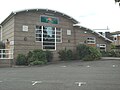
 Brickhill Community Centre - geograph.org.uk - 5551284.jpg 3,264 × 2,448; 3.42 MB
-
 Brickhill Drive - geograph.org.uk - 4988129.jpg 640 × 241; 39 KB
-
 BrickhillCommunityCentre.JPG 1,280 × 960; 312 KB
-
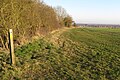
 Bridleway by a drain - geograph.org.uk - 6070705.jpg 1,600 × 1,066; 530 KB
-
 Bridleway down to Brickhill - geograph.org.uk - 6070701.jpg 1,600 × 1,066; 483 KB
-
 Bridleway towards Highfield Farm - geograph.org.uk - 6070715.jpg 1,600 × 1,066; 592 KB
-
 Bridleway towards North Brickhill Country Park - geograph.org.uk - 6070623.jpg 1,600 × 1,066; 652 KB
-
 Clapham Park entrance - geograph.org.uk - 5549332.jpg 3,264 × 2,448; 5.85 MB
-
 Curlew Crescent - geograph.org.uk - 4157758.jpg 640 × 480; 70 KB
-
 Curlew Crescent - geograph.org.uk - 4157776.jpg 640 × 480; 80 KB
-
-
 Footpath to Clapham Park - geograph.org.uk - 6105402.jpg 1,600 × 1,066; 482 KB
-
 Hawk Drive - geograph.org.uk - 4157796.jpg 640 × 480; 99 KB
-
 Helford Close - geograph.org.uk - 2855803.jpg 640 × 480; 58 KB
-
 Houses on Rowallan Drive, Brickhill - geograph.org.uk - 5549331.jpg 3,264 × 2,448; 2.17 MB
-
 John Bunyan Trail heading south - geograph.org.uk - 6103107.jpg 1,600 × 1,066; 613 KB
-
 John Bunyan Trail heading towards Clapham Park - geograph.org.uk - 6105396.jpg 1,600 × 1,066; 572 KB
-
 Kimbolton Road, Bedford - geograph.org.uk - 6534140.jpg 1,920 × 1,280; 1.8 MB
-
 Lambourn Way, Brickhill, Bedford - geograph.org.uk - 1396990.jpg 640 × 480; 99 KB
-
 Lowther Road - geograph.org.uk - 5551289.jpg 3,264 × 2,448; 2.23 MB
-
 Martin Close, Bedford - geograph.org.uk - 2291598.jpg 640 × 480; 59 KB
-
 New trees by the bridleway - geograph.org.uk - 6070706.jpg 1,600 × 1,066; 443 KB
-
 Parkwood allotments - geograph.org.uk - 6105393.jpg 1,600 × 1,068; 384 KB
-
 Plover Way - geograph.org.uk - 4157768.jpg 640 × 480; 91 KB
-
 Rhineland Way - geograph.org.uk - 2689041.jpg 640 × 480; 66 KB
-
 Rother Close, Brickhill, Bedford - geograph.org.uk - 1396972.jpg 640 × 480; 86 KB
-
 Scott Primary School - geograph.org.uk - 6105401.jpg 1,600 × 1,066; 377 KB
-
 Shops at Brickhill - geograph.org.uk - 5551275.jpg 3,264 × 2,448; 2.14 MB
-
 Soggy bridleway towards Clapham Park - geograph.org.uk - 6070616.jpg 1,600 × 1,066; 519 KB
-
 Sports field at Brickhill - geograph.org.uk - 5550759.jpg 3,264 × 2,448; 4.63 MB
-
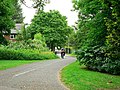
 Suburban footpath - geograph.org.uk - 6105404.jpg 1,600 × 1,066; 596 KB
-
 Tamar Road, Brickhill, Bedford - geograph.org.uk - 1396961.jpg 640 × 478; 96 KB
-
 Tamar Road, Brickhill, Bedford - geograph.org.uk - 1402900.jpg 640 × 480; 79 KB
-
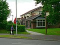 The Pheasant, Kimbolton Road - geograph.org.uk - 1404757.jpg 640 × 480; 89 KB
-
 Torridge Rise - geograph.org.uk - 2849195.jpg 640 × 480; 53 KB
-
 Tracks through the field - geograph.org.uk - 6070710.jpg 1,600 × 1,066; 560 KB
-
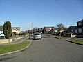
 Traffic lights - geograph.org.uk - 4988123.jpg 640 × 386; 79 KB
-
 Trent Road, Brickhill, Bedford - geograph.org.uk - 1402880.jpg 640 × 480; 83 KB
-
 Tyne Crescent - geograph.org.uk - 3703281.jpg 640 × 480; 62 KB
-
 Welcome to Brickhill - geograph.org.uk - 5549329.jpg 3,264 × 2,448; 2.58 MB


