Category:Brick Lane Mosque
Jump to navigation
Jump to search
| Object location | | View all coordinates using: OpenStreetMap |
|---|
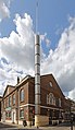
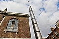
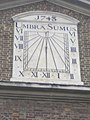
English: Brick Lane Mosque is a mosque in London. The building was established in 1743 as a Huguenot Protestant chapel, in 1809 became a Wesleyan chapel, in 1819 a Methodist chapel, in the late 19th century the Spitalfields Great Synagogue, and in 1976 a mosque.
mosque in the London Borough of Tower Hamlets, England,UK  | |||||
| Upload media | |||||
| Instance of | |||||
|---|---|---|---|---|---|
| Made from material | |||||
| Location | London Borough of Tower Hamlets, Greater London, London, England | ||||
| Architectural style | |||||
| Heritage designation |
| ||||
| Inception |
| ||||
| official website | |||||
 | |||||
Media in category "Brick Lane Mosque"
The following 26 files are in this category, out of 26 total.
-
 Brick Lane Jamme Masjid (parallel verticals version).jpg 3,006 × 5,182; 11.96 MB
-
 Brick lane Jamme Masjid - panoramio - el ui.jpg 3,264 × 2,448; 3.35 MB
-
 Brick lane Jamme Masjid - panoramio.jpg 2,448 × 3,264; 3.88 MB
-
 Brick Lane Jamme Masjid.jpg 4,059 × 5,412; 13.73 MB
-
 Brick Lane Mosque (South Face - 01).jpg 3,120 × 4,340; 8.84 MB
-
 Brick Lane Mosque (South Face Detail - 01).jpg 4,592 × 3,448; 11.21 MB
-
 Brick Lane Mosque - geograph.org.uk - 3245537.jpg 2,560 × 1,920; 1.02 MB
-
 Brick Lane Mosque - geograph.org.uk - 6652744.jpg 685 × 1,024; 113 KB
-
 Brick Lane Mosque - geograph.org.uk - 6652852.jpg 672 × 1,024; 146 KB
-
 Brick Lane Mosque - geograph.org.uk - 6652856.jpg 684 × 1,024; 186 KB
-
 Brick Lane Mosque - geograph.org.uk - 6652859.jpg 684 × 1,024; 163 KB
-
 Brick Lane Mosque Annexe - geograph.org.uk - 6657978.jpg 658 × 1,024; 164 KB
-
 Brick Lane Mosque.JPG 3,264 × 2,448; 2.17 MB
-
 Brick Lane Mosque2.JPG 2,448 × 3,264; 2.04 MB
-
 Brick lane sign - panoramio.jpg 3,264 × 2,448; 3.73 MB
-
 Detail Brick lane Jamme Masjid - panoramio.jpg 3,264 × 2,448; 2.39 MB
-
 Fancy fanlight.jpg 1,827 × 1,659; 172 KB
-
 FournierStreetMosque.jpg 2,592 × 1,936; 737 KB
-
 London - Bricklane Mosque.jpg 5,184 × 3,456; 6.29 MB
-
 "Umbra Sumus" sundial - geograph.org.uk - 321257.jpg 640 × 480; 107 KB
-
 Mosque, Brick Lane E1 - geograph.org.uk - 2568338.jpg 480 × 640; 47 KB
-
-
 The Great London Mosque in Brick Lane - geograph.org.uk - 320559.jpg 480 × 640; 102 KB
-
 Umbra Sumus (5438665795).jpg 3,888 × 2,592; 2.44 MB
-
 View of the Christ Church Spitalfields from Brick Lane - geograph.org.uk - 3961586.jpg 2,592 × 1,944; 2.05 MB
-
 View of the Christ Church Spitalfields from Brick Lane ^2 - geograph.org.uk - 3961606.jpg 2,592 × 1,944; 1.16 MB
.jpg)


.jpg)
.jpg)


.jpg)

