Category:Brazil photographs taken on 2014-01-11
Jump to navigation
Jump to search
| ← | Saturday 11 January 2014 | → | ||
| ← | January 2014 | → | ||

Brazil photographs taken on 11 January 2014.
Image files should be categorized here automatically using {{taken on}} template. Direct categorisation is also possible, if automatic is impossible.
Media in category "Brazil photographs taken on 2014-01-11"
The following 152 files are in this category, out of 152 total.
-
 .PINTURA DA NATUREZA.JPG 5,184 × 2,920; 14.39 MB
-
 .ÁGUA E CÉU EM PERFEITA HARMONIA.JPG 5,184 × 2,920; 4.79 MB
-
 Barigui, 808 PureView - panoramio.jpg 3,072 × 1,728; 2.51 MB
-
 Cachoeira da Lua em São Thomé das Letras - MG.JPG 4,608 × 3,456; 3.4 MB
-
 Cachoeira da Lua em São Thomé das Letras.JPG 4,608 × 3,456; 3.92 MB
-
 Cataratas do Iguaçu, Foz do Iguaçu, PR, Brasil 01.JPG 4,608 × 3,456; 6.03 MB
-
 Cataratas do Iguaçu, Foz do Iguaçu, PR, Brasil 02.JPG 4,608 × 3,456; 6 MB
-
 Cataratas do Iguaçu, Foz do Iguaçu, PR, Brasil 03.JPG 4,608 × 3,456; 6.13 MB
-
 Cataratas do Iguaçu, Foz do Iguaçu, PR, Brasil 04.JPG 4,608 × 3,456; 6 MB
-
 Cataratas do Iguaçu, Foz do Iguaçu, PR, Brasil 05.JPG 4,608 × 3,456; 6 MB
-
 Cataratas do Iguaçu, Foz do Iguaçu, PR, Brasil 06.JPG 4,608 × 3,456; 5.73 MB
-
 Cataratas do Iguaçu, Foz do Iguaçu, PR, Brasil 07.JPG 4,608 × 3,456; 6.29 MB
-
 Cataratas do Iguaçu, Foz do Iguaçu, PR, Brasil 08.JPG 4,608 × 3,456; 6.18 MB
-
 Cataratas do Iguaçu, Foz do Iguaçu, PR, Brasil 09.JPG 4,608 × 3,456; 6.01 MB
-
 CEDAE - panoramio (1).jpg 2,592 × 1,936; 2.18 MB
-
 CEDAE - panoramio (2).jpg 2,592 × 1,936; 2.31 MB
-
 CEDAE - panoramio.jpg 2,592 × 1,936; 2.22 MB
-
 Couto de Magalhães de Minas - State of Minas Gerais, Brazil - panoramio (1).jpg 4,288 × 3,216; 2.89 MB
-
 Couto de Magalhães de Minas - State of Minas Gerais, Brazil - panoramio (2).jpg 4,288 × 3,216; 3.02 MB
-
 Couto de Magalhães de Minas - State of Minas Gerais, Brazil - panoramio.jpg 4,288 × 2,824; 2.64 MB
-
 Datas - State of Minas Gerais, Brazil - panoramio (1).jpg 4,288 × 3,216; 3.11 MB
-
 Datas - State of Minas Gerais, Brazil - panoramio.jpg 4,288 × 3,216; 3.12 MB
-
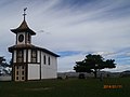
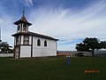
 Datas MG Brasil - Capela - panoramio.jpg 4,288 × 2,824; 2.51 MB
-
 Datas MG Brasil - Casarão colonial - panoramio.jpg 4,288 × 2,824; 2.35 MB
-
 Datas MG Brasil - Igreja Matriz do Divino - panoramio.jpg 4,288 × 3,216; 3.06 MB
-
 Datas MG Brasil - Matriz do Divino - panoramio.jpg 4,288 × 3,216; 3.04 MB
-
 Datas MG Brasil - Praça do Divino - panoramio (1).jpg 4,288 × 2,806; 2.44 MB
-
 Datas MG Brasil - Praça do Divino - panoramio.jpg 4,288 × 2,824; 2.54 MB
-
 Datas MG Brasil - Vista da MG 259, para Diamantina - panoramio.jpg 4,288 × 3,216; 3.73 MB
-
 Diamantina MG Brasil - Beco - panoramio.jpg 4,288 × 3,216; 3 MB
-
 Diamantina MG Brasil - Caminho dos Escravos - panoramio (1).jpg 4,288 × 3,216; 2.6 MB
-
 Diamantina MG Brasil - Estrada de chão Serro Diamantina - panoramio.jpg 4,288 × 3,216; 3.2 MB
-
 Diamantina MG Brasil - Igreja do Bomfim - panoramio.jpg 4,288 × 3,216; 2.99 MB
-
 Diamantina MG Brasil - Igreja do Carmo - panoramio.jpg 4,288 × 3,216; 3.05 MB
-
 Diamantina MG Brasil - Igreja do Rosário - panoramio.jpg 4,288 × 3,216; 2.86 MB
-
 Diamantina MG Brasil - Igreja S. Francisco - panoramio.jpg 4,288 × 3,216; 2.99 MB
-
 Diamantina MG Brasil - Matriz de Santo Antonio - panoramio.jpg 4,288 × 3,216; 2.92 MB
-
 Diamantina MG Brasil - Praça do Mercado ao entardecer - panoramio.jpg 4,288 × 3,216; 2.95 MB
-
 Diamantina MG Brasil - Rua da Quitanda - panoramio (2).jpg 4,288 × 3,216; 2.88 MB
-
 Diamantina MG Brasil - Rua da Quitanda - panoramio (4).jpg 4,288 × 3,216; 3.05 MB
-
 Diamantina MG Brasil - Rua Direita - panoramio (1).jpg 4,288 × 3,216; 3.07 MB
-
 Drying my Wings.JPG 2,816 × 2,112; 1.04 MB
-
 Encontro do rio com o mar, em Barra Nova, Espírito Santo.JPG 4,000 × 3,000; 4.68 MB
-
 Entrada do Parque Nacional Pedra da Boca.jpg 640 × 480; 133 KB
-
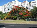 Flamboyant do Parque do Flamengo 01.jpg 3,648 × 2,736; 3.81 MB
-
 Flamboyant do Parque do Flamengo 02.jpg 3,648 × 2,736; 3.79 MB
-
 Flamboyant do Parque do Flamengo 03.jpg 3,648 × 2,736; 3.87 MB
-
 Flamboyant do Parque do Flamengo 04.jpg 3,648 × 2,736; 3.3 MB
-
 Flamboyant do Parque do Flamengo 05.jpg 3,648 × 2,736; 3.48 MB
-
 Flamboyant do Parque do Flamengo 06.jpg 3,648 × 2,736; 4.26 MB
-
 Flamboyant do Parque do Flamengo 07.jpg 3,648 × 2,736; 4.36 MB
-
 Flamboyant do Parque do Flamengo 08.jpg 3,648 × 2,736; 4 MB
-
 Flamboyant do Parque do Flamengo 09.jpg 3,648 × 2,736; 4.37 MB
-
 Flamboyant do Parque do Flamengo 10.jpg 3,648 × 2,736; 4.55 MB
-
 Flamboyant do Parque do Flamengo 11.jpg 3,648 × 2,736; 4.5 MB
-
 Flamboyant do Parque do Flamengo 12.jpg 3,648 × 2,736; 4.23 MB
-
 Formação rochosa em Itaguaçu, ES, Brasil. - panoramio.jpg 1,200 × 655; 569 KB
-
 Guarapari2.JPG 4,384 × 3,288; 7.02 MB
-
 Guarapari3.JPG 3,000 × 4,000; 4.89 MB
-
 Guarapari4.jpg 3,000 × 4,000; 6.85 MB
-
 Guarapari5.JPG 4,000 × 3,000; 5.46 MB
-
 Jericoacoara11012014.JPG 2,760 × 4,912; 10.97 MB
-
 Kirei Koi.JPG 2,112 × 2,816; 1.11 MB
-
 Litoral sul fluminense.jpg 4,320 × 3,240; 3.1 MB
-
 Mendanha, Diamantina MG Brasil - Arquitetura típica da região - panoramio.jpg 4,288 × 2,803; 2.47 MB
-
 Mendanha, Diamantina MG Brasil - Capela - panoramio.jpg 4,288 × 3,216; 3.12 MB
-
 Mendanha, Diamantina MG Brasil - Igreja N. S. das Mercês - panoramio (1).jpg 4,288 × 2,818; 2.16 MB
-
 Mendanha, Diamantina MG Brasil - Igreja N. S. das Mercês - panoramio (2).jpg 4,288 × 3,216; 3.08 MB
-
 Mendanha, Diamantina MG Brasil - Igreja N. S. das Mercês - panoramio.jpg 4,288 × 3,216; 3.04 MB
-
 Mendanha, Diamantina MG Brasil - Igreja N.S. da Mercês - panoramio.jpg 4,288 × 3,216; 3.07 MB
-
 Mendanha, Diamantina MG Brasil - Muro de pedra feito por escravos - panoramio.jpg 4,288 × 3,216; 3.22 MB
-
 Mendanha, Diamantina MG Brasil - Placa da Estrada Real - panoramio.jpg 4,288 × 3,216; 3.16 MB
-

-
 Mendanha, Diamantina MG Brasil - Ponte pedestres sobre o Jequitinhonha - panoramio.jpg 4,288 × 3,216; 3.2 MB
-
 Mendanha, Diamantina MG Brasil - Ponte sobre o Jequitinhonha - panoramio.jpg 4,288 × 3,216; 3.18 MB
-
 Mendanha, Diamantina MG Brasil - Rio Jequitinhonha - panoramio.jpg 4,288 × 3,216; 3.06 MB
-
 Mendanha, Diamantina MG Brasil - Vis parcial - panoramio.jpg 4,288 × 3,216; 3.27 MB
-
 Mendanha, Diamantina MG Brasil - Vista do povoado - panoramio.jpg 4,288 × 3,216; 3.24 MB
-
 Mendanha, Diamantina MG Brasil - Vista do Vilarejo - panoramio.jpg 4,288 × 3,216; 3.23 MB
-
 Milho Verde, Serro MG Brasil - Capela do Rosário - panoramio (1).jpg 4,288 × 3,216; 2.94 MB
-
 Milho Verde, Serro MG Brasil - Capela do Rosário - panoramio (2).jpg 4,288 × 3,216; 2.92 MB
-
 Milho Verde, Serro MG Brasil - Capela do Rosário - panoramio (3).jpg 4,288 × 3,216; 2.92 MB
-
 Milho Verde, Serro MG Brasil - Capela do Rosário - panoramio.jpg 4,288 × 3,216; 2.99 MB
-
 Milho Verde, Serro MG Brasil - Estrada para Capivari, pico do Itambé - panoramio.jpg 4,288 × 3,216; 2.91 MB
-

-
 Milho Verde, Serro MG Brasil - Trevo de Capivari - panoramio.jpg 4,288 × 3,216; 3.19 MB
-

-
 NATUREZA EM DETALHES, CORES E LUZ..JPG 5,184 × 2,920; 4.87 MB
-
 NE 008.jpg 3,456 × 5,184; 8.14 MB
-
 NE 028.jpg 5,184 × 3,456; 11.77 MB
-
 NE 030.jpg 5,184 × 3,456; 10.9 MB
-
 NE 031.jpg 5,184 × 3,456; 9.5 MB
-
 NE 049.jpg 5,184 × 3,456; 12.35 MB
-
 O banco da Etação.jpg 1,920 × 1,280; 1.15 MB
-
 OBSERVANDO O ENTARDECER 2.JPG 5,184 × 2,920; 11.41 MB
-
 OBSERVANDO O ENTARDECER..JPG 5,184 × 2,920; 6.95 MB
-
 Parque Nacional do Monte Roraima Erick Caldas Xavier (3).jpg 2,592 × 1,944; 2.42 MB
-
 Península de Maraú - BA.jpg 1,800 × 1,200; 885 KB
-
 Península de Maraú 1 - BA.jpg 1,800 × 1,200; 1.02 MB
-
 Península de Maraú.jpg 1,800 × 1,200; 790 KB
-
 Planície próxima ao Poço Verde em São Thomé das Letras.JPG 4,608 × 3,456; 3.45 MB
-
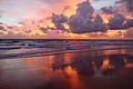
 Por do Sol na Praia de Ipanema.JPG 2,000 × 1,325; 317 KB
-
 Poço Verde em São Thomé das Letras - MG.JPG 4,608 × 3,456; 3.4 MB
-
 Poço Verde em São Thomé das Letras.JPG 4,608 × 3,456; 3.42 MB
-
 Poço Verde na cidade de São Thomé das Letras - MG.JPG 4,608 × 3,456; 3.46 MB
-
 Poço Verde na cidade de São Thomé das Letras.JPG 4,608 × 3,456; 3.42 MB
-
 Praia do Quebra Coco.jpg 2,560 × 1,920; 1.25 MB
-
 Pôr do sol em Petrolina.jpg 640 × 480; 34 KB
-
 Ready to take-off.JPG 2,112 × 2,816; 1.11 MB
-
 Represa vista dentro do Mirante do Núcleo do Engordador, Parque Estadual da Cantareira.jpg 5,184 × 3,456; 14.88 MB
-
 REVERENCIANDO A LUA...JPG 5,184 × 2,920; 6.07 MB
-
 Serro MG Brasil - Capela de Santa Rita - panoramio (2).jpg 4,288 × 3,216; 2.86 MB
-
 Serro MG Brasil - Casarão da prefeitura - panoramio.jpg 4,288 × 3,216; 3.12 MB
-
 Serro MG Brasil - Casarão na pça. João Pinheiro - panoramio.jpg 4,288 × 3,216; 3.07 MB
-
 Serro MG Brasil - Casarão na Pça. João Pinheiro - panoramio.jpg 4,288 × 3,216; 3.1 MB
-
 Serro MG Brasil - Escadaria da Capela de Santa Rita - panoramio (1).jpg 4,288 × 3,216; 3.18 MB
-
 Serro MG Brasil - Escandaria da Capela de Santa Rita - panoramio.jpg 4,288 × 3,216; 3.21 MB
-
 Serro MG Brasil - Igreja do Carmo - panoramio.jpg 4,288 × 3,216; 3.16 MB
-
 Serro MG Brasil - Interior da Igreja de N, S. da Conceição - panoramio.jpg 4,288 × 3,216; 3.17 MB
-
 Serro MG Brasil - panoramio (1).jpg 4,288 × 3,216; 3.08 MB
-
 Serro MG Brasil - panoramio.jpg 4,288 × 3,216; 3.12 MB
-
 Serro MG Brasil - Praça João Pinheiro - panoramio (1).jpg 4,288 × 3,216; 3.18 MB
-
 Serro MG Brasil - Pça João Pinheiro - panoramio.jpg 4,288 × 3,216; 3.11 MB
-
 Serro MG Brasil - Pça. João Pinherro com vista Igreja do Carmo - panoramio.jpg 4,288 × 3,216; 3.16 MB
-
 Serro MG Brasil - Rua Antonio Honório com vista para Capela de Santa Rita - panoramio.jpg 4,288 × 3,216; 3.12 MB
-
 Serro MG Brasil - Vista parcial - panoramio.jpg 4,288 × 3,216; 3.19 MB
-
 São Gonçalo do Rio das Pedras, Serro MG Brasil - Igreja N. S. do Rosário - panoramio.jpg 4,288 × 3,216; 3.19 MB
-
 São Gonçalo do Rio das Pedras, Serro MG Brasil - Largo Felix Antonio - panoramio (1).jpg 4,288 × 3,216; 3.16 MB
-
 São Gonçalo do Rio das Pedras, Serro MG Brasil - Largo Felix Antonio - panoramio.jpg 4,288 × 3,216; 3.12 MB
-
 São Gonçalo do Rio das Pedras, Serro MG Brasil - Matriz de S. Gonçalo - panoramio (1).jpg 3,681 × 3,008; 2.12 MB
-
 São Gonçalo do Rio das Pedras, Serro MG Brasil - Matriz de S. Gonçalo - panoramio.jpg 4,288 × 3,216; 3.17 MB
-
 São Gonçalo do Rio das Pedras, Serro MG Brasil - Rua do povoado - panoramio.jpg 4,288 × 3,216; 3.06 MB
-
 São Gonçalo do Rio das Pedras, Serro MG Brasil - Rua Principal - panoramio.jpg 4,288 × 3,216; 3.16 MB
-
 Tradição do Bonde.jpg 1,920 × 1,280; 1.05 MB
-
 Tres Barras, Serro MG Brasil - Igreja São Geraldo - panoramio.jpg 4,288 × 3,216; 3.13 MB
-
 Tres Barras, Serro MG Brasil - Sinalização - panoramio.jpg 4,288 × 3,216; 2.98 MB
-
 Tres Barras, Serro MG Brasil - Travessia do Rio Jequitinhonha - panoramio.jpg 4,288 × 3,216; 3.14 MB
-

-
 Vau, Serro MG Brasil - Igrejinha do Vau - panoramio.jpg 4,288 × 3,216; 2.8 MB
-
 Waterfall Piabetá Rio de Janeiro (108 m) - panoramio (1).jpg 4,928 × 3,264; 1.09 MB
-
 Waterfall Piabetá Rio de Janeiro (108 m) - panoramio (10).jpg 4,928 × 3,264; 1.21 MB
-
 Waterfall Piabetá Rio de Janeiro (108 m) - panoramio (11).jpg 4,928 × 3,264; 1.38 MB
-
 Waterfall Piabetá Rio de Janeiro (108 m) - panoramio (12).jpg 4,928 × 3,264; 1.03 MB
-
 Waterfall Piabetá Rio de Janeiro (108 m) - panoramio (2).jpg 3,264 × 4,928; 1.25 MB
-
 Waterfall Piabetá Rio de Janeiro (108 m) - panoramio (3).jpg 3,264 × 4,928; 1.09 MB
-
 Waterfall Piabetá Rio de Janeiro (108 m) - panoramio (4).jpg 3,264 × 4,928; 1.3 MB
-
 Waterfall Piabetá Rio de Janeiro (108 m) - panoramio (5).jpg 3,264 × 4,928; 1.3 MB
-
 Waterfall Piabetá Rio de Janeiro (108 m) - panoramio (6).jpg 3,264 × 4,928; 1.43 MB
-
 Waterfall Piabetá Rio de Janeiro (108 m) - panoramio (7).jpg 3,264 × 4,928; 1.23 MB
-
 Waterfall Piabetá Rio de Janeiro (108 m) - panoramio (8).jpg 3,264 × 4,928; 1.29 MB
-
 Waterfall Piabetá Rio de Janeiro (108 m) - panoramio (9).jpg 4,928 × 3,264; 1.52 MB
-
 Waterfall Piabetá Rio de Janeiro (108 m) - panoramio.jpg 3,264 × 4,928; 1.33 MB


.jpg)
.jpg)

.jpg)
.jpg)

.jpg)


.jpg)


.jpg)


.jpg)
.jpg)
.jpg)


.jpg)
.jpg)


.jpg)
.jpg)
.jpg)


.jpg)


.jpg)


.jpg)


.jpg)

.jpg)


.jpg)

.jpg)


_-_panoramio_(1).jpg)
_-_panoramio_(10).jpg)
_-_panoramio_(11).jpg)
_-_panoramio_(12).jpg)
_-_panoramio_(2).jpg)
_-_panoramio_(3).jpg)
_-_panoramio_(4).jpg)
_-_panoramio_(5).jpg)
_-_panoramio_(6).jpg)
_-_panoramio_(7).jpg)
_-_panoramio_(8).jpg)
_-_panoramio_(9).jpg)
_-_panoramio.jpg)