Category:Brazil photographs taken on 2012-04-08
Jump to navigation
Jump to search
| ← | Sunday 8 April 2012 | → | ||
| ← | April 2012 | → | ||

Brazil photographs taken on 8 April 2012.
Image files should be categorized here automatically using {{taken on}} template. Direct categorisation is also possible, if automatic is impossible.
Media in category "Brazil photographs taken on 2012-04-08"
The following 72 files are in this category, out of 72 total.
-
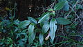 Aciotis rubricaulis (Mart. ex DC.) Triana (6914142020).jpg 1,600 × 903; 714 KB
-
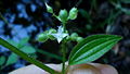
 Aciotis rubricaulis (Mart. ex DC.) Triana (6914142266).jpg 1,600 × 900; 712 KB
-
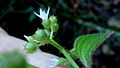
 Aciotis rubricaulis (Mart. ex DC.) Triana (6914142786).jpg 1,600 × 902; 660 KB
-
 Aciotis rubricaulis (Mart. ex DC.) Triana (6914143200).jpg 1,600 × 905; 637 KB
-
 Aciotis rubricaulis (Mart. ex DC.) Triana (6914143370).jpg 899 × 1,600; 497 KB
-
 Aciotis rubricaulis (Mart. ex DC.) Triana (6914143570).jpg 1,600 × 901; 555 KB
-
 Aciotis rubricaulis (Mart. ex DC.) Triana (7060227011).jpg 1,600 × 901; 696 KB
-
 Aciotis rubricaulis (Mart. ex DC.) Triana (7060227463).jpg 1,600 × 904; 534 KB
-
 Aciotis rubricaulis (Mart. ex DC.) Triana (7060228319).jpg 1,600 × 902; 569 KB
-
 Aciotis rubricaulis (Mart. ex DC.) Triana (7060228509).jpg 1,600 × 905; 625 KB
-
 Aciotis rubricaulis (Mart. ex DC.) Triana (7060228743).jpg 1,600 × 899; 677 KB
-
 Air Canada Boeing 767-300ER C-FPCA GRU 2012-4-8.png 1,200 × 812; 2.79 MB
-
 Arquitetura colonial (Ouro Preto).jpg 4,896 × 3,672; 5.13 MB
-

-
 Bairro Boca da Mata, divide os Estados de São Paulo e Minas Gerais. - panoramio.jpg 3,648 × 2,736; 4.08 MB
-
 Bairro Boca da mata. - panoramio (1).jpg 3,648 × 2,736; 5.21 MB
-
 Bairro Boca da mata. - panoramio.jpg 3,648 × 2,736; 4.34 MB
-
 Bairro Boca damata. - panoramio.jpg 3,648 × 2,736; 4.25 MB
-
 Boca da Mata. - panoramio.jpg 3,648 × 2,736; 4.31 MB
-
 Boeing 737-8AS, Gol Linhas Aereas Inteligentes AN2096359.jpg 1,200 × 866; 243 KB
-
 Boeing 737-8EH, Gol Linhas Aereas Inteligentes AN2099495.jpg 1,250 × 913; 234 KB
-
 Bêla construção em torno da Cachoeira Boca da mata. - panoramio.jpg 3,648 × 2,736; 3.56 MB
-
 Cachoeira Boca da Mata. - panoramio.jpg 3,648 × 2,736; 4.13 MB
-
 Cachoeira da Boca da Mata esta localizada na Serra da Manqueira. - panoramio.jpg 3,648 × 2,736; 4.26 MB
-
 Cachoeira da Boca da Mata Paisagem. - panoramio.jpg 3,648 × 2,736; 6.17 MB
-
 Cachoeira da Boca da mata é formado pelo Rio Camanducaia. - panoramio.jpg 3,648 × 2,736; 4.12 MB
-
 Cachoeira da Boca da Mata. - panoramio (1).jpg 3,648 × 2,736; 4.22 MB
-
 Cachoeira da Boca da Mata. - panoramio.jpg 3,648 × 2,736; 3.84 MB
-
 Cachoeira formada pelo Rio Camanducaia. - panoramio.jpg 3,648 × 2,736; 6.5 MB
-
 Campo de São Bento - panoramio (2).jpg 4,608 × 3,456; 7.91 MB
-
 Cantorchilus longirostris -Registro, Sao Paulo, Brazil-8 (1).jpg 640 × 474; 226 KB
-
 Cantorchilus longirostris -Registro, Sao Paulo, Brazil-8.jpg 640 × 518; 254 KB
-
 Casas de Minas (Ouro Preto).jpg 4,896 × 3,672; 4 MB
-
 Catamaran - panoramio.jpg 4,288 × 3,216; 3.16 MB
-
 Choeira no Bairro Boca da Mata. - panoramio.jpg 3,648 × 2,736; 3.99 MB
-
 Chuva - panoramio (2).jpg 2,592 × 1,456; 693 KB
-
 Comunidade de Sant'Ana - Conrado - Miguel Pereira - panoramio (1).jpg 2,048 × 1,536; 847 KB
-
 Comunidade de Sant'Ana - Conrado - Miguel Pereira - panoramio.jpg 1,536 × 2,048; 1.19 MB
-
 Comunidade Sant'Ana - Miguel Pereira - panoramio.jpg 1,560 × 2,048; 1.04 MB
-
 Cristo de braços abertos aos visitantes da Pêdra Bêla Maio 2012. - panoramio.jpg 3,264 × 2,448; 3 MB
-
 Detalhe Edifícios R. Bernardo Vasconcellos (Ouro Preto).jpg 4,896 × 3,672; 4.03 MB
-
 Escadaria que dá acesso a Pêdra Bêla Maio 2012. - panoramio.jpg 3,264 × 2,448; 5.6 MB
-
 Estação de conrado - Miguel Pereira - panoramio.jpg 2,048 × 1,536; 1.19 MB
-

-
 Fundo da Igreja de Paraty - panoramio.jpg 3,648 × 2,736; 2.56 MB
-
 Gados em torno da Cachoeira Boca da Mata. - panoramio.jpg 3,648 × 2,736; 3.72 MB
-
 Icaraí no inverno - panoramio.jpg 4,607 × 2,767; 2.52 MB
-
 Icaraí, Niterói - State of Rio de Janeiro, Brazil - panoramio.jpg 3,648 × 2,736; 2.56 MB
-
 Ilhabela - SP - panoramio (3).jpg 3,648 × 2,736; 3.27 MB
-
 Mares de Morros1.jpg 4,288 × 3,216; 3.3 MB
-
 Montanhas em torno da Cachoeira da Boca da mata. - panoramio.jpg 3,648 × 2,736; 3.95 MB
-
 Museu da Inconfidência e Tiradentes.jpg 4,816 × 3,304; 7.53 MB
-
 Paisagem em Icarái - panoramio.jpg 4,172 × 2,741; 2.28 MB
-
 Paisagem em torno da Cachoeira da Boca da mata. - panoramio.jpg 3,648 × 2,736; 3.95 MB
-
 Paisagem em torno do Bairro Boca da mata. - panoramio.jpg 3,648 × 2,736; 4.06 MB
-
 Paisagem visto da Pêdra Bêla Maio 2012. - panoramio.jpg 3,264 × 2,448; 4.88 MB
-
 Pedra Bela Paisagem. - panoramio.jpg 3,648 × 2,736; 5.72 MB
-

-
 Ponte sobre a Cachoeira da Boca da Mata. - panoramio.jpg 3,648 × 2,736; 4.21 MB
-
 Ponte sobre o Rio Camanducaia no Bairro Boca da Mata. - panoramio.jpg 3,648 × 2,736; 4.37 MB
-

-
 Praça do Centro em Campo Largo 2012 Nokia N8 - panoramio.jpg 4,000 × 2,248; 1.64 MB
-
 Praça Tiradentes (Ouro Preto).jpg 4,896 × 3,672; 5.54 MB
-
 R. Bernardo Vasconcellos Ouro Preto.jpg 3,672 × 4,896; 3.9 MB
-
 República Soberana - panoramio.jpg 4,288 × 3,216; 7.59 MB
-
 SP-322, Acesso a Olímpia, SP - panoramio.jpg 4,608 × 2,592; 4.38 MB
-
 Surf na Praia de icaraí - panoramio.jpg 4,608 × 3,456; 3.71 MB
-
 Surf na praia de icaraí - panoramio.jpg 4,608 × 3,456; 4 MB
-
 Vale da Lua (23).jpg 2,592 × 1,944; 1.45 MB
-
 Vale da Lua (68).jpg 2,592 × 1,944; 1.63 MB
-
 Vila do Abraão - panoramio (1).jpg 4,288 × 3,216; 3.19 MB
-
 Vila do Abraão - panoramio (2).jpg 4,288 × 3,216; 3.13 MB
_Triana_(6914142020).jpg)
_Triana_(6914142266).jpg)
_Triana_(6914142786).jpg)
_Triana_(6914143200).jpg)
_Triana_(6914143370).jpg)
_Triana_(6914143570).jpg)
_Triana_(7060227011).jpg)
_Triana_(7060227463).jpg)
_Triana_(7060228319).jpg)
_Triana_(7060228509).jpg)
_Triana_(7060228743).jpg)

.jpg)


.jpg)


.jpg)


.jpg)
.jpg)

.jpg)


.jpg)
.jpg)


.jpg)


.jpg)


.jpg)


.jpg)
.jpg)
.jpg)
.jpg)