Category:Braybrooke
Jump to navigation
Jump to search
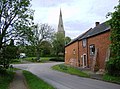
English: Braybrooke is a small village in north west Northamptonshire, England. It is situated about halfway between Market Harborough and Desborough. It lies in a valley between two ridges one of which is surmounted by the A6 trunk road. The surrounding land in the parish is a mixture of pasture and arable.
village and civil parish in Northamptonshire, United Kingdom  | |||||
| Upload media | |||||
| Instance of | |||||
|---|---|---|---|---|---|
| Location | North Northamptonshire, Northamptonshire, East Midlands, England | ||||
 | |||||
Subcategories
This category has only the following subcategory.
A
Media in category "Braybrooke"
The following 164 files are in this category, out of 164 total.
-
 "Improving access to the countryside" - geograph.org.uk - 445448.jpg 640 × 477; 150 KB
-
 A6 Harborough Road - geograph.org.uk - 3424202.jpg 1,858 × 1,386; 814 KB
-
 A6 Harborough Road towards Market Harborough - geograph.org.uk - 3424206.jpg 4,000 × 3,000; 3.44 MB
-
 A6 southbound - geograph.org.uk - 4157906.jpg 640 × 480; 42 KB
-
 A6 towards Market Harborough - geograph.org.uk - 5253932.jpg 480 × 640; 38 KB
-
 A6 towards Market Harborough - geograph.org.uk - 6192703.jpg 1,024 × 684; 267 KB
-
 A6 towards Market Harborough - geograph.org.uk - 6192708.jpg 1,024 × 684; 308 KB
-
 A6 towards Market Harborough - geograph.org.uk - 6192710.jpg 1,024 × 684; 228 KB
-
 ALE Cipollini Cycling Team - geograph.org.uk - 5025260.jpg 427 × 640; 62 KB
-
 Along the path to Braybrooke - geograph.org.uk - 4536524.jpg 480 × 640; 57 KB
-
 Arched Bridge - geograph.org.uk - 175213.jpg 640 × 480; 135 KB
-
 B576 Harborough Road at The Hermitage - geograph.org.uk - 3424156.jpg 2,460 × 1,689; 1.16 MB
-
 Braybrooke Castle earthworks - geograph.org.uk - 2868465.jpg 640 × 427; 83 KB
-
 Braybrooke church and baptist chapel - geograph.org.uk - 445471.jpg 640 × 477; 95 KB
-
 Braybrooke Cricket Club - geograph.org.uk - 445457.jpg 640 × 477; 75 KB
-
 Braybrooke Cricket Club's roller - geograph.org.uk - 445464.jpg 640 × 477; 75 KB
-
 Braybrooke Lodge auto-gate - geograph.org.uk - 445443.jpg 640 × 477; 80 KB
-
 Braybrooke Parish Church - geograph.org.uk - 4525758.jpg 480 × 640; 97 KB
-

-

-

-
 Braybrooke Road meets the A6 Harborough Road - geograph.org.uk - 3424215.jpg 3,677 × 2,614; 2.7 MB
-
 Braybrooke, Northamptonshire - geograph.org.uk - 5862160.jpg 1,024 × 768; 210 KB
-
 Braybrooke-Bridge over The River Jordan - geograph.org.uk - 4816450.jpg 1,600 × 1,200; 558 KB
-
 Bridge over the Jordan - geograph.org.uk - 1812201.jpg 3,648 × 2,736; 2.23 MB
-
 Bridge over the River Jordan, Braybrooke - geograph.org.uk - 5862162.jpg 1,024 × 768; 203 KB
-
 Bridleway to Braybrooke - geograph.org.uk - 4849251.jpg 640 × 640; 129 KB
-
 Bridleway to Braybrooke - geograph.org.uk - 4849253.jpg 640 × 640; 126 KB
-
 Bridleway to Braybrooke - geograph.org.uk - 4849256.jpg 640 × 640; 78 KB
-
 Bridleway to Braybrooke. - geograph.org.uk - 337448.jpg 640 × 480; 116 KB
-
 Buttercup Meadow - geograph.org.uk - 4525749.jpg 640 × 480; 80 KB
-
 By the banks of the River Jordan - geograph.org.uk - 1986278.jpg 4,000 × 3,000; 2.85 MB
-
 By Wyndie Rydge Farm - geograph.org.uk - 5472721.jpg 480 × 640; 55 KB
-
 Close to Ritches Lodge - geograph.org.uk - 5293421.jpg 640 × 480; 48 KB
-
 Countryside near Braybrooke - geograph.org.uk - 4744524.jpg 640 × 426; 50 KB
-
 Crossroads near Braybrooke, Northamptonshire - geograph.org.uk - 5861398.jpg 1,024 × 768; 200 KB
-
 Desborough Road, Braybrooke - geograph.org.uk - 1994005.jpg 4,000 × 3,000; 2.87 MB
-
 Desborough Road, Braybrooke - geograph.org.uk - 5861411.jpg 1,024 × 768; 178 KB
-
 Desborough, Travel Plaza - geograph.org.uk - 3973466.jpg 1,024 × 768; 111 KB
-
 Down the slope to Park Hill Farm - geograph.org.uk - 1812250.jpg 3,648 × 2,736; 2.14 MB
-
 Dried up pond - geograph.org.uk - 4525752.jpg 640 × 480; 94 KB
-
 Drive to Upper lodge - geograph.org.uk - 396464.jpg 640 × 480; 98 KB
-
 Drops Cycling Team - geograph.org.uk - 5025259.jpg 427 × 640; 64 KB
-
 Farm track near Braybrooke - geograph.org.uk - 5862199.jpg 1,024 × 768; 235 KB
-
 Farm track near Market Harborough - geograph.org.uk - 5862216.jpg 1,024 × 768; 214 KB
-
 Farmland along the A6 Harborough Road - geograph.org.uk - 3424166.jpg 4,000 × 3,000; 3.37 MB
-
 Field road out of Braybrooke - geograph.org.uk - 5462708.jpg 480 × 640; 104 KB
-
 Field view near Braybrooke - geograph.org.uk - 4525739.jpg 640 × 480; 63 KB
-
 Footpath to Braybrooke - geograph.org.uk - 175216.jpg 640 × 480; 115 KB
-
 Garden in Braybrooke - geograph.org.uk - 445467.jpg 640 × 477; 136 KB
-
 Gates to the Estate - geograph.org.uk - 5293423.jpg 640 × 480; 72 KB
-
 Good works of Northamptonshire County Council - geograph.org.uk - 1986246.jpg 4,000 × 3,000; 2.8 MB
-
 Grass roller - geograph.org.uk - 4525754.jpg 640 × 480; 65 KB
-
 Grazing cattle on the old castle earthworks, Braybrooke - geograph.org.uk - 3545819.jpg 4,240 × 3,130; 4.26 MB
-
 Green Lane, Braybrooke - geograph.org.uk - 4525735.jpg 480 × 640; 76 KB
-
 Harborough Road - geograph.org.uk - 5293417.jpg 640 × 480; 44 KB
-
 Harborough Road to Braybrooke - geograph.org.uk - 5472719.jpg 480 × 640; 53 KB
-
 Harborough Road, near Braybrooke - geograph.org.uk - 5862191.jpg 1,024 × 768; 187 KB
-
 Harborough Road, near Braybrooke - geograph.org.uk - 5862196.jpg 1,024 × 768; 217 KB
-
 Harborough Road, near Braybrooke - geograph.org.uk - 5862209.jpg 1,024 × 768; 161 KB
-

-
 Jurassic Way between Great Oxendon and Braybrooke - geograph.org.uk - 1811579.jpg 3,648 × 2,736; 2.17 MB
-
 Jurassic Way near Braybrooke, Northampton - geograph.org.uk - 5861409.jpg 1,024 × 768; 267 KB
-
 Jurassic Way to Park Hill Farm - geograph.org.uk - 1986236.jpg 4,000 × 3,000; 2.88 MB
-
 Jurassic Way under the Midland Mainline track - geograph.org.uk - 1986256.jpg 4,000 × 3,000; 2.86 MB
-
 Jurassic Way west toward Braybrooke - geograph.org.uk - 1986224.jpg 4,000 × 3,000; 2.93 MB
-
 Jurassic, Macmillan and Midshires Ways out of Braybrooke - geograph.org.uk - 1994064.jpg 4,000 × 3,000; 2.87 MB
-
 Lake at Waterloo Lodge - geograph.org.uk - 4849261.jpg 640 × 640; 127 KB
-
 Leaving Waterloo Lodge - geograph.org.uk - 4849264.jpg 640 × 640; 114 KB
-
 Left hand bend in Braybrooke Road - geograph.org.uk - 5639215.jpg 640 × 480; 24 KB
-
 Leicestershire Countryside - geograph.org.uk - 4744522.jpg 502 × 640; 56 KB
-
 Look Left. - geograph.org.uk - 359066.jpg 640 × 480; 132 KB
-
 Mature farm building - geograph.org.uk - 1812184.jpg 3,648 × 2,736; 2.12 MB
-

-
 New road layout at the Hermitage - geograph.org.uk - 307223.jpg 640 × 480; 73 KB
-
 Newton Way, Braybrooke - geograph.org.uk - 5862174.jpg 1,024 × 768; 169 KB
-
 Onto the Jurassic Way... - geograph.org.uk - 444769.jpg 640 × 477; 141 KB
-
 Over head line works at Braybrooke - geograph.org.uk - 1811592.jpg 640 × 480; 94 KB
-
 Pond near Braybrooke - geograph.org.uk - 4525755.jpg 640 × 480; 88 KB
-
 Powerlines. - geograph.org.uk - 338679.jpg 640 × 480; 89 KB
-
 Pylon by the Midland Mainline - geograph.org.uk - 4782703.jpg 640 × 494; 39 KB
-
 Railway Bridge. - geograph.org.uk - 337474.jpg 640 × 480; 118 KB
-
 Railway track with approaching express - geograph.org.uk - 337470.jpg 640 × 480; 111 KB
-
 Ridge ^ Furrow near Braybrooke - geograph.org.uk - 4525740.jpg 640 × 480; 63 KB
-

-
 Ritches Lodge Farm near Braybrooke - geograph.org.uk - 5861395.jpg 1,024 × 768; 199 KB
-
 Road dips before ascending ridge to Braybrooke - geograph.org.uk - 3545802.jpg 4,320 × 3,240; 5.33 MB
-
 Road from Braybrooke meets A6. - geograph.org.uk - 337444.jpg 640 × 480; 96 KB
-
 Road passes under railway bridge near Braybrooke - geograph.org.uk - 3545810.jpg 4,320 × 3,240; 6.01 MB
-
 Rolling countryside - geograph.org.uk - 4782719.jpg 640 × 426; 41 KB
-
 Roundabout on A6 towards Market Harborough - geograph.org.uk - 6192706.jpg 1,024 × 684; 244 KB
-
 Rural lane near Braybrooke, Northamptonshire - geograph.org.uk - 5861391.jpg 1,024 × 768; 228 KB
-
 Seat by the unsurfaced Oxendon Road - geograph.org.uk - 1811573.jpg 3,648 × 2,736; 2.13 MB
-
 Seat not for sitting on - geograph.org.uk - 1994250.jpg 4,000 × 3,000; 2.91 MB
-
 Sign of the Times. - geograph.org.uk - 337456.jpg 640 × 480; 120 KB
-
 Site of Braybrooke Castle - geograph.org.uk - 1993946.jpg 4,000 × 3,000; 2.85 MB
-
 Small pond in a field - geograph.org.uk - 4782705.jpg 640 × 353; 36 KB
-
 Stables near Braybrooke - geograph.org.uk - 445477.jpg 640 × 477; 111 KB
-
 Stile on the Jurassic Way - geograph.org.uk - 1812215.jpg 3,648 × 2,736; 2.26 MB
-
 Team GB Cycling - geograph.org.uk - 5025267.jpg 427 × 640; 64 KB
-
 Temporary bridge for National Grid Contractors - geograph.org.uk - 1811605.jpg 3,648 × 2,736; 2.17 MB
-

-
 The Jordan Valley - geograph.org.uk - 4744526.jpg 451 × 640; 42 KB
-
 The Swan, Braybrooke - geograph.org.uk - 2542114.jpg 1,496 × 1,122; 468 KB
-
 The tail of The Tour of Britain - geograph.org.uk - 5025264.jpg 427 × 640; 82 KB
-
 The tail of The Tour of Britain - geograph.org.uk - 5025265.jpg 427 × 640; 78 KB
-
 The tail of The Tour of Britain - geograph.org.uk - 5025268.jpg 427 × 640; 80 KB
-
 The tail of The Tour of Britain - geograph.org.uk - 5025272.jpg 427 × 640; 81 KB
-
 The top of Green Lane, Braybrooke - geograph.org.uk - 4525738.jpg 480 × 640; 99 KB
-
 Three Ways at The Hermitage - geograph.org.uk - 1986192.jpg 4,000 × 3,000; 2.86 MB
-
 Tour of Britain - geograph.org.uk - 5025082.jpg 427 × 640; 58 KB
-
 Tour of Britain - geograph.org.uk - 5025083.jpg 427 × 640; 64 KB
-
 Tour of Britain - geograph.org.uk - 5025084.jpg 427 × 640; 73 KB
-
 Tour of Britain - geograph.org.uk - 5025090.jpg 427 × 640; 52 KB
-
 Tour of Britain - geograph.org.uk - 5025249.jpg 427 × 640; 62 KB
-
 Tour of Britain - geograph.org.uk - 5025252.jpg 427 × 640; 65 KB
-
 Tour of Britain - geograph.org.uk - 5025255.jpg 427 × 640; 64 KB
-
 Tour of Britain convoy - geograph.org.uk - 5024937.jpg 640 × 427; 86 KB
-
 Tour of Britain convoy - geograph.org.uk - 5024938.jpg 427 × 640; 58 KB
-
 Tour of Britain convoy - geograph.org.uk - 5025072.jpg 427 × 640; 67 KB
-
 Tour of Britain convoy - geograph.org.uk - 5025073.jpg 427 × 640; 58 KB
-
 Tour of Britain convoy - geograph.org.uk - 5025075.jpg 427 × 640; 61 KB
-
 Tour of Britain convoy - geograph.org.uk - 5025077.jpg 427 × 640; 59 KB
-
 Tour of Britain convoy - geograph.org.uk - 5025079.jpg 427 × 640; 53 KB
-
 Tour of Britain convoy - geograph.org.uk - 5025081.jpg 427 × 640; 59 KB
-
 Tour of Britain convoy - geograph.org.uk - 5025086.jpg 427 × 640; 62 KB
-
 Tour of Britain convoy - geograph.org.uk - 5025088.jpg 427 × 640; 60 KB
-
 Towards Market Harborough - geograph.org.uk - 4849258.jpg 640 × 640; 49 KB
-
 Towards Ritches Lodge - geograph.org.uk - 5293420.jpg 480 × 640; 61 KB
-
 Towards Waterloo Lodge - geograph.org.uk - 4849257.jpg 640 × 640; 49 KB
-
 Towards Waterloo Lodge - geograph.org.uk - 4849263.jpg 640 × 640; 83 KB
-
 Track to farmland along the A6 Harborough Road - geograph.org.uk - 3424258.jpg 4,000 × 3,000; 3.38 MB
-
 View from beside The Bungalow - geograph.org.uk - 5293415.jpg 480 × 640; 51 KB
-
 View from Waterloo Lodge - geograph.org.uk - 4849265.jpg 640 × 640; 61 KB
-
 View to Braybrooke Lower Lodge. - geograph.org.uk - 337477.jpg 640 × 480; 69 KB
-
 View towards Braybrooke. - geograph.org.uk - 364495.jpg 640 × 480; 92 KB
-
 Wheat field - geograph.org.uk - 4782721.jpg 640 × 426; 39 KB
-
 Wheat Field - geograph.org.uk - 4782725.jpg 640 × 487; 37 KB
-
 Wheat fields on the Jurassic Way to Great Oxenden - geograph.org.uk - 1994237.jpg 4,000 × 3,000; 2.88 MB
-
 Winding Lane - geograph.org.uk - 175214.jpg 640 × 480; 125 KB
-

-
 A Small Section of Midshires Way. - geograph.org.uk - 364504.jpg 640 × 480; 135 KB
-
 A6 bypass of Desborough. - geograph.org.uk - 372807.jpg 640 × 480; 82 KB
-
 Another good bridge - geograph.org.uk - 445453.jpg 640 × 477; 138 KB
-
 Blackthorn or hawthorn^ - geograph.org.uk - 445473.jpg 640 × 477; 138 KB
-
 Bridge over A6. - geograph.org.uk - 372818.jpg 640 × 480; 95 KB
-
 Bridge over River Jordan. - geograph.org.uk - 359465.jpg 640 × 450; 127 KB
-
 Crossing the Track. - geograph.org.uk - 359057.jpg 640 × 480; 169 KB
-
 Entrance to Sewage works. - geograph.org.uk - 359455.jpg 640 × 480; 127 KB
-
 Footpath across the rape field - geograph.org.uk - 445482.jpg 640 × 477; 82 KB
-
 Gable House - geograph.org.uk - 396000.jpg 640 × 427; 115 KB
-
 Just checking the broken stile - geograph.org.uk - 445450.jpg 640 × 477; 112 KB
-
 Landscaping the A6 - geograph.org.uk - 444773.jpg 640 × 477; 119 KB
-
 Look Right. - geograph.org.uk - 359062.jpg 640 × 480; 108 KB
-
 Open Country. - geograph.org.uk - 364517.jpg 640 × 480; 84 KB
-
 Road to Braybrook - geograph.org.uk - 396456.jpg 640 × 480; 89 KB
-
 Roundabout on "new" A6. - geograph.org.uk - 396006.jpg 640 × 427; 73 KB
-
 Stables. - geograph.org.uk - 359471.jpg 640 × 480; 113 KB
-
 Towards Park Hill Farm - geograph.org.uk - 444777.jpg 640 × 477; 91 KB
-
 Towards the River Jordan - geograph.org.uk - 444775.jpg 640 × 477; 57 KB
-
 Train and bridge - geograph.org.uk - 396028.jpg 640 × 427; 112 KB
-
 Uphill Muddy Track. - geograph.org.uk - 359482.jpg 640 × 480; 100 KB
-
 View across Country. - geograph.org.uk - 444977.jpg 640 × 480; 110 KB
-
 View on the Other Side. - geograph.org.uk - 359075.jpg 640 × 480; 68 KB


