Category:Brauhausteich (Bad Schmiedeberg)
Jump to navigation
Jump to search
| Object location | | View all coordinates using: OpenStreetMap |
|---|
| NO WIKIDATA ID FOUND! Search for Brauhausteich (Bad Schmiedeberg) on Wikidata | |
| Upload media |
Media in category "Brauhausteich (Bad Schmiedeberg)"
The following 6 files are in this category, out of 6 total.
-
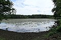 Bad Schmiedeberg - Reinharz - Schlosspark - Brauhausteich 01 ies.jpg 5,616 × 3,744; 20.73 MB
-
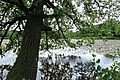 Bad Schmiedeberg - Reinharz - Schlosspark - Brauhausteich 02 ies.jpg 5,616 × 3,744; 25.41 MB
-
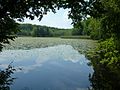
 Bad Schmiedeberg - Reinharz - Schlosspark - Brauhausteich 03 ies.jpg 5,616 × 3,744; 26.19 MB
-
 Brauhausteich.jpg 1,440 × 1,080; 329 KB
-
 L02 407 Reinharz, Brauhausteich.jpg 6,858 × 4,572; 13.39 MB
-
 L04 801 Reinharz, Brauhausteich.jpg 6,822 × 4,548; 6.39 MB


