Category:Brandon, County Durham
Jump to navigation
Jump to search
English: Brandon is a village in County Durham, in England. It is situated a short distance to the southwest of Durham. Brandon was originally one of the seven townships within the ancient Parish of Brancepeth. It grew from a sparsely populated agricultural area into a populous mining district after the establishment of collieries and later coke and fireclay works. Until the 19th century Brandon village, formally known as East Brandon, was one of the larger settlements in Brancepeth Parish.
village in County Durham, UK  | |||||
| Upload media | |||||
| Instance of | |||||
|---|---|---|---|---|---|
| Location | Brandon and Byshottles, County Durham, North East England, England | ||||
 | |||||
Media in category "Brandon, County Durham"
The following 14 files are in this category, out of 14 total.
-
 Brandon - Bishop Auckland Railway Path - geograph.org.uk - 4263791.jpg 1,500 × 1,000; 2.28 MB
-
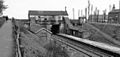 Brandon Colliery Station 1890265 8edbedea.jpg 640 × 305; 59 KB
-
 Brandon Convenience Stone - geograph.org.uk - 3832994.jpg 640 × 427; 206 KB
-
 Brandon Cricket Club premises - geograph.org.uk - 3353054.jpg 3,294 × 2,134; 1.73 MB
-
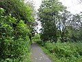
 Brandon to Bishop Auckland Walk at Brandon - geograph.org.uk - 2072804.jpg 2,000 × 1,500; 3.51 MB
-
 Brandon, County Durham.svg 1,095 × 1,076; 964 KB
-
 Cemetery at Brandon Village - geograph.org.uk - 4842205.jpg 1,500 × 1,096; 1.74 MB
-
 Housing estate at Brandon - geograph.org.uk - 3068336.jpg 4,608 × 3,456; 4.75 MB
-
 New organ pipes - geograph.org.uk - 979642.jpg 480 × 640; 101 KB
-
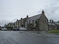
 North End, Brandon - geograph.org.uk - 124427.jpg 640 × 480; 97 KB
-
 Old railway walk at Brandon - geograph.org.uk - 3068329.jpg 4,608 × 3,456; 5.64 MB
-
 The Bay Horse in Brandon Village - geograph.org.uk - 3459474.jpg 3,648 × 2,736; 1.9 MB
-
 The Morley Wood at Brandon - geograph.org.uk - 2845045.jpg 3,648 × 2,736; 1.87 MB
-
 Young crop field near Brandon - geograph.org.uk - 4815839.jpg 640 × 480; 57 KB


