Category:Brampton, Carlisle
Jump to navigation
Jump to search
town and civil parish in Cumbria, England, UK  | |||||
| Upload media | |||||
| Instance of | |||||
|---|---|---|---|---|---|
| Location | Cumberland, Cumbria, North West England, England | ||||
| Population |
| ||||
| Said to be the same as | Brampton (Wikimedia duplicated page, civil parish) | ||||
 | |||||
English: Brampton is a small market town and civil parish within the City of Carlisle district of Cumbria, England about 9 miles (14 km) east of Carlisle and 2 miles south of Hadrian's Wall. It is situated off the A69 road which bypasses it. At the 2001 census it had a population of 4,361. Brampton railway station, about a mile outside the town itself, is located on the Newcastle and Carlisle Railway.
Subcategories
This category has the following 11 subcategories, out of 11 total.
B
- Brampton Methodist Church (2 F)
- Brampton Town railway station (11 F)
M
- Brampton Old Church (4 F)
- Milton, Carlisle (3 F)
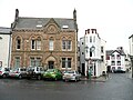
- Moot Hall, Brampton, Carlisle (17 F)
N
- Naworth Castle (16 F)
R
S
Media in category "Brampton, Carlisle"
The following 200 files are in this category, out of 519 total.
(previous page) (next page)-
 'Edgewood', Station Road - geograph.org.uk - 6188869.jpg 1,024 × 659; 225 KB
-
 156478 at Farlam Road bridge, Milton - June 2016 - geograph.org.uk - 5011441.jpg 1,250 × 893; 1.36 MB
-
-
 66702 at Brampton - August 2016 - geograph.org.uk - 5088191.jpg 1,250 × 865; 1.09 MB
-
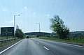
 A bend in the A69 - geograph.org.uk - 3209809.jpg 1,600 × 939; 383 KB
-
 A dentist's sign in Brampton - geograph.org.uk - 2831148.jpg 427 × 640; 290 KB
-
 A stand of beech trees - geograph.org.uk - 5484655.jpg 480 × 640; 398 KB
-
 A6071 at Irthing Bridge - geograph.org.uk - 3550247.jpg 640 × 481; 48 KB
-
 A6071 at Irthing Bridge - geograph.org.uk - 4130475.jpg 640 × 481; 66 KB
-
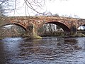 A6071 river bridge. - geograph.org.uk - 128086.jpg 640 × 480; 109 KB
-
 A689 8 miles from Carlisle - geograph.org.uk - 6188527.jpg 1,024 × 683; 248 KB
-

-
 A689 approaching Middle Farm - geograph.org.uk - 3477398.jpg 640 × 395; 49 KB
-
 A689 at Milton Hill - geograph.org.uk - 4001428.jpg 640 × 406; 57 KB
-

-
 A689 eastbound - geograph.org.uk - 3495028.jpg 640 × 441; 41 KB
-
 A689 eastbound - geograph.org.uk - 3495034.jpg 640 × 419; 44 KB
-
 A69 eastbound - geograph.org.uk - 3495048.jpg 640 × 480; 56 KB
-
 A69 eastbound - geograph.org.uk - 3495065.jpg 640 × 458; 93 KB
-
 A69 eastbound - geograph.org.uk - 3495069.jpg 640 × 476; 91 KB
-
 A69 over Track leading to Low Gelt - geograph.org.uk - 4768170.jpg 1,066 × 800; 300 KB
-
 Abbey Bridge B^B house - geograph.org.uk - 3477428.jpg 640 × 383; 75 KB
-

-

-

-

-
 ABW Hardware, Gelt Road - geograph.org.uk - 5972250.jpg 1,024 × 683; 723 KB
-
 An otter in the River Irthing - geograph.org.uk - 2840731.jpg 640 × 432; 242 KB
-
 Ancient beech tree, Miltonrigg Woods - geograph.org.uk - 5029971.jpg 1,944 × 2,592; 4.02 MB
-
 Approach to Gelt Woods from Brampton - geograph.org.uk - 1519427.jpg 640 × 480; 61 KB
-
 Approaching Brampton from the southwest - geograph.org.uk - 2840711.jpg 640 × 427; 175 KB
-

-
 Army Cadet Force building, Lovers Lane - geograph.org.uk - 5218007.jpg 640 × 480; 295 KB
-
 Autumn colours at Talkin Tarn - geograph.org.uk - 5588982.jpg 1,024 × 768; 340 KB
-
 Back of the Old Brewery - geograph.org.uk - 5972245.jpg 1,024 × 683; 1,018 KB
-
 Barclays Bank 2023.jpg 8,000 × 6,000; 9.38 MB
-
 Bastle and farmhouse at Temon - geograph.org.uk - 1564404.jpg 640 × 480; 99 KB
-
 Beech woodland - geograph.org.uk - 6318900.jpg 640 × 427; 149 KB
-

-
 Benchmark on boundary wall of Westwood - geograph.org.uk - 6188876.jpg 1,024 × 683; 240 KB
-

-

-
 Benchmark on house 'Edgewood' - geograph.org.uk - 6188859.jpg 644 × 1,024; 252 KB
-
 Benchmark on the Moot Hall - geograph.org.uk - 6188770.jpg 1,024 × 672; 260 KB
-

-
 Bends along A6071 - geograph.org.uk - 5738018.jpg 1,600 × 1,200; 746 KB
-

-
-
 Birky Brow - geograph.org.uk - 1284805.jpg 420 × 640; 59 KB
-
 Blue Green algae at Talkin Tarn - geograph.org.uk - 6359048.jpg 4,608 × 3,456; 3.07 MB
-
 Bluebells near Boothby - geograph.org.uk - 6158544.jpg 2,592 × 1,944; 2.4 MB
-

-
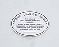 Bonnie Prince Charlie plaque - geograph.org.uk - 1363931.jpg 640 × 506; 36 KB
-
 Border Rambler bus, Front Street, Brampton, Cumbria 01.jpg 3,826 × 1,940; 1.42 MB
-
 Border Rambler bus, Front Street, Brampton, Cumbria 02.jpg 2,479 × 1,859; 1,002 KB
-
 Brampton - geograph.org.uk - 1363935.jpg 640 × 480; 63 KB
-
 Brampton - geograph.org.uk - 3191032.jpg 640 × 481; 600 KB
-
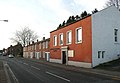
 Brampton - geograph.org.uk - 946823.jpg 640 × 480; 77 KB
-
 Brampton - geograph.org.uk - 946824.jpg 640 × 480; 70 KB
-
 Brampton Cemetery - geograph.org.uk - 2866156.jpg 640 × 427; 241 KB
-
 Brampton Fell Gates - geograph.org.uk - 3978780.jpg 3,072 × 2,304; 3.01 MB
-
 Brampton Fell Gates - geograph.org.uk - 3978791.jpg 2,903 × 2,236; 5.16 MB
-
 Brampton Fell Gates - geograph.org.uk - 3978800.jpg 2,869 × 1,945; 4.92 MB
-
 Brampton Fell Gates - geograph.org.uk - 3978808.jpg 2,900 × 1,992; 4.82 MB
-
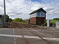 Brampton Fell signal box - geograph.org.uk - 6170030.jpg 1,600 × 1,200; 376 KB
-
 Brampton Fire Station - geograph.org.uk - 889451.jpg 640 × 480; 295 KB
-
 Brampton Golf Club - geograph.org.uk - 6083077.jpg 1,024 × 768; 911 KB
-
 Brampton in Cumbria - geograph.org.uk - 3476446.jpg 640 × 480; 78 KB
-
 Brampton Library 2023.jpg 8,000 × 6,000; 12.27 MB
-
 Brampton Live 2007 - geograph.org.uk - 635053.jpg 640 × 480; 119 KB
-

-
 Brampton Old Church - geograph.org.uk - 2866179.jpg 640 × 480; 369 KB
-
 Brampton police station - geograph.org.uk - 1908307.jpg 640 × 427; 223 KB
-
 Brampton Police Station - geograph.org.uk - 2180054.jpg 1,024 × 768; 133 KB
-
 Brampton Quarry - geograph.org.uk - 7042.jpg 640 × 480; 201 KB
-
 Brampton Ridge - geograph.org.uk - 2691715.jpg 480 × 640; 91 KB
-

-
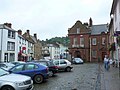
 Brampton Square - geograph.org.uk - 3778270.jpg 640 × 480; 74 KB
-
 Brampton town centre - geograph.org.uk - 4618611.jpg 1,600 × 1,200; 306 KB
-
 Brampton town centre - geograph.org.uk - 4855101.jpg 1,600 × 900; 388 KB
-
 Brampton turning from A689 - geograph.org.uk - 3477404.jpg 640 × 406; 52 KB
-
 Brampton War Memorial Hospital - geograph.org.uk - 5971199.jpg 1,024 × 683; 779 KB
-
 Brampton, Cumbria - geograph.org.uk - 3298492.jpg 1,024 × 768; 140 KB
-
 Brampton, Cumbria, P.O. (2129813818).jpg 1,280 × 960; 182 KB
-
 Brampton, Police Station - geograph.org.uk - 806228.jpg 640 × 480; 77 KB
-
 Brampton, Townfoot Industrial Estate - geograph.org.uk - 2960463.jpg 1,024 × 722; 103 KB
-
 Bramptonfell Gates - geograph.org.uk - 1237915.jpg 640 × 480; 84 KB
-
 Bramptonfell gates, Brampton - geograph.org.uk - 1148151.jpg 640 × 480; 82 KB
-

-

-

-

-
 Cambeck Bridge (geograph 7158692).jpg 5,184 × 3,888; 4.01 MB
-
 Cambeck Bridge - geograph.org.uk - 5367563.jpg 640 × 480; 94 KB
-
 Canada Geese, Talkin Tarn - geograph.org.uk - 5591499.jpg 1,024 × 768; 339 KB
-
 Capon Tree Monument - geograph.org.uk - 216880.jpg 450 × 600; 321 KB
-
 Car park by Talkin Tarn - geograph.org.uk - 6159188.jpg 2,592 × 1,944; 1.82 MB
-
 Carlisle Road - Longtown Road, CA8 - geograph.org.uk - 3767037.jpg 640 × 480; 59 KB
-
 Carlisle to Newcastle Line west of Brampton - geograph.org.uk - 4855103.jpg 1,800 × 1,012; 1.86 MB
-
 Causeway Path alongside The River Gelt - geograph.org.uk - 4768210.jpg 1,066 × 800; 399 KB
-

-
 Christmas tree^^ - geograph.org.uk - 1639347.jpg 640 × 480; 143 KB
-
 Church Lane (2) - geograph.org.uk - 3767544.jpg 480 × 640; 90 KB
-
 Church Lane - geograph.org.uk - 1582106.jpg 480 × 640; 60 KB
-

-

-
 Converted chapel off Main Street - geograph.org.uk - 5217954.jpg 480 × 640; 294 KB
-
 Copse on Brampton Ridge - geograph.org.uk - 3764433.jpg 640 × 480; 102 KB
-
 Cotehill Farm - geograph.org.uk - 1363874.jpg 640 × 480; 67 KB
-
 Cotehill Farm - geograph.org.uk - 889459.jpg 640 × 480; 314 KB
-
 Cottages at Low Gelt Bridge - geograph.org.uk - 3795774.jpg 640 × 480; 146 KB
-
 Cottages on The Sands - geograph.org.uk - 3763689.jpg 640 × 480; 81 KB
-

-

-
 Cumbrian traffic jam - September 2016 - geograph.org.uk - 5123920.jpg 1,250 × 957; 1.66 MB
-
 December snow, near Brampton - geograph.org.uk - 1639270.jpg 640 × 480; 127 KB
-
 Dental surgery, Brampton.jpg 429 × 640; 140 KB
-
 Derelict barn at Tarn End House - geograph.org.uk - 6083069.jpg 1,024 × 683; 930 KB
-
 Disused school building, Moat Street - geograph.org.uk - 5217936.jpg 640 × 480; 340 KB
-

-
 Door, Brampton ^ District War Memorial Hospital - geograph.org.uk - 5971201.jpg 768 × 1,024; 709 KB
-
 Ducks in a row - geograph.org.uk - 5484550.jpg 480 × 640; 206 KB
-
 E And D Young, Jewellers, T And M Savage, Freezer Food Centre And Flat Above.jpg 6,000 × 8,000; 9.26 MB
-
 Early autumn evening, Brampton - geograph.org.uk - 1511056.jpg 480 × 640; 54 KB
-
 Early autumn sunset, Brampton - geograph.org.uk - 1511075.jpg 640 × 480; 27 KB
-

-
 Easterly view from The Motte - geograph.org.uk - 2892308.jpg 796 × 594; 122 KB
-
 Entering Brampton on A6071 - geograph.org.uk - 4001420.jpg 640 × 372; 44 KB
-
 Entering Brampton on Carlisle Road - geograph.org.uk - 3477408.jpg 640 × 373; 63 KB
-
 Entering Brampton village from the East. - geograph.org.uk - 6636.jpg 640 × 480; 126 KB
-
 Entrance to house Westwood from Station Road - geograph.org.uk - 6188901.jpg 1,024 × 660; 248 KB
-
 Escape Lane - geograph.org.uk - 1261005.jpg 640 × 480; 122 KB
-
 Evening at Talkin Tarn - geograph.org.uk - 6467118.jpg 1,799 × 1,199; 414 KB
-
 Evening at Talkin Tarn - windsurfer - geograph.org.uk - 6467120.jpg 1,799 × 1,199; 531 KB
-
 Falkins Hill, Brampton - geograph.org.uk - 1149068.jpg 640 × 504; 135 KB
-
 Fallen logs - geograph.org.uk - 5484546.jpg 640 × 480; 329 KB
-

-
 Farmland and trees at Crooked Holme - geograph.org.uk - 2840717.jpg 640 × 427; 189 KB
-

-

-

-

-

-
 Farmland east of Brampton - geograph.org.uk - 3770789.jpg 640 × 480; 64 KB
-
 Farmland east of Hemblesgate - geograph.org.uk - 3774213.jpg 640 × 480; 101 KB
-
 Farmland near the River Gelt - geograph.org.uk - 3209747.jpg 640 × 480; 58 KB
-
 Farmland off the A69 - geograph.org.uk - 3209807.jpg 640 × 480; 82 KB
-
 Farmland towards Miltonrigg Wood - geograph.org.uk - 3209812.jpg 640 × 428; 66 KB
-
 Farmland, Bishoptonfell Gates - geograph.org.uk - 3430971.jpg 640 × 570; 55 KB
-
 Field entrance near Brampton - geograph.org.uk - 3209792.jpg 640 × 480; 97 KB
-
 Field near to Catgallows Hill - geograph.org.uk - 4226293.jpg 1,500 × 932; 1.2 MB
-

-
 Fields below Brampton Ridge - geograph.org.uk - 889449.jpg 640 × 480; 302 KB
-
 Flat Fruit Shop The Old Bakery.jpg 6,000 × 8,000; 11.67 MB
-

-

-
 Footbridge over Hell Beck - geograph.org.uk - 4768214.jpg 1,066 × 800; 395 KB
-
 Footpath and Cycleway to Brampton - geograph.org.uk - 4769027.jpg 1,066 × 800; 382 KB
-
 Footpath at the southern end of Talkin Tarn (2008) - geograph.org.uk - 6083059.jpg 1,024 × 768; 1.04 MB
-
 Footpath by Brampton Quarries, Gelt Wood - geograph.org.uk - 3795768.jpg 640 × 480; 153 KB
-
 Footpath junction, Gelt Wood - geograph.org.uk - 3795780.jpg 640 × 480; 162 KB
-
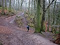
 Footpath through Gelt Woods - geograph.org.uk - 4235366.jpg 480 × 640; 219 KB
-
 Footpath to Brampton - geograph.org.uk - 216887.jpg 450 × 600; 191 KB
-
 Former Talkin Tarn Hotel - geograph.org.uk - 4768927.jpg 1,066 × 800; 409 KB
-

-
 Front Street (2) - geograph.org.uk - 1582090.jpg 640 × 480; 67 KB
-
 Front Street - geograph.org.uk - 1582086.jpg 640 × 480; 66 KB
-

-
 Front Street, Brampton - geograph.org.uk - 2892208.jpg 816 × 612; 117 KB
-
 Front Street, Brampton - geograph.org.uk - 2893771.jpg 803 × 592; 114 KB
-
 Front Street, Brampton in 1986 - geograph.org.uk - 2282353.jpg 557 × 800; 114 KB
-
 Front Street-Market Place, Brampton - geograph.org.uk - 3550284.jpg 640 × 480; 79 KB
-
 Fruits ^ Roots, Brampton - geograph.org.uk - 5217974.jpg 480 × 640; 328 KB
-

-
 Garden centre entrance from B6071 - geograph.org.uk - 4001417.jpg 640 × 389; 66 KB
-
 Gate and driveway to Naworth Castle - geograph.org.uk - 3017219.jpg 1,024 × 684; 160 KB
-
 Gelt Road, Aaron's Town, Brampton - geograph.org.uk - 207935.jpg 640 × 480; 69 KB
-
 Gelt Road, Brampton - geograph.org.uk - 207918.jpg 640 × 480; 71 KB
-
 Geltbridge Cottages - geograph.org.uk - 4768173.jpg 1,066 × 800; 259 KB
-
 George John Johnson memorial - geograph.org.uk - 806240.jpg 640 × 480; 108 KB
-
 Graffiti in Brampton Quarry, Gelt Wood - geograph.org.uk - 3809165.jpg 640 × 480; 125 KB
-
 Graves on the edge - geograph.org.uk - 2866735.jpg 640 × 480; 311 KB
-
 Grazing calves at Cotehill Farm - geograph.org.uk - 938316.jpg 640 × 479; 292 KB
-
 Grazing near Brampton - geograph.org.uk - 3209806.jpg 640 × 412; 52 KB
-
 Grazing towards Rowbank Wood - geograph.org.uk - 3430977.jpg 640 × 520; 59 KB
-
 Grazing, Capontree Hill - geograph.org.uk - 3209796.jpg 640 × 480; 86 KB
-
 Grazing, Milton - geograph.org.uk - 3430979.jpg 640 × 509; 61 KB
-
 Grazing, Naworth Castle Estates - geograph.org.uk - 3209828.jpg 640 × 480; 90 KB
-
 Grazing, Naworth Park - geograph.org.uk - 3209824.jpg 640 × 480; 81 KB
-
 Greenhill nearing A69 roundabout - geograph.org.uk - 3550294.jpg 640 × 481; 56 KB
-
 Ground flora, Miltonrigg Woods - geograph.org.uk - 4971774.jpg 2,364 × 1,773; 3.48 MB
-

-
 Headquarters of Charles Edward Stuart - geograph.org.uk - 490780.jpg 640 × 429; 53 KB
-
 Hedgehog sculpture, Talkin Tarn - geograph.org.uk - 5588984.jpg 1,024 × 767; 364 KB
-
 High Cross Street, CA8 - geograph.org.uk - 3768625.jpg 480 × 640; 63 KB
-
 House on the Edge of Brampton - geograph.org.uk - 4768150.jpg 1,935 × 800; 374 KB
-
 Houses on Capon Tree Road (Capon Hill) - geograph.org.uk - 4768168.jpg 1,066 × 800; 205 KB
-
 Howard Arms Hotel.jpg 8,000 × 6,000; 9.15 MB
-
 Howard Arms Lane - geograph.org.uk - 1582037.jpg 480 × 640; 50 KB
-
 Howard Monument the Motte, Brampton - geograph.org.uk - 101134.jpg 640 × 480; 179 KB


_-_geograph.org.uk_-_3775207.jpg)


.jpg)


.jpg)
_(12001016663).jpg)
.jpg)


_-_geograph.org.uk_-_3767544.jpg)


_-_geograph.org.uk_-_3770823.jpg)


_-_geograph.org.uk_-_6083059.jpg)


_-_geograph.org.uk_-_1582090.jpg)


_-_geograph.org.uk_-_4768168.jpg)


