Category:Bradfield Combust with Stanningfield
Jump to navigation
Jump to search
English: Bradfield Combust with Stanningfield is a civil parish in the St Edmundsbury borough of Suffolk, England.
civil parish in Suffolk, UK | |||||
| Upload media | |||||
| Instance of | |||||
|---|---|---|---|---|---|
| Named after | |||||
| Location |
| ||||
 | |||||
Subcategories
This category has the following 3 subcategories, out of 3 total.
Media in category "Bradfield Combust with Stanningfield"
The following 52 files are in this category, out of 52 total.
-
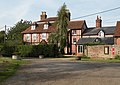 A view of Bradfield House from Ixer Lane - geograph.org.uk - 2078665.jpg 3,593 × 2,557; 1.15 MB
-

-
 A134 near Cross Green - geograph.org.uk - 5400548.jpg 640 × 480; 60 KB
-
 A134 towards Bury St Edmunds - geograph.org.uk - 5400551.jpg 640 × 480; 63 KB
-
 At Work - geograph.org.uk - 2619690.jpg 1,024 × 768; 280 KB
-
 Bradfield Combust Methodist church and church hall - geograph.org.uk - 6323481.jpg 4,608 × 3,072; 5.21 MB
-
 Bradfield Hall - geograph.org.uk - 1368067.jpg 640 × 427; 126 KB
-
 Bury Road - geograph.org.uk - 5400581.jpg 640 × 480; 62 KB
-
 Bury Road - geograph.org.uk - 5400584.jpg 640 × 480; 81 KB
-
 Chapel Road - geograph.org.uk - 2619665.jpg 1,024 × 768; 207 KB
-
 Chapel Road - geograph.org.uk - 5400573.jpg 640 × 480; 61 KB
-
 Chapel Road towards Hoggard's Green - geograph.org.uk - 5401738.jpg 2,848 × 2,136; 1.31 MB
-
 Church Farmhouse, Stanningfield (geograph 6922247).jpg 1,024 × 768; 239 KB
-
 Clock Tower, Coldham Hall - geograph.org.uk - 2078207.jpg 640 × 480; 79 KB
-
 Close up, Elizabeth II postbox on Chapel Road - geograph.org.uk - 5401736.jpg 959 × 1,817; 477 KB
-
 Copse on site of moat - geograph.org.uk - 2077423.jpg 640 × 480; 79 KB
-

-
 Crop field near Syringa Farm - geograph.org.uk - 5400579.jpg 640 × 480; 62 KB
-
 Dead End - geograph.org.uk - 2619679.jpg 1,024 × 768; 300 KB
-
 Elizabeth II postbox on Chapel Road - geograph.org.uk - 5401735.jpg 2,848 × 2,136; 1.25 MB
-
 Farming - geograph.org.uk - 2619694.jpg 1,024 × 768; 228 KB
-
 Farmland near Windsor Green - geograph.org.uk - 5400541.jpg 640 × 480; 57 KB
-
 Footpath - geograph.org.uk - 2905906.jpg 1,024 × 768; 210 KB
-
 Footpath - geograph.org.uk - 2905922.jpg 1,024 × 768; 257 KB
-
 Footpath and bridleway - geograph.org.uk - 2077426.jpg 640 × 480; 70 KB
-
 Footpath to Cocks Green Lane - geograph.org.uk - 4917310.jpg 1,024 × 768; 245 KB
-
 Grazing off Bury Road - geograph.org.uk - 5400582.jpg 640 × 480; 79 KB
-
 Grounds of Bradfield Hall - geograph.org.uk - 1379688.jpg 427 × 640; 113 KB
-

-
 Haystack - geograph.org.uk - 2620527.jpg 1,024 × 768; 156 KB
-
 Hedgerow near Windsor Green - geograph.org.uk - 5400536.jpg 640 × 480; 66 KB
-
 Ixer Lane sign - geograph.org.uk - 4200910.jpg 2,948 × 2,214; 3.34 MB
-
 Ixer Lane Victorian Postbox - geograph.org.uk - 4201479.jpg 3,072 × 2,304; 2.02 MB
-
 Ixer Lane Victorian Postbox - geograph.org.uk - 4201480.jpg 2,304 × 3,072; 1.91 MB
-
 Ixer Lane Victorian Postbox - geograph.org.uk - 4201483.jpg 3,072 × 2,304; 1.73 MB
-
 Lake - geograph.org.uk - 2905911.jpg 1,024 × 768; 187 KB
-
 Makins Farm - geograph.org.uk - 2077431.jpg 640 × 480; 96 KB
-
 Methodist Chapel, Bradfield Combust - geograph.org.uk - 5400554.jpg 640 × 480; 73 KB
-
 Mill Lane - geograph.org.uk - 2905918.jpg 768 × 1,024; 265 KB
-
 Oak Tree - geograph.org.uk - 2905887.jpg 1,024 × 768; 232 KB
-
 Reduce Speed Now - geograph.org.uk - 2905931.jpg 1,024 × 768; 247 KB
-
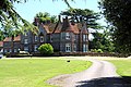
 Rockwood Hall - geograph.org.uk - 2078196.jpg 640 × 480; 96 KB
-

-
 St.Edmunds Way - geograph.org.uk - 2619683.jpg 768 × 1,024; 369 KB
-
 St.Edmunds Way - geograph.org.uk - 2619703.jpg 1,024 × 768; 232 KB
-
 Stanningfield village sign - geograph.org.uk - 6323501.jpg 3,072 × 4,608; 5.83 MB
-
 Stanningfield village sign - geograph.org.uk - 6323503.jpg 4,608 × 3,072; 5.01 MB
-
 Stanningfield War Memorial on Hoggard's Green. - geograph.org.uk - 6323489.jpg 4,608 × 3,072; 6.13 MB
-
 Stanningfield War Memorial on Hoggard's Green. - geograph.org.uk - 6323492.jpg 4,608 × 3,072; 6.1 MB
-
 The beginning of Mill Lane - geograph.org.uk - 4904447.jpg 1,024 × 768; 217 KB
-
 Through The Trees - geograph.org.uk - 2905904.jpg 768 × 1,024; 304 KB
-
 Track to Seymour Hall Farm - geograph.org.uk - 1092112.jpg 427 × 640; 114 KB


.jpg)


