Category:Bracebridge Heath
Jump to navigation
Jump to search
English: Bracebridge Heath is a commuter village approximately long-distance footpath which runs from the Humber Bridge to Oakham.
village in the United Kingdom  | |||||
| Upload media | |||||
| Instance of | |||||
|---|---|---|---|---|---|
| Location | North Kesteven, Lincolnshire, East Midlands, England | ||||
 | |||||
Subcategories
This category has the following 3 subcategories, out of 3 total.
B
- Bracebridge Heath Reservoir (8 F)
S
Media in category "Bracebridge Heath"
The following 79 files are in this category, out of 79 total.
-
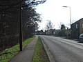
 A15 at Bracebridge Heath boundary - geograph.org.uk - 3653270.jpg 640 × 481; 64 KB
-
 A15 Bracebridge Heath - geograph.org.uk - 4787319.jpg 1,024 × 765; 90 KB
-
 A15 London Road looking north - geograph.org.uk - 3653275.jpg 640 × 481; 73 KB
-
 A15 northbound in Bracebridge Heath - geograph.org.uk - 3653273.jpg 640 × 481; 71 KB
-
 A15 Sleaford Road - geograph.org.uk - 4787318.jpg 1,024 × 820; 86 KB
-
 A15 towards Sleaford - geograph.org.uk - 2829521.jpg 640 × 480; 78 KB
-
 A607 towards Lincoln - geograph.org.uk - 2829517.jpg 640 × 480; 57 KB
-
 A607-A15 Junction at Bracebridge Heath - geograph.org.uk - 4209681.jpg 640 × 480; 275 KB
-
 Allotments, Bracebridge Heath - geograph.org.uk - 2829510.jpg 640 × 480; 96 KB
-
 Bertie Basset's House^ - geograph.org.uk - 1094773.jpg 640 × 480; 59 KB
-
 Bloxholm Lane - geograph.org.uk - 3563877.jpg 640 × 480; 58 KB
-
 Bloxholm Lane - geograph.org.uk - 90228.jpg 640 × 480; 128 KB
-
 Bloxholm Lane and the Manor House, Bracebridge Heath (geograph 6893362).jpg 1,024 × 768; 211 KB
-
 Bloxholm Lane, near the A15 - geograph.org.uk - 3221602.jpg 3,088 × 2,056; 2.2 MB
-

-
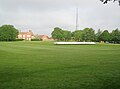 Bracebridge Heath cricket ground, Lincs (geograph 3105002).jpg 3,544 × 2,626; 2.31 MB
-
 Bracebridge Heath Methodist Church - geograph.org.uk - 1018210.jpg 640 × 480; 142 KB
-
 Bracebridge Heath, Grantham Road - geograph.org.uk - 4209669.jpg 640 × 480; 282 KB
-
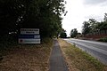
 Bracebridge Heath, London Road (A15) - geograph.org.uk - 4209684.jpg 640 × 480; 272 KB
-
 Bracebridge Heath, Manor House entrance - geograph.org.uk - 4192478.jpg 1,280 × 960; 574 KB
-
 Canwick Avenue - geograph.org.uk - 3103526.jpg 2,728 × 1,929; 1.27 MB
-
 Canwick Avenue entering Bracebridge Heath - geograph.org.uk - 3221604.jpg 3,088 × 2,056; 1.08 MB
-
 Co-op Funeral Services, Bracebridge Heath - geograph.org.uk - 4402503.jpg 1,024 × 768; 160 KB
-
 Coningsby Crescent - geograph.org.uk - 5995953.jpg 1,024 × 768; 128 KB
-
 Coningsby Crescent, near Bracebridge Heath - geograph.org.uk - 3190907.jpg 3,088 × 2,056; 2.05 MB
-
 Conningsby Crescent off Cross O'Cliff Hill - geograph.org.uk - 5847357.jpg 1,600 × 1,065; 621 KB
-
 Conningsby Crescent off Cross O'Cliff Hill - geograph.org.uk - 5847358.jpg 1,600 × 1,065; 519 KB
-
 Cross O’Cliff Court - geograph.org.uk - 3105316.jpg 3,523 × 2,606; 2.51 MB
-
 Cut Mark, Bracebridge Heath, Manor House - geograph.org.uk - 4192470.jpg 960 × 1,280; 478 KB
-
 Earthworks for the Lincoln Eastern Bypass - geograph.org.uk - 6151481.jpg 1,024 × 768; 232 KB
-
 Fields at Bracebridge Heath - geograph.org.uk - 364052.jpg 640 × 480; 87 KB
-
 Footpath towards Bracebridge Heath - geograph.org.uk - 2829512.jpg 640 × 480; 110 KB
-
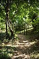
 Footpath, Bracebridge Heath - geograph.org.uk - 364077.jpg 640 × 480; 95 KB
-
 Gap in the Path - geograph.org.uk - 1094650.jpg 480 × 640; 123 KB
-
 Grantham Road, Bracebridge Heath - geograph.org.uk - 4209677.jpg 640 × 480; 303 KB
-
 Junction of Redhall Drive with A15 - geograph.org.uk - 3190900.jpg 3,088 × 2,056; 1.76 MB
-
 Lancaster Tour 2014 - geograph.org.uk - 4268298.jpg 1,280 × 850; 256 KB
-
 Lancia Crescent, Bracebridge Heath - geograph.org.uk - 3190896.jpg 3,088 × 2,056; 1.63 MB
-
 Landing lights - geograph.org.uk - 1293876.jpg 640 × 426; 71 KB
-
 Lincoln Road, Bracebridge Heath - geograph.org.uk - 6235804.jpg 1,872 × 1,204; 984 KB
-
 London Road at the junction of Stanley Crescent - geograph.org.uk - 5652899.jpg 2,048 × 1,536; 1.17 MB
-
 London Road, Bracebridge Heath - geograph.org.uk - 5652893.jpg 2,048 × 1,536; 1 MB
-
 London Road, Bracebridge Heath - geograph.org.uk - 6193416.jpg 1,920 × 1,280; 1.29 MB
-

-

-
 Main Avenue, Bracebridge Heath - geograph.org.uk - 2006051.jpg 640 × 480; 86 KB
-
 Minster Court from Sleaford Road - geograph.org.uk - 5654977.jpg 2,266 × 1,676; 1.76 MB
-

-

-
 Path leading to Brant Road, Lincoln - geograph.org.uk - 5847469.jpg 1,600 × 1,065; 827 KB
-
 Path leading to Brant Road, Lincoln - geograph.org.uk - 5847473.jpg 1,600 × 1,065; 659 KB
-
 Petrol station forecourt on Sleaford Road - geograph.org.uk - 5651472.jpg 2,304 × 1,728; 1.15 MB
-
 Petrol station gardens by Sleaford Road - geograph.org.uk - 5651471.jpg 2,304 × 1,728; 847 KB
-
 Petrol station on Sleaford Road, Bracebridge Heath - geograph.org.uk - 6192729.jpg 1,920 × 1,280; 1.23 MB
-
 Public footpath north of Bracebridge Heath - geograph.org.uk - 3105326.jpg 3,538 × 2,621; 3.39 MB
-
 R.A.F. Waddington, aerial 2011 - geograph.org.uk - 3534728.jpg 800 × 533; 88 KB
-
 Road to Westfield Farm - geograph.org.uk - 3221611.jpg 3,088 × 2,056; 1.44 MB
-
 Sleaford Road, Bracebridge Heath - geograph.org.uk - 6192214.jpg 1,920 × 1,280; 996 KB
-
 Sleaford Road, Bracebridge Heath - geograph.org.uk - 6192215.jpg 1,872 × 1,204; 919 KB
-

-
 The Blacksmiths pub, Bracebridge Heath - geograph.org.uk - 6194811.jpg 1,920 × 1,280; 1.65 MB
-
 The Blacksmiths pub, Bracebridge Heath - geograph.org.uk - 6231838.jpg 1,884 × 1,224; 1.15 MB
-

-
 The Bull public house - geograph.org.uk - 6211857.jpg 3,477 × 2,318; 1.7 MB
-
 The chapel at the former St. John's Hospital - geograph.org.uk - 6197255.jpg 1,024 × 768; 157 KB
-
 The Homestead - geograph.org.uk - 3107343.jpg 3,515 × 2,612; 2.14 MB
-
 The Homestead restaurant, Bracebridge Heath - geograph.org.uk - 5654976.jpg 2,304 × 1,728; 1.83 MB
-

-

-
 The Viking Way leaving Waldo Road - geograph.org.uk - 5995403.jpg 1,024 × 768; 250 KB
-
 The Viking Way near Cross o’ Cliff Court - geograph.org.uk - 3635413.jpg 3,528 × 2,360; 2 MB
-
 Track to Westfield Farm (bridleway) - geograph.org.uk - 3563867.jpg 640 × 480; 81 KB
-
 Viking Way - geograph.org.uk - 1444092.jpg 426 × 640; 137 KB
-
 Viking Way at Cross O'Cliff Hill (A15 road) - geograph.org.uk - 5847351.jpg 1,600 × 1,065; 881 KB
-
 Viking Way enters Bracebridge Heath - geograph.org.uk - 5847352.jpg 1,600 × 1,065; 611 KB
-
 Viking Way from Waldo Road - geograph.org.uk - 5847362.jpg 1,065 × 1,600; 777 KB
-
 Viking Way near Bracebridge Heath - geograph.org.uk - 5847363.jpg 1,600 × 1,065; 653 KB
-
 Viking Way near Bracebridge Heath - geograph.org.uk - 5847462.jpg 1,600 × 1,065; 674 KB
-
 Viking Way near Bracebridge Heath - geograph.org.uk - 5847466.jpg 1,600 × 1,065; 565 KB


.jpg)


.jpg)


_-_geograph.org.uk_-_4209684.jpg)


_-_geograph.org.uk_-_5482717.jpg)


_-_geograph.org.uk_-_3563867.jpg)

_-_geograph.org.uk_-_5847351.jpg)


