Category:Box, Wiltshire
Jump to navigation
Jump to search
village in Wiltshire, England, UK  | |||||
| Upload media | |||||
| Instance of | |||||
|---|---|---|---|---|---|
| Location | Wiltshire, South West England, England | ||||
| Population |
| ||||
| official website | |||||
 | |||||
Images of Box, Wiltshire, UK.
Subcategories
This category has the following 14 subcategories, out of 14 total.
B
- Blue Vein, Wiltshire (1 F)
- Box and Ditteridge War Memorial (empty)
- Box railway station (2 F)
C
D
H
- Henley, Box (4 F)
K
- Kingsdown, Box (3 F)
M
- Middlehill Tunnel (5 F)
R
- Rudloe Manor (4 F)
Media in category "Box, Wiltshire"
The following 187 files are in this category, out of 187 total.
-
 1GL Boltmark on Box church - geograph.org.uk - 2826352.jpg 2,304 × 1,704; 1.69 MB
-
 3 Kingsdown House, Kingsdown, Box (geograph 7097748).jpg 3,136 × 2,336; 1.46 MB
-
 3-7, Market Place.jpg 4,032 × 3,024; 3.19 MB
-
 Anyone late will serve detention^ - geograph.org.uk - 2804697.jpg 1,704 × 2,304; 1.44 MB
-
 Approaching Ingalls Cottages - geograph.org.uk - 3750995.jpg 800 × 600; 322 KB
-
 Arable field and golf course - geograph.org.uk - 3753681.jpg 800 × 450; 191 KB
-
 Ashley Farm House - geograph.org.uk - 699903.jpg 640 × 452; 121 KB
-
 Back to the road - geograph.org.uk - 2804763.jpg 1,704 × 2,304; 2.16 MB
-
 Bargates, Box - geograph.org.uk - 3752023.jpg 800 × 600; 316 KB
-
 Barns at Ingalls Cottages - geograph.org.uk - 5023592.jpg 1,600 × 1,065; 491 KB
-
 Beeches at the entrance to Cheney Court - geograph.org.uk - 3751973.jpg 800 × 600; 340 KB
-
 Benches on Box Hill Common - geograph.org.uk - 3752042.jpg 800 × 600; 318 KB
-
 Blind house, Box - geograph.org.uk - 1892066.jpg 480 × 640; 104 KB
-
 Box car park - geograph.org.uk - 4294568.jpg 2,560 × 1,920; 1.1 MB
-
 Box Common - geograph.org.uk - 326224.jpg 640 × 480; 95 KB
-
 Box Common - geograph.org.uk - 326227.jpg 640 × 480; 58 KB
-
 Box from Quarry Hill - geograph.org.uk - 812805.jpg 640 × 407; 107 KB
-
 Box in July.jpg 640 × 480; 53 KB
-
 Box Mill Theatre - geograph.org.uk - 445892.jpg 640 × 477; 98 KB
-
 Box playing fields - geograph.org.uk - 445901.jpg 640 × 477; 104 KB
-
 Box Post Office - geograph.org.uk - 2804766.jpg 1,704 × 2,304; 1.48 MB
-
 Box tunnel, western portal - geograph.org.uk - 5723133.jpg 1,600 × 1,200; 517 KB
-
 Box, Wiltshire ... blue-yellow doors. - Flickr - BazzaDaRambler.jpg 2,900 × 3,125; 1.34 MB
-
 Box, Wiltshire ... grand facade. - Flickr - BazzaDaRambler.jpg 3,757 × 3,009; 1.87 MB
-
 Box, Wiltshire ... SN13 257 at the post office. - Flickr - BazzaDaRambler.jpg 4,340 × 5,747; 2.99 MB
-
 Box, Wiltshire sign.jpg 1,650 × 2,200; 3.13 MB
-
 Bridle path through Thorn Wood - geograph.org.uk - 2804765.jpg 2,304 × 1,704; 1.74 MB
-
 Bridleway through the Larches - geograph.org.uk - 3166711.jpg 1,920 × 1,279; 2.64 MB
-
 Bridleway through The Larches - geograph.org.uk - 3166821.jpg 1,920 × 1,279; 2.73 MB
-
 Bristol to Paddington main line - geograph.org.uk - 699981.jpg 640 × 582; 133 KB
-
 Brown fields near Colerne, Wiltshire - geograph.org.uk - 4640751.jpg 1,024 × 679; 155 KB
-
 By Brook flooding - geograph.org.uk - 3240019.jpg 640 × 331; 45 KB
-
 By Brook runs through the field - geograph.org.uk - 2452138.jpg 1,500 × 1,000; 153 KB
-
 Cemetery, Box, Wiltshire - geograph.org.uk - 1443510.jpg 640 × 480; 138 KB
-
 Chapel in the cemetery - geograph.org.uk - 2804749.jpg 2,304 × 1,704; 1.69 MB
-
 Chapel Plaister - geograph.org.uk - 3752071.jpg 800 × 600; 378 KB
-
 Cheney Court entrance - geograph.org.uk - 3751980.jpg 800 × 600; 331 KB
-
 Church Lane, Box, Wiltshire - geograph.org.uk - 1443566.jpg 640 × 479; 158 KB
-
 Coleridge House.jpg 4,032 × 3,024; 2.78 MB
-

-
 Colerne water tower.jpg 640 × 480; 32 KB
-
 Country road - geograph.org.uk - 137471.jpg 640 × 480; 59 KB
-
 Dalebrook.jpg 3,024 × 4,032; 3.19 MB
-
 Drewett's Mill - geograph.org.uk - 704609.jpg 640 × 433; 111 KB
-
 Driveway, Wadswick - geograph.org.uk - 1879930.jpg 480 × 640; 181 KB
-
 Entrance to Hazelbury Manor - geograph.org.uk - 3752073.jpg 800 × 600; 355 KB
-
 Entry drive to Hatt Farm - geograph.org.uk - 813725.jpg 640 × 454; 75 KB
-
 Farleigh Down Tunnel transit shed - geograph.org.uk - 4118055.jpg 640 × 426; 97 KB
-
 Farmland, Box Hill - geograph.org.uk - 3833573.jpg 480 × 640; 187 KB
-
 Five-ways Junction - geograph.org.uk - 2506716.jpg 3,284 × 2,484; 1.13 MB
-
 Flush Bracket - geograph.org.uk - 2826344.jpg 1,704 × 2,304; 2.17 MB
-
 Folly Farm - geograph.org.uk - 3166882.jpg 1,280 × 720; 720 KB
-
 Footbridge beside watermill - geograph.org.uk - 6751191.jpg 1,600 × 1,064; 683 KB
-
 Footbridge over Lid Brook - geograph.org.uk - 3750984.jpg 800 × 600; 387 KB
-
 Footpath on Wormcliffe Lane after heavy rain - geograph.org.uk - 3233616.jpg 1,200 × 1,600; 880 KB
-
 Footpath, Blue Vein - geograph.org.uk - 1880037.jpg 640 × 481; 156 KB
-
 Footpath, Blue Vein - geograph.org.uk - 1880040.jpg 640 × 480; 183 KB
-
 Footpath, Kingsdown - geograph.org.uk - 1880712.jpg 640 × 480; 121 KB
-
 Forking tracks - geograph.org.uk - 3752049.jpg 800 × 600; 321 KB
-
 Frogmore House.jpg 4,032 × 3,024; 3.7 MB
-
 Grassland on Box Hill - geograph.org.uk - 3752066.jpg 800 × 600; 266 KB
-
 Handy map - geograph.org.uk - 2804719.jpg 2,304 × 1,704; 1.64 MB
-
 Hazelbury Manor - geograph.org.uk - 5705553.jpg 3,253 × 2,057; 2.62 MB
-
 Hazelbury Manor entrance and the B3109 - geograph.org.uk - 5705557.jpg 3,264 × 2,448; 1.94 MB
-
 Herd out to pasture - geograph.org.uk - 847953.jpg 640 × 419; 57 KB
-
 High road, low road - geograph.org.uk - 2804756.jpg 2,304 × 1,704; 1.79 MB
-
 Highlands Close - geograph.org.uk - 5645115.jpg 1,920 × 2,247; 688 KB
-
 House by a railway cutting - geograph.org.uk - 5329388.jpg 640 × 426; 91 KB
-
 If I could just reach a little higher... - geograph.org.uk - 2833544.jpg 1,704 × 2,304; 881 KB
-
 Inscription on Drinking Fountain - geograph.org.uk - 811717.jpg 640 × 427; 149 KB
-
 It's that way - geograph.org.uk - 2804761.jpg 2,304 × 1,704; 1.55 MB
-
 J Price (Bath) Ltd, Quarry Hill, Box - geograph.org.uk - 3752021.jpg 800 × 600; 313 KB
-
 Lane into Somerset - geograph.org.uk - 3751997.jpg 800 × 600; 358 KB
-
 Lane to Colerne - geograph.org.uk - 1718327.jpg 640 × 478; 116 KB
-

-
 Manor Farm, Wadswick (2) - geograph.org.uk - 812961.jpg 640 × 502; 67 KB
-
 Manor Farm, Wadswick (3) - geograph.org.uk - 813671.jpg 640 × 449; 77 KB
-
 Manor Farm, Wadswick - geograph.org.uk - 802204.jpg 640 × 471; 76 KB
-
 Market Place, Box - geograph.org.uk - 811685.jpg 640 × 438; 111 KB
-
 Meadow east of Box - geograph.org.uk - 802180.jpg 640 × 484; 125 KB
-
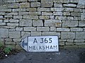
 Milestone in Box - geograph.org.uk - 2804771.jpg 1,704 × 2,304; 1.75 MB
-
 Milestone, Kingsdown - geograph.org.uk - 1880053.jpg 480 × 640; 214 KB
-
 Mill Lane, Box - geograph.org.uk - 5023665.jpg 1,600 × 1,065; 691 KB
-
 Mini-roundabout at Hawthorn - geograph.org.uk - 2506842.jpg 2,953 × 1,796; 869 KB
-
 Minor road at Lidbrooks Bottom - geograph.org.uk - 5023587.jpg 1,600 × 1,102; 770 KB
-
 Oak tree at Alcombe - geograph.org.uk - 3751995.jpg 800 × 600; 321 KB
-
 Old milestone, Kingsdown - geograph.org.uk - 1880046.jpg 640 × 480; 131 KB
-
 Old Toll House by Devizes Road, Box (geograph 6115094).jpg 640 × 479; 121 KB
-
 Old Toll House by Kingsdown Road, Blue Vein (geograph 6114503).jpg 640 × 409; 105 KB
-
 On the Macmillan Way Near Box - geograph.org.uk - 6751178.jpg 1,600 × 1,064; 373 KB
-
 On the Macmillan Way Near Box - geograph.org.uk - 6751187.jpg 640 × 426; 73 KB
-
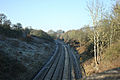 Paddington to Bristol main line - geograph.org.uk - 699976.jpg 640 × 426; 101 KB
-
 Path south of Weavern Farm - geograph.org.uk - 3166486.jpg 1,280 × 853; 781 KB
-
 Ploughed and rolled - geograph.org.uk - 802193.jpg 640 × 427; 83 KB
-
 Ploughed Field on Bannerdown. - geograph.org.uk - 3158994.jpg 640 × 480; 99 KB
-
 Post Office and stores, London Road. - geograph.org.uk - 812763.jpg 640 × 476; 93 KB
-
 Private Track in The Larches - geograph.org.uk - 3166693.jpg 853 × 1,280; 1.22 MB
-
 Public footpath sign - geograph.org.uk - 1184141.jpg 640 × 480; 111 KB
-
 Quarry Hill, Box - geograph.org.uk - 3752028.jpg 800 × 451; 285 KB
-
 Railway tracks in Box, Wiltshire.jpg 2,250 × 3,000; 3.91 MB
-

-

-
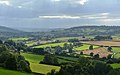
 Rolling Somerset countryside, viewed from the A4 outside Box - geograph.org.uk - 2535465.jpg 3,456 × 2,592; 3.11 MB
-

-
 Rough grassland, By Brook - geograph.org.uk - 5329386.jpg 640 × 426; 63 KB
-
 School on Box High Street - geograph.org.uk - 2804702.jpg 1,704 × 2,304; 1.38 MB
-
 Sign for the Queen's Head - geograph.org.uk - 1892202.jpg 480 × 640; 113 KB
-
 Smoke on the wind - geograph.org.uk - 3751983.jpg 800 × 600; 322 KB
-
 Spring Quarry - geograph.org.uk - 4119270.jpg 640 × 416; 91 KB
-
 St Jude's Cottage 2.jpg 3,024 × 4,032; 3.22 MB
-
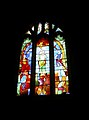 St Thomas à Becket, Box - geograph.org.uk - 2833548.jpg 1,704 × 2,304; 875 KB
-
 Stanley House Stoney Steps.jpg 4,032 × 3,024; 3.01 MB
-
 The A4, west of Box - geograph.org.uk - 1443521.jpg 640 × 480; 154 KB
-
 The Bear, Box High Street - geograph.org.uk - 2804757.jpg 2,304 × 1,704; 1.47 MB
-
 The Blind House, Box - geograph.org.uk - 812752.jpg 640 × 534; 96 KB
-
 The By Brook valley - geograph.org.uk - 3750993.jpg 800 × 451; 265 KB
-
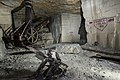
 The Cathedral, Box Mine - geograph.org.uk - 1195167.jpg 1,830 × 2,751; 1.52 MB
-
 The Chequers Inn.jpg 4,032 × 3,024; 5.26 MB
-
 The Closes - geograph.org.uk - 445924.jpg 640 × 477; 95 KB
-
 The house in the triangle - geograph.org.uk - 2506827.jpg 3,405 × 2,333; 1.13 MB
-
 The Manor House 3.jpg 4,032 × 3,024; 3.66 MB
-
 The Old Dairy, Gate Piers, Wall And Railings.jpg 4,032 × 3,024; 3.56 MB
-
 The Old Jockey - geograph.org.uk - 802250.jpg 640 × 462; 77 KB
-
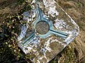
 The Poynder Fountain.jpg 3,024 × 4,032; 4.55 MB
-
 The Quarryman Arms Box Hill - geograph.org.uk - 6751167.jpg 1,600 × 944; 453 KB
-
 The Quarryman Arms Box Hill - geograph.org.uk - 6751173.jpg 1,064 × 1,600; 479 KB
-
 The Queen's Head, Box - geograph.org.uk - 1892086.jpg 640 × 480; 119 KB
-
 The Queens' Head, Box - geograph.org.uk - 811771.jpg 640 × 448; 89 KB
-
 The Swan near Ashley - geograph.org.uk - 1880723.jpg 640 × 480; 111 KB
-
 The Wharf, Box - geograph.org.uk - 2535492.jpg 3,456 × 2,592; 2.98 MB
-
 This must be it - geograph.org.uk - 2804712.jpg 1,704 × 2,304; 1.7 MB
-
 Thorney Pits - geograph.org.uk - 3752063.jpg 800 × 600; 311 KB
-

-
 Track and footpath - geograph.org.uk - 3752035.jpg 800 × 600; 354 KB
-
 Triangulation Pillar - geograph.org.uk - 3514939.jpg 4,912 × 1,920; 4.01 MB
-
 Trig top - geograph.org.uk - 2826346.jpg 2,304 × 1,704; 1.65 MB
-
 Tutton Hill - geograph.org.uk - 3750986.jpg 800 × 600; 422 KB
-
 Unusual adornment - geograph.org.uk - 2804769.jpg 2,304 × 1,704; 1.62 MB
-
 View from Wadswick Lane - geograph.org.uk - 813693.jpg 640 × 483; 51 KB
-
 View over the By Valley from Box Hill, Wiltshire - geograph.org.uk - 4638324.jpg 1,024 × 636; 141 KB
-
 View Southwest from Rudloe - geograph.org.uk - 3166922.jpg 1,920 × 1,080; 1.43 MB
-

-
 View Towards Colerne - geograph.org.uk - 3166894.jpg 1,920 × 1,080; 1.34 MB
-
 Wadswick trig - geograph.org.uk - 2826349.jpg 2,304 × 1,704; 1.74 MB
-
 Washwell from Longsplatt - geograph.org.uk - 813758.jpg 640 × 473; 70 KB
-
 West Lung, Spring Quarry - geograph.org.uk - 4118347.jpg 640 × 427; 102 KB
-
 White Ennox Lane - geograph.org.uk - 3752053.jpg 800 × 600; 400 KB
-
 Wisteria on Frogmore House, Box - geograph.org.uk - 802161.jpg 640 × 474; 111 KB
-
 Woodland beside the bridleway - geograph.org.uk - 3166832.jpg 1,920 × 1,279; 2.69 MB
-
 WW2 Pill Box at Box - geograph.org.uk - 515506.jpg 520 × 390; 113 KB
-
 A4 London Road, Box - geograph.org.uk - 558917.jpg 480 × 640; 107 KB
-
 Abandoned house - geograph.org.uk - 212421.jpg 600 × 450; 104 KB
-
 Abandonment near Ashley - geograph.org.uk - 699989.jpg 640 × 433; 140 KB
-
 Action at Kingsdown Golf Course - geograph.org.uk - 781658.jpg 640 × 477; 110 KB
-
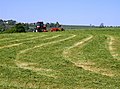 Activity at Widdenham Farm - geograph.org.uk - 445876.jpg 640 × 477; 98 KB
-
 Arable fields near Hatt Farm - geograph.org.uk - 445917.jpg 640 × 477; 117 KB
-
 Ashley - geograph.org.uk - 690344.jpg 640 × 412; 131 KB
-
 Ashley Corner House from the green - geograph.org.uk - 702620.jpg 640 × 425; 110 KB
-
 Ashley Farm - geograph.org.uk - 687626.jpg 640 × 481; 172 KB
-
 Box boxed - geograph.org.uk - 445907.jpg 640 × 477; 89 KB
-
 Descent to the By Brook - geograph.org.uk - 445849.jpg 640 × 477; 126 KB
-
 Dry valley - geograph.org.uk - 212412.jpg 600 × 450; 52 KB
-
 Evening collection - geograph.org.uk - 167654.jpg 640 × 480; 140 KB
-
 Flowing into the By Brook - geograph.org.uk - 445853.jpg 640 × 477; 150 KB
-
 Folly Farm - geograph.org.uk - 703532.jpg 640 × 457; 82 KB
-
 Footpath near Blue Vein - geograph.org.uk - 445914.jpg 640 × 477; 110 KB
-
 Ingalls Cottages - geograph.org.uk - 704613.jpg 640 × 439; 65 KB
-
 Kingsdown Golf Club - geograph.org.uk - 64978.jpg 640 × 480; 96 KB
-
 Longsplatt - geograph.org.uk - 131509.jpg 640 × 480; 82 KB
-
 Lower Rudloe Farm - geograph.org.uk - 709492.jpg 640 × 454; 85 KB
-
 Meander on the By Brook - geograph.org.uk - 445887.jpg 640 × 477; 114 KB
-
 Norbin Farm - geograph.org.uk - 326220.jpg 640 × 480; 33 KB
-
 Pastoral scene by the By Brook - geograph.org.uk - 445862.jpg 640 × 477; 128 KB
-
 Road into Box - geograph.org.uk - 703544.jpg 640 × 451; 108 KB
-
 Slade's Farm - geograph.org.uk - 709463.jpg 640 × 457; 111 KB
-
 Squeeze stile south of Drewett's Mill - geograph.org.uk - 445885.jpg 640 × 477; 159 KB
-
 Sunflowers - geograph.org.uk - 212403.jpg 600 × 412; 91 KB
-
 The 10th at Kingsdown - geograph.org.uk - 64979.jpg 640 × 480; 107 KB
-
 The By Brook - geograph.org.uk - 212434.jpg 450 × 600; 101 KB
-
 The By Brook - geograph.org.uk - 445890.jpg 640 × 477; 123 KB
-
 The Northey, near Box - geograph.org.uk - 699909.jpg 640 × 426; 107 KB
-
 View from Box Common. - geograph.org.uk - 326230.jpg 640 × 480; 37 KB
-
 View from Widdenham Farm - geograph.org.uk - 445867.jpg 640 × 477; 97 KB
-
 Wadswick trig - geograph.org.uk - 190893.jpg 640 × 480; 119 KB
-
 Washwell near Henley - geograph.org.uk - 212426.jpg 600 × 450; 103 KB
-
 Weavern Farm - geograph.org.uk - 445855.jpg 640 × 477; 126 KB
-
 ボックス村.jpg 1,600 × 1,200; 429 KB

.jpg)


_Ltd,_Quarry_Hill,_Box_-_geograph.org.uk_-_3752021.jpg)


_-_geograph.org.uk_-_812961.jpg)
_-_geograph.org.uk_-_813671.jpg)


.jpg)
.jpg)


