Category:Bowning, New South Wales
Jump to navigation
Jump to search
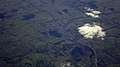
English: Bowning, altitude: 602m, is a small town in the Southern Tablelands, 14 km west of Yass on the Hume Highway in Yass Valley Shire. Bowning is an aboriginal word meaning big hill. (→Bowning, New South Wales)
Français : Bowning ( habitants) est une localité de Nouvelle-Galles du Sud en Australie à 10 km de Yass. (→Bowning)
locality in New South Wales, Australia | |||||
| Upload media | |||||
| Instance of | |||||
|---|---|---|---|---|---|
| Location |
| ||||
| Population |
| ||||
| Elevation above sea level |
| ||||
 | |||||
Subcategories
This category has the following 5 subcategories, out of 5 total.
Media in category "Bowning, New South Wales"
The following 10 files are in this category, out of 10 total.
-
 Bowning and Hume Highway from the air (1).jpg 2,000 × 1,333; 2.17 MB
-
 Bowning and Hume Highway from the air (2).jpg 2,000 × 1,333; 2.2 MB
-
 Bowning and Hume Highway from the air (3).jpg 2,000 × 1,333; 2.31 MB
-
 Bowning and Hume Highway from the air.jpg 2,000 × 1,121; 1.82 MB
-
 Bowning Burley Griffin Way.JPG 6,016 × 4,000; 7.32 MB
-
 Bowning Public School 001.JPG 5,672 × 3,744; 8.33 MB
-
 Bowning Rollonin Cafe 001.JPG 6,016 × 4,000; 10.07 MB
-
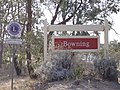
 Bowning Town Entry Sign 001.JPG 5,776 × 3,640; 10.59 MB
-
 Entering Bowning.jpg 2,816 × 2,112; 2.55 MB
-
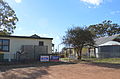
 Part of Bowning Township.jpg 2,816 × 2,112; 1.91 MB
.jpg)
.jpg)
.jpg)


