Category:Bowershall
Jump to navigation
Jump to search
village in Fife, Scotland, UK | |||||
| Upload media | |||||
| Instance of | |||||
|---|---|---|---|---|---|
| Location |
| ||||
 | |||||
English: Bowershall is a village in Fife, Scotland, UK, situated near Craigluscar Hill, two miles north of Dunfermline, one mile north of Townhill, and to the west of Loch Fitty, south of the B915.
Media in category "Bowershall"
The following 18 files are in this category, out of 18 total.
-
 A future holiday park^ - geograph.org.uk - 1032868.jpg 640 × 359; 93 KB
-
 Balmule Farm - geograph.org.uk - 1032857.jpg 640 × 359; 81 KB
-
 Disused railway, Cairncubie Road - geograph.org.uk - 1032823.jpg 640 × 359; 68 KB
-
 Farmland - geograph.org.uk - 82385.jpg 640 × 480; 105 KB
-
 Forest Track - geograph.org.uk - 191351.jpg 640 × 480; 117 KB
-
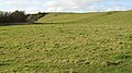 Grassland near Lochend - geograph.org.uk - 1034185.jpg 640 × 359; 98 KB
-

-
 Lochhead Recycling Centre - geograph.org.uk - 130869.jpg 640 × 480; 101 KB
-
 Meldrum's Mill Burn - geograph.org.uk - 1032835.jpg 640 × 480; 121 KB
-
 Opencast, Drumtuthill - geograph.org.uk - 76038.jpg 640 × 419; 50 KB
-
 Path - geograph.org.uk - 191646.jpg 640 × 480; 146 KB
-
 Poultry Farm. - geograph.org.uk - 82371.jpg 640 × 480; 80 KB
-
 Railway trackbed, Bowershall - geograph.org.uk - 1032829.jpg 640 × 480; 139 KB
-
 Regenerated Woodland - geograph.org.uk - 130990.jpg 640 × 502; 100 KB
-
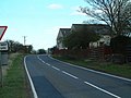 Road junction - geograph.org.uk - 164194.jpg 640 × 480; 74 KB
-
 Road Junction - geograph.org.uk - 82395.jpg 640 × 480; 134 KB
-
 Wattie's Ford Bridge - geograph.org.uk - 259191.jpg 640 × 424; 51 KB
-
 Wet land, Balmule - geograph.org.uk - 1032859.jpg 640 × 359; 55 KB


