Category:Bowcombe
Jump to navigation
Jump to search
hamlet on the Isle of Wight, in England, UK  | |||||
| Upload media | |||||
| Instance of | |||||
|---|---|---|---|---|---|
| Location | Newport and Carisbrooke, Isle of Wight, South East England, England | ||||
 | |||||
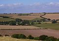
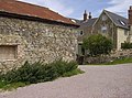
English: Bowcombe is a village on the Isle of Wight. It is located three kilometres southwest of Newport in the centre of the island. Public transport is provided by Southern Vectis buses on route 7.
Media in category "Bowcombe"
The following 26 files are in this category, out of 26 total.
-
 Bowcombe - geograph.org.uk - 496599.jpg 640 × 477; 112 KB
-
 Bowcombe IW 2.jpg 1,803 × 1,255; 911 KB
-
 Bowcombe, Isle of Wight, UK.jpg 1,875 × 1,380; 1.06 MB
-
 Derelict cottages at Bowcombe - geograph.org.uk - 498374.jpg 640 × 477; 107 KB
-

-
 Junction on Bowcombe Down - geograph.org.uk - 498357.jpg 640 × 477; 83 KB
-
 Sowing the winter wheat - geograph.org.uk - 62513.jpg 640 × 427; 78 KB
-
 All posts point to Chillerton - geograph.org.uk - 499830.jpg 640 × 477; 72 KB
-
 Approaching Garstons - geograph.org.uk - 499720.jpg 640 × 477; 92 KB
-
 Bowcombe Farm - geograph.org.uk - 499702.jpg 640 × 477; 73 KB
-
 Bowcombe Farm - geograph.org.uk - 499705.jpg 640 × 477; 87 KB
-
 Dewpond on Garstons Down - geograph.org.uk - 499926.jpg 640 × 477; 83 KB
-
 Flax - geograph.org.uk - 499918.jpg 640 × 477; 129 KB
-
 Flax below Garstons Down - geograph.org.uk - 499909.jpg 640 × 477; 129 KB
-
 Footpath towards Carisbrooke - geograph.org.uk - 499711.jpg 640 × 477; 95 KB
-
 Garstons - geograph.org.uk - 499722.jpg 640 × 477; 104 KB
-
 Geology on the Shepherd's Trail - geograph.org.uk - 499858.jpg 640 × 477; 94 KB
-
 Geology on the Shepherd's Trail - geograph.org.uk - 499869.jpg 640 × 477; 71 KB
-
 Newbarn Lane - geograph.org.uk - 499901.jpg 640 × 477; 111 KB
-
 On the Tennyson Trail - geograph.org.uk - 498343.jpg 640 × 477; 108 KB
-
 Part of Dukem Copse - geograph.org.uk - 499932.jpg 640 × 477; 127 KB
-
 Part of Whitelane Farm - geograph.org.uk - 498366.jpg 640 × 477; 64 KB
-
 Path junction above Vayres Farm - geograph.org.uk - 496511.jpg 640 × 477; 76 KB
-
 Ready for spreading - geograph.org.uk - 499715.jpg 640 × 477; 120 KB
-
 Sheep near Garstons - geograph.org.uk - 499717.jpg 640 × 477; 98 KB
-
 Snowdrop Lane - geograph.org.uk - 496497.jpg 640 × 477; 122 KB


