Category:Bowbridge Road, Newark-on-Trent
Jump to navigation
Jump to search
Bowbridge Road, Newark-on-Trent, Nottinghamshire, England.
Bowbridge Road becomes Bowbridge Lane at the intersection with Hawton Lane.
| Object location | | View all coordinates using: OpenStreetMap |
|---|
Media in category "Bowbridge Road, Newark-on-Trent"
The following 9 files are in this category, out of 9 total.
-
 Benchmark on ^181 Bowbridge Road - geograph.org.uk - 5246109.jpg 683 × 1,024; 250 KB
-
 Benchmark on ^54 Bowbridge Road - geograph.org.uk - 5165853.jpg 658 × 1,024; 287 KB
-
 Bowbridge Road - geograph.org.uk - 3128666.jpg 1,280 × 960; 128 KB
-
 Former bus garage, Bowbridge Road - geograph.org.uk - 3128662.jpg 1,280 × 960; 120 KB
-
 Hawtonville Children's Centre, Bowbridge Road - geograph.org.uk - 5246035.jpg 1,024 × 746; 178 KB
-

-
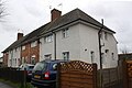 Houses on Bowbridge Road - geograph.org.uk - 5246098.jpg 1,024 × 684; 143 KB
-
 Jet filling station, Bowbridge Road - geograph.org.uk - 3128661.jpg 1,280 × 960; 120 KB
-
 Junction of Clumber Avenue and Bowbridge Road - geograph.org.uk - 5246116.jpg 1,024 × 683; 155 KB


