Category:Boundary stones of Schönburg-Waldenburg in Ruhland
Jump to navigation
Jump to search
| Object location | | View all coordinates using: OpenStreetMap |
|---|
Grenzsteine Schönburg-Waldenburg in Ruhland
[edit]Media in category "Boundary stones of Schönburg-Waldenburg in Ruhland"
The following 17 files are in this category, out of 17 total.
-
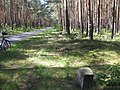
 Radweg Arnsdorf-Jannowitz nordwärts bei der Gemarkungsgrenze, alter Grenzstein, 01.jpg 3,648 × 2,736; 4.95 MB
-
 Radweg Arnsdorf-Jannowitz südwärts bei der Gemarkungsgrenze, alter Grenzstein, 01.jpg 3,648 × 2,736; 4.97 MB
-
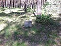 Radweg Arnsdorf-Jannowitz, Gemarkungsgrenze, alter Grenzstein, Ostsüdostansicht, 01.jpg 3,648 × 2,736; 5.09 MB
-
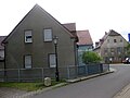
 Ruhland, Goethestr. 13, Grenzstein an der Ecke des Nebengebäudes, 01.jpg 1,704 × 2,272; 434 KB
-
 Ruhland, Goethestr. 13, Grenzstein an der Ecke des Nebengebäudes, 02.jpg 2,272 × 1,704; 703 KB
-
 Ruhland, Goethestr., alter Grenzstein an der Ecke Hartwigstr. 14, Winter, 01.jpg 3,000 × 4,000; 4.11 MB
-
 Ruhland, Goethestr., alter Grenzstein an der Ecke Hartwigstr. 14, Winter, 02.jpg 3,000 × 4,000; 4.7 MB
-
 Ruhland, Gutshof 3 Ostansicht vom Lindenplatz, mit Grenzstein, 01.jpg 2,112 × 2,816; 2.4 MB
-
 Ruhland, Gutshof 3 Ostansicht vom Lindenplatz, mit Grenzstein, 02.jpg 2,816 × 2,112; 2.11 MB
-
 Ruhland, Kamenzer Straße ostsüdostwärts beim alten Grenzstein, Sommer, 01.jpg 4,000 × 3,000; 6.99 MB
-
 Ruhland, Kamenzer Straße, alter Grenzstein, Sommer, 01.jpg 3,000 × 4,000; 7.16 MB
-
 Ruhland, Lindenplatz, Grenzstein an der Nordwestecke, Nordansicht, 01.jpg 2,816 × 2,112; 1.33 MB
-
 Ruhland, Lindenplatz, Grenzstein an der Nordwestecke, Nordansicht, 02.jpg 2,816 × 2,112; 2.97 MB
-
 Ruhland, Waldesruh bei Hausnr. 2, Grenzstein an der K6603, Frühsommer, 01.jpg 5,328 × 4,000; 12.03 MB
-
 Ruhland, Waldesruh bei Hausnr. 2, Grenzstein an der K6603, Frühsommer, 02.jpg 5,328 × 4,000; 13.96 MB
-
 Ruhland, Waldesruh, Feld nördlich Hausnr. 2, Grenzstein an der K 6603, Frühsommer, 01.jpg 5,328 × 4,000; 9.52 MB
-
 Ruhland, Waldesruh, Grenzstein an der K 6603 nördlich Hausnr. 2, Frühsommer, Frühsommer, 01.jpg 5,328 × 4,000; 13.22 MB


