Category:Boundary stones of Penzance
Jump to navigation
Jump to search
Media in category "Boundary stones of Penzance"
The following 24 files are in this category, out of 24 total.
-
 Borough boundary - geograph.org.uk - 1228561.jpg 417 × 528; 105 KB
-
 Boundary stone - geograph.org.uk - 3420147.jpg 640 × 427; 144 KB
-
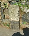
 Boundary Stone at Alverton Road, Penzance.jpg 3,024 × 4,032; 6.37 MB
-
 Boundary stone on the coast path - geograph.org.uk - 3197720.jpg 2,000 × 1,500; 1.42 MB
-
 Boundary stone on the coast path - geograph.org.uk - 3197724.jpg 1,500 × 2,000; 1.18 MB
-
 Heamoor - Borough of Penzance Boundary Stone (1934).jpg 3,024 × 4,032; 4.39 MB
-
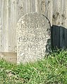
 Marking the boundary - geograph.org.uk - 1228508.jpg 640 × 500; 155 KB
-
 Marking the boundary - geograph.org.uk - 1231381.jpg 510 × 595; 89 KB
-
 Morrab Gardens - granite artefacts (May 2020).jpg 3,024 × 4,032; 5.49 MB
-
 Mousehole - Borough of Penzance Boundary Stone (1934).jpg 3,024 × 4,032; 3.61 MB
-

-

-
 On the boundary - geograph.org.uk - 1230172.jpg 518 × 636; 99 KB
-
 On the edge of town - geograph.org.uk - 1228522.jpg 478 × 588; 99 KB
-
 Outer limits - geograph.org.uk - 1232650.jpg 461 × 558; 129 KB
-
 Penzance - 1687 boundary stone (1).jpg 3,024 × 4,032; 5.29 MB
-
 Penzance - 1687 boundary stone (2).jpg 3,024 × 4,032; 5.72 MB
-
 Penzance - 1687 boundary stone (3).jpg 2,110 × 2,543; 1.94 MB
-
 Penzance - St Clare boundary stone (1).jpg 3,024 × 4,032; 7.85 MB
-
 Penzance - St Clare boundary stone (2).jpg 3,024 × 4,032; 7.91 MB
-
 Penzance bound - geograph.org.uk - 1232668.jpg 521 × 557; 98 KB
-
 Tredavoe - Borough of Penzance Boundary Stone (1934).jpg 2,301 × 2,422; 1.79 MB
-
 Tregavarah - Borough of Penzance Boundary Stone (1934).jpg 3,024 × 4,032; 4.7 MB
-
 Western limits - geograph.org.uk - 1228532.jpg 491 × 590; 134 KB


.jpg)


.jpg)
.jpg)

.jpg)


.jpg)
.jpg)
.jpg)
.jpg)
.jpg)

.jpg)
.jpg)
