Category:Boundary stones in the Metropolitan Borough of Kirklees
Jump to navigation
Jump to search
Media in category "Boundary stones in the Metropolitan Borough of Kirklees"
The following 81 files are in this category, out of 81 total.
-
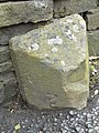
 84 Boundary stone, Hartshead side - geograph.org.uk - 2998990.jpg 2,000 × 1,500; 836 KB
-
 Boundary marker Meltham - South Crosland (14609827980).jpg 3,328 × 4,031; 11.41 MB
-

-
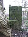
 Boundary Marker, Trinity Street, Huddersfield.jpg 473 × 669; 50 KB
-
 Boundary Stone (2), Holmbridge.jpg 450 × 600; 89 KB
-
 Boundary stone - geograph.org.uk - 2331909.jpg 1,200 × 1,600; 470 KB
-
 Boundary Stone at Howden Clough - geograph.org.uk - 3345300.jpg 1,500 × 2,000; 713 KB
-
 Boundary Stone at Howden Clough - geograph.org.uk - 3345308.jpg 1,500 × 2,000; 1.11 MB
-
 Boundary stone by Redbrook Reservoir - geograph.org.uk - 3734486.jpg 5,184 × 3,888; 5.49 MB
-

-
 Boundary stone on Deer Hill, Meltham - geograph.org.uk - 4682141.jpg 2,048 × 1,536; 800 KB
-
 Boundary stone, Clifton side - geograph.org.uk - 2998974.jpg 2,000 × 1,500; 993 KB
-
 Boundary stone, Hartshead - Mirfield - geograph.org.uk - 1930050.jpg 2,000 × 1,479; 852 KB
-
 Boundary stone, Hartshead - Mirfield - geograph.org.uk - 1930074.jpg 1,722 × 2,000; 987 KB
-
 Boundary stone, Huddersfield Road - geograph.org.uk - 2418401.jpg 1,500 × 2,000; 1.31 MB
-
 Boundary Stone, Leeds Road (A62) - geograph.org.uk - 6409937.jpg 2,000 × 1,428; 1.2 MB
-
 Boundary stone, Meltham and Marsden - geograph.org.uk - 4978300.jpg 2,000 × 1,373; 817 KB
-
 Boundary stone, St Peg Lane - geograph.org.uk - 3292035.jpg 1,496 × 2,000; 941 KB
-
 Boundary stone, Wessenden Head Road - geograph.org.uk - 2774741.jpg 640 × 469; 180 KB
-
 Boundary stone, West Nab Moss, Meltham - geograph.org.uk - 2425056.jpg 1,527 × 2,000; 1.24 MB
-
 Boundary stone, West Nab Moss, Meltham - geograph.org.uk - 2425085.jpg 1,500 × 2,000; 1.26 MB
-
 Boundary stone, West Nab Moss, Meltham - geograph.org.uk - 2425262.jpg 1,442 × 2,000; 1.19 MB
-
 Boundary Stone, White Reaps, Lingards - geograph.org.uk - 4683210.jpg 2,048 × 1,536; 1.02 MB
-
 Boundary stone, White Reaps, Lingards - geograph.org.uk - 4683212.jpg 1,536 × 2,048; 750 KB
-
 Canal milestone and railway boundary stone, Bradley - geograph.org.uk - 2415232.jpg 2,000 × 1,500; 1.15 MB
-
 Canal milestone and railway boundary stone, Bradley - geograph.org.uk - 2415237.jpg 2,000 × 1,500; 1.21 MB
-
 Close view of stone inscribed ‘WR’, Hunsworth Lane - geograph.org.uk - 3263110.jpg 1,855 × 2,000; 1.01 MB
-
 Driveways and possible estate boundary stone, Spen Lane - geograph.org.uk - 3405738.jpg 2,000 × 1,462; 1.23 MB
-
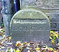 Local board boundary stone - geograph.org.uk - 3725522.jpg 1,539 × 1,350; 915 KB
-

-

-
 Old Boundary Marker - geograph.org.uk - 6477213.jpg 2,244 × 2,245; 1.55 MB
-
-

-

-

-

-

-

-

-

-

-

-

-

-

-
 Old Boundary Marker by the A629, Leeds Road, Mirfield (geograph 6060988).jpg 1,200 × 1,600; 380 KB
-

-
 Old Boundary Marker by the A640, Deanhead Moss - geograph.org.uk - 6048741.jpg 1,200 × 1,600; 545 KB
-

-
-
 Old Boundary Marker by the A643, Lindley Moor Road (geograph 6037110).jpg 1,936 × 1,296; 386 KB
-

-

-

-

-

-

-

-

-

-
 Old Boundary Marker on Deanhead Moss - geograph.org.uk - 6035596.jpg 600 × 800; 195 KB
-

-

-

-

-

-

-

-
 Old Boundary Marker on Pole Hill - geograph.org.uk - 6094730.jpg 600 × 800; 174 KB
-

-

-

-

-

-

-
 Railway boundary stone off Burbeary Road - geograph.org.uk - 4392042.jpg 2,000 × 1,500; 1.41 MB
-
 Railway boundary stone on the canal towpath, Bradley - - geograph.org.uk - 2415260.jpg 2,000 × 1,500; 1.26 MB
-
 Railway boundary stone, Bradley - geograph.org.uk - 2415243.jpg 1,500 × 2,000; 1.15 MB
-
 Railway boundary stone, Bradley - geograph.org.uk - 2415248.jpg 2,000 × 1,500; 1.13 MB
-
 Railway boundary stone, Bradley - geograph.org.uk - 2415254.jpg 1,500 × 2,000; 1.21 MB

.jpg)
.jpg)

,_Holmbridge.jpg)


_-_geograph.org.uk_-_6409937.jpg)


.jpg)


.jpg)


.jpg)


