Category:Boulder, Utah
Jump to navigation
Jump to search
town in Garfield County, Utah, United States   | |||||
| Upload media | |||||
| Instance of | |||||
|---|---|---|---|---|---|
| Named after | |||||
| Location | Garfield County, Utah | ||||
| Inception |
| ||||
| Population |
| ||||
| Area |
| ||||
| Elevation above sea level |
| ||||
| Different from | |||||
| official website | |||||
 | |||||
English: Media related to Boulder, Utah, a town in central Garfield County, Utah, United States.
Media in category "Boulder, Utah"
The following 43 files are in this category, out of 43 total.
-
 Barn BoulderUT.jpg 1,764 × 1,176; 488 KB
-
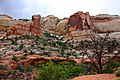 Beautiful Cliffs dyeclan.com - panoramio.jpg 3,088 × 2,056; 4.9 MB
-
 Beautiful Green Tree dyeclan.com - panoramio.jpg 3,088 × 2,056; 5.62 MB
-
 Blazin Trees - panoramio.jpg 2,160 × 1,440; 770 KB
-
 Boulder Airport and UFO Landing Site (3685430882).jpg 1,600 × 1,067; 389 KB
-
 Boulder Mountain Lodge (3679565968).jpg 1,600 × 1,057; 597 KB
-
 Boulder Mt. View - panoramio.jpg 2,160 × 1,440; 867 KB
-
 Boulder Top - panoramio (1).jpg 2,160 × 1,440; 642 KB
-
 Boulder Top - panoramio (2).jpg 2,160 × 1,440; 759 KB
-
 Boulder Top - panoramio.jpg 972 × 648; 211 KB
-
 Boulder, Boulder Mtn Lodge (3679112507).jpg 1,600 × 1,063; 264 KB
-
 Boulder, Boulder Mtn Lodge (3679112927).jpg 1,063 × 1,600; 277 KB
-
 Boulder, Schoolhouse Ledge (3679924764).jpg 1,067 × 1,600; 583 KB
-
 Boulder, Thompson Ledge (3680191794).jpg 1,600 × 1,063; 657 KB
-
 Boulder, UT 84716, USA - panoramio.jpg 3,264 × 2,448; 3.19 MB
-
 BoulderUT Overview.jpg 1,756 × 1,176; 523 KB
-
 CtyMapGarfield.png 936 × 689; 66 KB
-
 Desret Varnish dyeclan.com - panoramio.jpg 3,088 × 2,056; 5.53 MB
-
 East of Boulder (3680193352).jpg 1,600 × 1,063; 425 KB
-
 Fantastic Scenery dyeclan.com - panoramio.jpg 2,056 × 3,088; 5.32 MB
-
 First Light.jpg 4,185 × 3,133; 8.59 MB
-

-
 Garfieldcounty ut.png 1,671 × 502; 45 KB
-

-
 Grand Staircase - Escalante N. M., Utah Hwy 12 9-2009 (5884922511).jpg 1,450 × 1,171; 326 KB
-
 Grand Staircase - Escalante N. M., Utah Hwy 12 9-2009 (5885497392).jpg 1,129 × 916; 210 KB
-
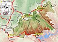 GSENM-map.jpg 668 × 483; 108 KB
-
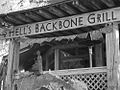 Hells Backbone Grill, Boulder UT (3685467652).jpg 1,000 × 750; 245 KB
-
 Kiva Koffeehouse - Flickr - brewbooks.jpg 3,071 × 2,448; 2.43 MB
-
 Large Dead Tree in Front of Cliffs dyeclan.com - panoramio.jpg 2,056 × 3,088; 3.7 MB
-
 Large Rock Formation dyeclan.com - panoramio.jpg 3,088 × 2,056; 3.74 MB
-
 Lower Bowns - panoramio.jpg 5,184 × 3,456; 5.39 MB
-
 Orange Cliffs on the Way Back From Lower Calf Creek Falls dyeclan.com - panoramio (1).jpg 3,088 × 2,056; 4.77 MB
-

-

-

-
 Scenic Byway 12 - Horses Grazing in Boulder - NARA - 7721693.jpg 1,773 × 1,164; 434 KB
-

-

-
 Scenic Byway 12 - Old, Pioneer-Era Fence in Boulder - NARA - 7721834.jpg 2,672 × 1,920; 1.62 MB
-
 Scenic Byway 12 - Overlooking Boulder - NARA - 7721713.jpg 1,756 × 1,176; 513 KB
-
 UTMap-doton-Boulder.PNG 238 × 300; 18 KB
-
 View from room in Boulder Mtn Lodge, Boulder UT (3684658979).jpg 1,000 × 667; 287 KB


.jpg)
.jpg)

.jpg)
.jpg)

.jpg)
.jpg)
.jpg)
.jpg)


.jpg)


.jpg)
.jpg)
.jpg)

.jpg)


.jpg)
.jpg)


.jpg)
Categories:
- Towns in Utah
- Populated places in Garfield County, Utah
- Places named after landforms
- Locations along Utah State Route 12 in Garfield County, Utah
- Locations along Utah State Route 23 (1927-1947)
- Locations along Utah State Route 54 (1914-1969) in Garfield County, Utah
- Locations along the Burr Trail Scenic Backway