Category:Boucher Trail
Jump to navigation
Jump to search
English: Boucher Trail in Grand Canyon West region.
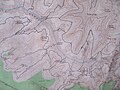
- The trail traverses Upper Hermit Canyon, starting below Dripping Springs. The trail goes west below Yuma Point, then the upper headwaters section of Travertine Canyon. It then descends into Boucher Canyon (east side), and ends at the intersection with Tonto Trail.
Grand Canyon hiking trail | |||||
| Upload media | |||||
| Instance of | |||||
|---|---|---|---|---|---|
| Located in protected area | |||||
| Location | Arizona | ||||
| Length |
| ||||
| Terminus | |||||
 | |||||
Media in category "Boucher Trail"
The following 10 files are in this category, out of 10 total.
-
 131112-Z-WT236-003 (10855083144).jpg 3,600 × 2,400; 2.35 MB
-
 Arizona. LOC 99446124-3.jpg 6,534 × 8,020; 11.28 MB
-
 Arizona. LOC 99446125-1.jpg 6,435 × 7,934; 9.86 MB
-
 Canyon wall, Boucher Basin, Grand Canyon LCCN2002718444.jpg 1,536 × 581; 116 KB
-

-
 Eremita Mesa, South Rim Grand Canyon, with Hermit Canyon and Pima Point.png 1,125 × 2,001; 11.33 MB
-
 Harvey Butchart's hiking map - Flickr - brewbooks (6).jpg 3,264 × 2,448; 4.13 MB
-
 Colorado River, Boucher Creek, Grand Canyon, Ariz (NYPL b12647398-69834).tiff 2,432 × 1,661; 11.56 MB
-

-

.jpg)


.jpg)

.jpg)
.png)
.png)