Category:Bottom Boat
Jump to navigation
Jump to search
English: Bottom Boat is a settlement in the unparished area of Stanley, in the Wakefield district, in the county of West Yorkshire, England.
settlement in Wakefield, West Yorkshire, England | |||||
| Upload media | |||||
| Instance of | |||||
|---|---|---|---|---|---|
| Location | Wakefield, West Yorkshire, Yorkshire and the Humber, England | ||||
 | |||||
Subcategories
This category has the following 3 subcategories, out of 3 total.
Media in category "Bottom Boat"
The following 44 files are in this category, out of 44 total.
-
 A642 Aberford Road, Bottom Boat, Wakefield - geograph.org.uk - 5828853.jpg 4,608 × 3,072; 1.94 MB
-
 Another one bites the dust - geograph.org.uk - 1001415.jpg 480 × 640; 82 KB
-
 Benches by the Trans Pennine Trail - geograph.org.uk - 6480929.jpg 1,600 × 1,200; 626 KB
-
 Bio-fuel crop - geograph.org.uk - 2014552.jpg 1,024 × 768; 253 KB
-
 Blot on the landscape - geograph.org.uk - 2790729.jpg 1,024 × 768; 565 KB
-
 Bottom Boat and power lines - geograph.org.uk - 5701980.jpg 3,529 × 2,480; 1.63 MB
-
 Bottom Boat Playground - geograph.org.uk - 5655531.jpg 1,024 × 683; 303 KB
-
 Bottom Boat, The Rising Sun Pub. - geograph.org.uk - 455198.jpg 640 × 480; 84 KB
-
 Bottomboat from the west - geograph.org.uk - 6480677.jpg 1,600 × 1,200; 617 KB
-

-
 Charlesworth Place - Moorhouse Grove - geograph.org.uk - 4321458.jpg 640 × 480; 68 KB
-
 Controlling access - geograph.org.uk - 2014558.jpg 1,024 × 768; 173 KB
-
 Footpath off Bottom Boat Lane - geograph.org.uk - 2013431.jpg 1,024 × 768; 216 KB
-
 Former Church - Bottom Boat Road - geograph.org.uk - 760003.jpg 640 × 480; 54 KB
-
 Former railway - geograph.org.uk - 2013476.jpg 1,024 × 768; 199 KB
-
 Former railway bridge - geograph.org.uk - 1001407.jpg 501 × 640; 122 KB
-
 Holmfield Chase - Bottom Boat Road - geograph.org.uk - 4321578.jpg 640 × 480; 67 KB
-
 Lorry in the clouds - geograph.org.uk - 2014258.jpg 1,024 × 768; 144 KB
-
 Only the sign deters entry - geograph.org.uk - 2015409.jpg 1,024 × 768; 200 KB
-
 Path on the riverbank near Bottomboat Reach - geograph.org.uk - 6482879.jpg 1,200 × 1,600; 840 KB
-
 Post-industrial landscape - geograph.org.uk - 2015019.jpg 1,024 × 768; 173 KB
-
 Properties in Bottomboat - geograph.org.uk - 1848497.jpg 640 × 480; 240 KB
-
 Public footpath from Bottomboat to Lake Yard - geograph.org.uk - 6479854.jpg 1,600 × 1,200; 467 KB
-
 River Calder - Foxholes - geograph.org.uk - 1941723.jpg 480 × 640; 317 KB
-
 Rough track - geograph.org.uk - 2015001.jpg 1,024 × 768; 211 KB
-
 Shoe factory, Bottomboat - geograph.org.uk - 1848482.jpg 640 × 480; 261 KB
-
 Site of dropped bridge, Trans Pennine Trail - geograph.org.uk - 6480969.jpg 1,600 × 1,200; 706 KB
-
 Spindle Tree Pub Sign - geograph.org.uk - 1001386.jpg 480 × 640; 85 KB
-

-
 Stone-built terraced houses - geograph.org.uk - 2014980.jpg 1,024 × 768; 162 KB
-
 The line of the Old Cut, just west of Bottomboat - geograph.org.uk - 6479888.jpg 1,600 × 1,200; 510 KB
-
 The Rising Sun Pub, Bottom Boat - geograph.org.uk - 455199.jpg 640 × 480; 78 KB
-
 The Rising Sun, Bottom Boat - geograph.org.uk - 2734891.jpg 640 × 480; 78 KB
-
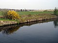
 The River Calder - geograph.org.uk - 2015030.jpg 1,024 × 768; 154 KB
-
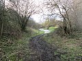
 The Trans Pennine Trail - geograph.org.uk - 2013440.jpg 1,024 × 768; 130 KB
-
 The way to Bottom Boat North - geograph.org.uk - 2762315.jpg 800 × 600; 166 KB
-
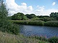
 Three waterways in the Calder valley, near Bottomboat - geograph.org.uk - 6480663.jpg 1,600 × 1,200; 518 KB
-
 TPT signpost - geograph.org.uk - 1505868.jpg 480 × 640; 160 KB
-
 Track - Bottom Boat Road - geograph.org.uk - 4321573.jpg 640 × 480; 131 KB
-
 Track - Bottom Boat Road - geograph.org.uk - 4321722.jpg 640 × 480; 101 KB
-
 Track from Newmarket Lane - geograph.org.uk - 6480984.jpg 1,600 × 1,200; 485 KB
-
 Trans Pennine Trail approaching Meadowfield Rise - geograph.org.uk - 6480681.jpg 1,600 × 1,200; 602 KB
-
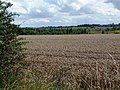 Wheat field - geograph.org.uk - 2015377.jpg 1,024 × 768; 230 KB
-
 Wm Lamb Footwear offices. - geograph.org.uk - 1001433.jpg 640 × 475; 75 KB


