Category:Botley Road
Jump to navigation
Jump to search
road in Oxford, England  | |||||
| Upload media | |||||
| Instance of | |||||
|---|---|---|---|---|---|
| Location | Oxford, Oxfordshire, South East England, England | ||||
 | |||||
Subcategories
This category has the following 3 subcategories, out of 3 total.
B
- Bulstake Bridge (5 F)
- Bus stops in Botley Road, Oxford (22 F)
O
- St Frideswide's Church, Oxford (19 F)
Media in category "Botley Road"
The following 72 files are in this category, out of 72 total.
-
 A420 - geograph.org.uk - 5627136.jpg 640 × 426; 68 KB
-
 A420 - geograph.org.uk - 5627140.jpg 640 × 426; 72 KB
-
 A420, Botley Rd - geograph.org.uk - 3937169.jpg 640 × 388; 70 KB
-
 A420, New Botley - geograph.org.uk - 5627137.jpg 640 × 426; 84 KB
-
 Alcove in the wall - geograph.org.uk - 1103479.jpg 640 × 480; 97 KB
-
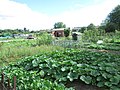 Allotments - Botley Road - geograph.org.uk - 3601478.jpg 640 × 480; 106 KB
-
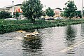
 Backwater by Botley Road - geograph.org.uk - 3321660.jpg 1,500 × 970; 333 KB
-
 Binsey Lane at the corner of Botley Road - geograph.org.uk - 4869834.jpg 2,048 × 1,152; 446 KB
-
 Bolted Doors - geograph.org.uk - 4308458.jpg 600 × 800; 94 KB
-
 Botley Rd (A420) - geograph.org.uk - 3937185.jpg 640 × 430; 85 KB
-
 Botley Rd seen from Warland's bicycle shop - geograph.org.uk - 5856343.jpg 4,000 × 3,000; 4.87 MB
-
 Botley Retail park from Lamarsh Road - geograph.org.uk - 5856711.jpg 5,184 × 3,456; 4.35 MB
-
 Botley Retail park, 2007 floods - geograph.org.uk - 5856758.jpg 1,840 × 1,232; 1.07 MB
-
 Botley Road - entering Oxford - geograph.org.uk - 3314709.jpg 640 × 425; 108 KB
-
 Botley Road - Oxford - geograph.org.uk - 313293.jpg 640 × 480; 108 KB
-
 Botley Road at the junction of Mill Street - geograph.org.uk - 4863403.jpg 2,048 × 1,536; 1.49 MB
-
 Botley Road bridge over Osney Ditch, 2007 floods - geograph.org.uk - 5856729.jpg 1,840 × 1,232; 973 KB
-
 Botley Road bridge over the River Thames - geograph.org.uk - 5176887.jpg 800 × 531; 143 KB
-
 Botley Road by Oxford Station - geograph.org.uk - 4835595.jpg 2,304 × 1,728; 968 KB
-

-
 Botley Road from Alexandra Road, 2007 floods - geograph.org.uk - 5856606.jpg 1,840 × 1,232; 1.02 MB
-
 Botley Road from the junction with Binsey Lane - geograph.org.uk - 3437302.jpg 3,264 × 1,836; 2.22 MB
-
 Botley Road from the railway bridge, Oxford - geograph.org.uk - 5481223.jpg 1,600 × 1,064; 317 KB
-
 Botley Road looking east from Osney Bridge, Oxford - geograph.org.uk - 5481225.jpg 1,600 × 1,064; 334 KB
-
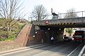 Botley Road railway bridge - geograph.org.uk - 5178422.jpg 1,024 × 683; 214 KB
-
 Botley Road Railway Bridge under reconstruction 20230831 125524.jpg 4,624 × 3,468; 6.46 MB
-
 Botley Road seen from outside Eggs Eggcetera - geograph.org.uk - 5856345.jpg 4,000 × 3,000; 4.88 MB
-
 Botley Road under reconstruction 20230831 125518.jpg 4,624 × 3,468; 7.08 MB
-
 Botley Road west of Oxford - geograph.org.uk - 4864677.jpg 2,048 × 1,536; 947 KB
-
 Botley Road, 2007 floods - geograph.org.uk - 5856384.jpg 1,840 × 1,232; 928 KB
-
 Botley Road, 2007 floods - geograph.org.uk - 5856725.jpg 1,840 × 1,232; 1.07 MB
-
 Botley Road, 2007 floods - geograph.org.uk - 5856760.jpg 1,840 × 1,232; 1,019 KB
-
 Botley Road, north side. 2007 floods - geograph.org.uk - 5856366.jpg 1,840 × 1,232; 940 KB
-
 Botley Road, Oxford - geograph.org.uk - 1391156.jpg 640 × 426; 69 KB
-
 Bullstake Close from Botley Road, 2007 floods - geograph.org.uk - 5856736.jpg 1,840 × 1,232; 1.1 MB
-
 Bullstake Close from Botley Road, 2007 floods - geograph.org.uk - 5856747.jpg 1,840 × 1,232; 1,014 KB
-
 Cafe on Botley Road, Oxford - geograph.org.uk - 6270507.jpg 800 × 514; 91 KB
-
 Changed use - geograph.org.uk - 1104362.jpg 640 × 480; 70 KB
-
 Channel by Botley Rd - geograph.org.uk - 3925629.jpg 640 × 430; 104 KB
-
 Co-operative House - geograph.org.uk - 1635059.jpg 640 × 480; 96 KB
-
 Corner of Alexandra Road and Botley Road, 2007 floods - geograph.org.uk - 5856405.jpg 1,840 × 1,232; 908 KB
-
 Corner of Henry Road and Botley Road, 2007 floods - geograph.org.uk - 5856368.jpg 1,840 × 1,232; 1.19 MB
-
 Courtney Pianos, Oxford - geograph.org.uk - 4211435.jpg 800 × 579; 124 KB
-
 Crossing Botley Road - geograph.org.uk - 2007115.jpg 1,600 × 1,114; 647 KB
-
 Currydor, Oxford - geograph.org.uk - 4211235.jpg 800 × 794; 153 KB
-
 Currys Botley road - geograph.org.uk - 1104344.jpg 640 × 480; 50 KB
-
 ENG Oxford Botley Road 01.jpg 4,032 × 3,024; 1.23 MB
-
 ENG Oxford Botley Road 02.jpg 4,032 × 3,024; 1.95 MB
-
 ENG Oxford Botley Road 03.jpg 4,032 × 3,024; 1.8 MB
-
 ENG Oxford Botley Road 04.jpg 4,032 × 3,024; 1.05 MB
-
-
 Footbridge over Botley Rd - geograph.org.uk - 4052241.jpg 640 × 430; 82 KB
-
 Funeral, Botley Road - geograph.org.uk - 2908688.jpg 1,600 × 1,142; 435 KB
-
 Junction of Botley Road and Binsey Lane - geograph.org.uk - 3265472.jpg 1,024 × 683; 176 KB
-
 Looking down Botley road - geograph.org.uk - 1102605.jpg 640 × 480; 77 KB
-
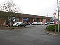
 MFI Oxford - geograph.org.uk - 1101625.jpg 640 × 480; 73 KB
-
 Mick's Cafe, Oxford - geograph.org.uk - 4243783.jpg 800 × 586; 144 KB
-

-
 Optare Solo YJ10 MFA Oxford BotleyRd.jpg 1,280 × 720; 514 KB
-
 Osney Court, 2007 floods - geograph.org.uk - 5856619.jpg 1,840 × 1,232; 1.05 MB
-
 Pink storage - geograph.org.uk - 1416044.jpg 640 × 480; 74 KB
-
 Oxford , Botley Road A420 - geograph.org.uk - 4053889.jpg 4,288 × 2,848; 5.37 MB
-
 Oxford , Botley Road A420 - geograph.org.uk - 4053907.jpg 4,288 × 2,848; 6.25 MB
-
 Houses at New Botley - geograph.org.uk - 1101634.jpg 640 × 480; 71 KB
-
 Oxford, Botley Road - panoramio.jpg 3,788 × 2,516; 2.81 MB
-
 Park and ride entrance - geograph.org.uk - 1635069.jpg 640 × 480; 73 KB
-
 Retirement flats on the Botley road - geograph.org.uk - 1102629.jpg 640 × 480; 58 KB
-
 Scania AlexanderDennis Enviro400 GF09 OXF Oxford BotleyRd.jpg 1,280 × 913; 764 KB
-
 Scania AlexanderDennis Enviro400 OU10 BGV Oxford BotleyRd.jpg 1,025 × 1,280; 917 KB
-
 The Botley road - geograph.org.uk - 1101608.jpg 640 × 480; 71 KB
-
 The Botley Road rail bridge - geograph.org.uk - 1415944.jpg 640 × 480; 88 KB
-
 Wickes outlet - geograph.org.uk - 1101600.jpg 640 × 480; 41 KB


_-_geograph.org.uk_-_3937185.jpg)


