Category:Botlek
Jump to navigation
Jump to search
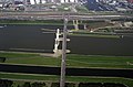
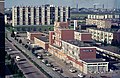
De Botlek is een haven- en industriegebied in Rotterdam, gelegen ten westen van de Oude Maas tussen het Scheur en de A15. Het noordwestelijk deel van het gebied ligt op het voormalige eiland Rozenburg; het zuidoostelijk gelegen deel ligt op wat vroeger de Welplaat was.
harbour area in Rotterdam, Netherlands  | |||||
| Upload media | |||||
| Instance of | |||||
|---|---|---|---|---|---|
| Part of | |||||
| Location | Rotterdam, South Holland, Netherlands | ||||
| Population |
| ||||
| Different from | |||||
 | |||||
Subcategories
This category has the following 11 subcategories, out of 11 total.
A
- Aerial photographs of Botlek (5 F)
B
- Botlektunnel (Rotterdam) (12 F)
E
- Emplacement Botlek (31 F)
- Events at Botlek (9 F)
G
- Grote Hartelsluis (2 F)
P
R
- Rozenburgsesluis (28 F)
S
- Satellite pictures of Botlek (2 F)
T
V
- Verkeerscentrale Rotterdam (40 F)
Media in category "Botlek"
The following 57 files are in this category, out of 57 total.
-
 2156 038704 Luchtopname Hartelbrug 2001.jpg 2,500 × 1,651; 827 KB
-
 Aladin ENI 06003722, Botlek, Port of Rotterdam.JPG 2,209 × 2,937; 1.56 MB
-
 Aqua Isala ENI 02316116, Botlek, Port of Rotterdam.JPG 3,741 × 2,495; 2.34 MB
-
 Aqua Mosa ENI 02311621, Botlek.JPG 3,162 × 2,101; 2.04 MB
-
 Ballast Nedam Botlek Rotterdam 2019.jpg 4,822 × 3,194; 6.41 MB
-
 Betuweroute Rotterdam 2019.jpg 4,928 × 3,264; 6.17 MB
-
 BOSTON , SMIT EBRO , ELBE , SD SEAL & SD SHARK (18113013909).jpg 3,241 × 1,605; 1.59 MB
-
 Botlek w.jpg 1,587 × 1,190; 435 KB
-
 Botlek.JPG 3,712 × 2,088; 2.7 MB
-
 Breeze ENI 02104388, Aladin ENI 06003722, Noraly ENI 06003460, Botlek, Port of Rotterdam.JPG 4,314 × 2,865; 3.36 MB
-
 Breeze ENI 02104388, Botlek, Port of Rotterdam.JPG 3,057 × 2,032; 1.81 MB
-
 Cabot, Port of Rotterdam.JPG 4,608 × 3,456; 6.34 MB
-
 Cosmos IMO 9251755, Botlek.JPG 4,274 × 2,842; 2.99 MB
-
 DIA41806 Spijkenisse volkstuinen Hekelingsweg 1963.jpg 3,401 × 2,035; 1.37 MB
-
 DIA42064 Spijkenisse gezicht op Hoogwerf en Botlek 1972.jpg 3,377 × 1,989; 718 KB
-
 DIA42065 Hartelbrug over het Voedingskanaal Spijkenisse 1972.jpg 3,340 × 1,967; 858 KB
-
 DIA6016 Spijkenisse panorama met 't Plateau 1969.jpg 3,361 × 2,190; 1.92 MB
-
 DIA6225 Panorama Spijkenisse-Noord ±1970.jpg 3,349 × 2,138; 1.51 MB
-
 Dronefoto van het mallebos en gebouwen in de verte.jpg 3,877 × 2,181; 3.19 MB
-
 Emerald Kalama Chemical Rotterdam 2019.jpg 4,928 × 3,264; 6.65 MB
-
 Graansilo in Botlek ingestort, vier arbeiders omgekomen, Bestanddeelnr 915-2527.jpg 2,461 × 3,703; 2.03 MB
-
 Graansilo in Botlek ingestort, vier arbeiders omgekomen, Bestanddeelnr 915-2530.jpg 3,688 × 2,422; 2.11 MB
-
Havendag Weeknummer 65-40 - Open Beelden - 31668.ogv 2 min 5 s, 320 × 240; 7.26 MB
-
 Hexion Rotterdam Botlek 2019.jpg 4,928 × 3,264; 5.45 MB
-
 Hunter ENI 02104230, Botlek, Port of Rotterdam.JPG 4,183 × 3,143; 2.9 MB
-
 JB 118, IMO 9657753, Botlek, Port of Rotterdam, pic2.JPG 4,608 × 3,456; 3.27 MB
-
 JB 118, IMO 9657753, Botlek, Port of Rotterdam.JPG 4,592 × 3,056; 4.62 MB
-
 Maassluis Botlek (33914437732).jpg 3,348 × 1,778; 3.07 MB
-
 Noah - ENI 02323448, Port of Rotterdam.jpg 4,608 × 3,456; 2.74 MB
-
 Noraly, ENI 06003460, Botlek, Port of Rotterdam.JPG 2,391 × 3,195; 1.65 MB
-
 OCEANIC FIRST (01).tif 3,066 × 1,765; 3.62 MB
-
 On the road to hook of holland (2) - Flickr - bertknot.jpg 2,372 × 2,005; 773 KB
-
 Oostzee ENI 06003472, Botlek, pic1.JPG 4,389 × 2,918; 3.28 MB
-
 Oostzee ENI 06003472, Botlek, pic2.JPG 4,189 × 3,143; 3 MB
-
 Oostzee ENI 06003472, Botlek, pic3.JPG 4,608 × 3,456; 3.45 MB
-
 Oostzee ENI 06003472, Botlek, pic4.JPG 4,608 × 3,456; 3.04 MB
-
 Oostzee ENI 06003472, Botlek, pic5.JPG 4,252 × 3,193; 3.15 MB
-
 Overseas Athens, IMO 9470260 at the Botlek, Port of Rotterdam pic1.JPG 3,914 × 2,936; 2.6 MB
-
 Overseas Athens, IMO 9470260 at the Botlek, Port of Rotterdam pic2.JPG 4,036 × 3,021; 2.51 MB
-
 Platform in Caland canal Rotterdam harbor.jpg 2,608 × 1,952; 2.83 MB
-

-
 Rijnmond (34155808870).jpg 2,550 × 1,358; 2.77 MB
-
 Rotterdam Locomotor 342 (18354717151).jpg 2,992 × 1,974; 1.19 MB
-

-

-
 Shin-Etsu Botlek Rotterdam 2019 2.jpg 4,928 × 3,264; 7.39 MB
-
 Shin-Etsu Botlek Rotterdam 2019.jpg 4,928 × 3,264; 7.05 MB
-
 SMIT RUSLAND & NORD EMPEROR (15759393296).jpg 4,647 × 2,674; 1.42 MB
-
 SMIT RUSLAND , BRO PRIORITY & SMIT FINLAND (15163126064).jpg 4,912 × 2,760; 2.1 MB
-
 Solution ENI 02331511, Botlek, Port of Rotterdam.JPG 3,857 × 2,564; 2.54 MB
-
 Staatscourant 2018, 29706.pdf 1,239 × 1,752, 2 pages; 184 KB
-
 Staatscourant 2019, 2712.pdf 1,239 × 1,752, 2 pages; 183 KB
-
 Storage tanks Botlek Rotterdam 2019.jpg 4,928 × 3,264; 6.74 MB
-
 Sunset near Spijkenisse botlek.jpg 1,067 × 1,600; 738 KB
-
 Uisge Gorm.JPG 3,405 × 2,553; 1.79 MB
-
 VAT Logistics Rotterdam 2019.jpg 4,928 × 3,264; 5.77 MB
-
 Vopak tank Europoort.jpg 3,456 × 2,304; 4.03 MB


.jpg)


.jpg)


_-_Flickr_-_bertknot.jpg)


.jpg)
.jpg)
_IMG_2515_2022-07-11_12.48.jpg)
_IMG_2507_2022-07-11_12.34.jpg)


.jpg)
.jpg)


