Category:Boschstraat 10, Zaltbommel
Jump to navigation
Jump to search
| Object location | | View all coordinates using: OpenStreetMap |
|---|
 | |||||
| Upload media | |||||
| Instance of |
| ||||
|---|---|---|---|---|---|
| Location | Zaltbommel, Gelderland, Netherlands | ||||
| Street address |
| ||||
| Located on street | |||||
| Heritage designation |
| ||||
 | |||||
|
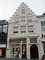
This is a category about rijksmonument number 40131
|
| Address |
|
Media in category "Boschstraat 10, Zaltbommel"
The following 2 files are in this category, out of 2 total.
-
 Aanzicht - Zaltbommel - 20220272 - RCE.jpg 1,200 × 963; 228 KB
-
 Boschstraat 10.jpg 3,000 × 4,000; 576 KB
