Category:Boreham, Wiltshire
Jump to navigation
Jump to search

settlement in Wiltshire, England | |||||
| Upload media | |||||
| Instance of | |||||
|---|---|---|---|---|---|
| Location | Wiltshire, South West England, England | ||||
 | |||||
Boreham, originally a separate hamlet, is an eastern conjoined suburb of Warminster, in Wiltshire, England.
Subcategories
This category has only the following subcategory.
B
Media in category "Boreham, Wiltshire"
The following 28 files are in this category, out of 28 total.
-
 Approaching Vedette Post No. 2 - geograph.org.uk - 486970.jpg 640 × 480; 69 KB
-
 Boreham Down, Imber Range - geograph.org.uk - 300361.jpg 640 × 480; 114 KB
-
 Boreham Road, Warminster.jpg 800 × 690; 169 KB
-
 Downs, West Stowell - geograph.org.uk - 282646.jpg 480 × 640; 136 KB
-
 Farmland, Shaw - geograph.org.uk - 278345.jpg 640 × 480; 115 KB
-
 Garrison equestrian centre - geograph.org.uk - 486960.jpg 640 × 480; 115 KB
-
 Golden Ball Hill - geograph.org.uk - 278348.jpg 640 × 480; 125 KB
-
 Knap Hill - geograph.org.uk - 282649.jpg 640 × 480; 120 KB
-
 Road junction, near Lurkeley Hill - geograph.org.uk - 339564.jpg 640 × 480; 61 KB
-
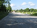 Road to Imber - geograph.org.uk - 486966.jpg 640 × 480; 79 KB
-
 Royal Tank Regiment workshops. - geograph.org.uk - 486954.jpg 640 × 480; 71 KB
-

-

-
 Southleigh Wood - geograph.org.uk - 348149.jpg 480 × 640; 37 KB
-
 St. Giles Garrison Church - geograph.org.uk - 143703.jpg 640 × 480; 60 KB
-
 Tank parking area, Imber Range - geograph.org.uk - 538719.jpg 640 × 477; 66 KB
-
 Tank washing area, Imber Range - geograph.org.uk - 538714.jpg 640 × 477; 68 KB
-

-
 The road to Imber - geograph.org.uk - 300360.jpg 640 × 480; 44 KB
-
 Woodcroft Wood - geograph.org.uk - 111095.jpg 640 × 480; 88 KB
-
 A36 Warminster bypass going west - geograph.org.uk - 1422900.jpg 640 × 474; 112 KB
-
 A36 Warminster bypass heading east - geograph.org.uk - 1422904.jpg 640 × 466; 120 KB
-
 Beneath Knap Hill - geograph.org.uk - 282652.jpg 640 × 480; 195 KB
-
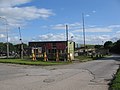
 Boreham, Warminster - geograph.org.uk - 240376.jpg 640 × 480; 87 KB
-
 Downs, West Stowell - geograph.org.uk - 282648.jpg 640 × 480; 170 KB
-
 Downs, West Stowell - geograph.org.uk - 282654.jpg 640 × 480; 111 KB
-

-
 The road from Imber - geograph.org.uk - 300357.jpg 640 × 480; 85 KB


