Category:Bomere Heath
Jump to navigation
Jump to search
English: Bomere Heath is a village in Shropshire, England lying north of the county town of Shrewsbury and in between Baschurch and Harlescott. It is situated between the A528 road and Berwick Road. The village sports a convenience store, a post office, garage, chip shop, hairdressers,and a pub, The Red Lion.
village in United Kingdom  | |||||
| Upload media | |||||
| Instance of | |||||
|---|---|---|---|---|---|
| Location | Pimhill, Shropshire, West Midlands, England | ||||
 | |||||
Media in category "Bomere Heath"
The following 21 files are in this category, out of 21 total.
-
 Birchymoor Coppice from across field - geograph.org.uk - 655566.jpg 640 × 480; 66 KB
-
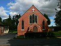 Bomere Heath Methodist church - geograph.org.uk - 567252.jpg 640 × 480; 96 KB
-
 Bomere Heath Wesleyan Chapel - geograph.org.uk - 567258.jpg 640 × 441; 66 KB
-
 Bridleways - geograph.org.uk - 567224.jpg 640 × 480; 99 KB
-
 Friesian Cattle - geograph.org.uk - 567298.jpg 640 × 480; 91 KB
-
 Grange Farm - geograph.org.uk - 567285.jpg 640 × 480; 86 KB
-
 House by the pedestrian crossing - geograph.org.uk - 1036717.jpg 640 × 480; 75 KB
-
 House on Broomhall Lane - geograph.org.uk - 655562.jpg 640 × 480; 102 KB
-
 Lane junction near Grange Farm - geograph.org.uk - 1036707.jpg 640 × 480; 67 KB
-

-

-
 Bowmere Heath Presbyterian - geograph.org.uk - 351786.jpg 640 × 480; 90 KB
-
 Pylons to the Sun - geograph.org.uk - 351790.jpg 480 × 640; 80 KB
-
 Rural scene with pylons - geograph.org.uk - 567923.jpg 640 × 480; 89 KB
-

-
 The Hayes - geograph.org.uk - 658731.jpg 640 × 480; 65 KB
-
 The Red Lion at Bomere Heath - geograph.org.uk - 1036708.jpg 640 × 480; 63 KB
-

-
 Wrexham to Shrewsbury Rail line - geograph.org.uk - 567235.jpg 480 × 640; 100 KB
-
 Footpath and Hedge - geograph.org.uk - 351798.jpg 640 × 480; 145 KB
-
 Road to Huffley - geograph.org.uk - 351800.jpg 640 × 480; 86 KB


