Category:Boll (Sauldorf)
Jump to navigation
Jump to search
quarter of Sauldorf, Baden-Württemberg, Germany  | |||||
| Upload media | |||||
| Instance of |
| ||||
|---|---|---|---|---|---|
| Location | Sauldorf, Landkreis Sigmaringen, Tübingen Government Region, Baden-Württemberg, Germany | ||||
| Area |
| ||||
| Elevation above sea level |
| ||||
 | |||||
Subcategories
This category has the following 3 subcategories, out of 3 total.
Media in category "Boll (Sauldorf)"
The following 7 files are in this category, out of 7 total.
-
 Cemetery - panoramio (4).jpg 4,320 × 2,629; 4.94 MB
-
 Feldkreuz SW von Boll bei Sauldorf 02.jpg 3,024 × 4,032; 5.24 MB
-
 Kriegerdenkmal in der Ortsmitte von Boll bei Sauldorf 04.jpg 3,024 × 4,032; 4.72 MB
-
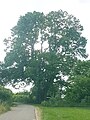 ND südlich am Reitplatz von Boll.jpg 3,024 × 4,032; 3.8 MB
-
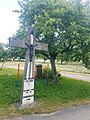
 Wegkreuz am Ortseingang von Boll an der Mainwanger Straße.jpg 3,024 × 4,032; 6.83 MB
-
 Wegkreuz am südlichen Ortsrand von Boll bei Sauldorf 01.jpg 3,024 × 4,032; 8.51 MB
-
 Wegkreuz am südlichen Ortsrand von Boll bei Sauldorf in der Schwandorfer Straße.jpg 3,024 × 4,032; 8.54 MB
.jpg)


