Category:Bogs in Ireland
Jump to navigation
Jump to search
Subcategories
This category has the following 3 subcategories, out of 3 total.
Media in category "Bogs in Ireland"
The following 37 files are in this category, out of 37 total.
-

-
 12 Bens from the Bog Road (6047392739).jpg 2,592 × 1,936; 1.51 MB
-
 Abbeyleix Bog Boardwalk.png 3,000 × 1,500; 7.61 MB
-
 Abhainn Bhoth Loiscthe (Owenboliska) - geograph.org.uk - 1270738.jpg 640 × 426; 182 KB
-
 Abhainn Bhoth Loiscthe (Owenboliska) - geograph.org.uk - 1270740.jpg 640 × 427; 200 KB
-
 Abhainn Bhoth Loiscthe (Owenboliska) - geograph.org.uk - 1270952.jpg 640 × 427; 183 KB
-
 Adjacent forest (Clonreher Bog).jpg 4,056 × 2,280; 4.84 MB
-
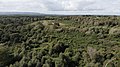
 Aerial shot of Clonreher Bog.jpg 4,056 × 2,280; 4 MB
-
 Bog deal - geograph.org.uk - 1537305.jpg 480 × 640; 127 KB
-
 Bog land near Lough Yganavan - geograph.org.uk - 774890.jpg 633 × 414; 83 KB
-
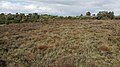
 Bog on Cró na Saileach - geograph.org.uk - 1352976.jpg 640 × 443; 81 KB
-
 Bog road to Roundstone, Connemara, County Galway, Ireland. December 2007 - panoramio.jpg 3,264 × 2,448; 3.53 MB
-
 Bogland near Killerry wood - geograph.org.uk - 1638538.jpg 1,080 × 810; 506 KB
-
 Bogland near Sradoon - geograph.org.uk - 1638542.jpg 640 × 480; 49 KB
-
 Clonreher Bog, facing north.jpg 4,056 × 2,280; 5.52 MB
-
 Corralanna, Co. Westmeath - geograph.org.uk - 1003301.jpg 640 × 427; 87 KB
-
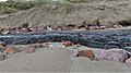
 Cutting turf in Carna.jpg 3,024 × 4,032; 3.9 MB
-
 Discharging Peat, Bord na Mona Railway, Srahmore , Co Mayo. March 1991 (4037378313).jpg 1,776 × 1,164; 126 KB
-
 Glenamoy Bog Complex.jpg 6,000 × 4,000; 6.25 MB
-
 Heather growing on Clonreher Bog.jpg 4,056 × 2,280; 5.69 MB
-
 Irish bog 2.jpg 2,592 × 1,944; 814 KB
-
 IRL Jan99 30 (9277950711).jpg 2,977 × 2,314; 1.03 MB
-
 Lough Boora Parklands.JPG 4,288 × 2,848; 2.92 MB
-
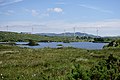
 Lough Derryduff & Wind Turbines.jpg 5,904 × 3,936; 5.76 MB
-
 Lough Derryduff near Portnoo.jpg 5,464 × 3,643; 3.44 MB
-
 Lough Derryduff.jpg 5,656 × 3,771; 5.42 MB
-
 Móin Trá-7298, Dingle Peninsula, Co. Kerry, Ireland.jpg 1,920 × 1,080; 594 KB
-
 Móin Trá-9372, Dingle Peninsula, Co. Kerry, Ireland.jpg 1,920 × 1,080; 764 KB
-
 Overgrown crannog, Achill Island.jpg 1,632 × 1,224; 397 KB
-
 Peat-bog-Ireland.jpg 640 × 480; 202 KB
-
 Road to the bog - geograph.org.uk - 1537364.jpg 640 × 480; 118 KB
-
 Slopes of Carrane HIll at Straduff - geograph.org.uk - 1630795.jpg 640 × 480; 93 KB
-
 The Big Bog - geograph.org.uk - 1089523.jpg 640 × 479; 62 KB
-
 Tourbière en Irlande.jpg 1,170 × 1,722; 378 KB
-
 West Of Ardara Maas Road SAC.jpg 5,861 × 1,704; 3.04 MB
-
 West Of Ardara Maas Road.jpg 6,000 × 4,000; 6.89 MB
-
 White Hill near Dunkineely - geograph.org.uk - 1702731.jpg 3,072 × 2,048; 2.66 MB
,_etc%27_(11149526756).jpg)
.jpg)

_-_geograph.org.uk_-_1270738.jpg)
_-_geograph.org.uk_-_1270740.jpg)
_-_geograph.org.uk_-_1270952.jpg)
.jpg)


.jpg)


.jpg)


