Category:Bodies of water in Yarmouth, Maine
Jump to navigation
Jump to search
Media in category "Bodies of water in Yarmouth, Maine"
The following 17 files are in this category, out of 17 total.
-
 1 Main Street, Yarmouth, Maine.jpg 1,536 × 2,048; 1.12 MB
-
 Brickyard Hollow 2, Yarmouth, Maine.jpg 2,436 × 1,026; 404 KB
-
 Brickyard Hollow, Yarmouth ME.jpg 1,928 × 1,314; 460 KB
-
 Broad Cove Yarmouth Maine.jpg 4,026 × 1,060; 608 KB
-
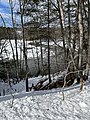
 Cleaves Brook.jpg 4,032 × 3,024; 6.59 MB
-
 Cousins River.jpg 3,024 × 4,032; 6.12 MB
-
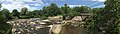 Grist Mill Park.jpg 8,432 × 2,384; 5.77 MB
-
 Larrabees Landing.jpeg 3,024 × 4,032; 3.39 MB
-
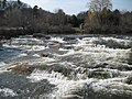
 Lower Falls, Yarmouth ME.jpg 664 × 584; 82 KB
-
 Lower Falls, Yarmouth, Maine.jpg 1,600 × 1,200; 1.29 MB
-
 Second Falls, Yarmouth, Maine.jpg 3,589 × 2,692; 3.08 MB
-
 Second Falls, Yarmouth.jpg 4,032 × 3,024; 3.09 MB
-
 White's Cove.jpg 4,032 × 3,024; 2.72 MB
-
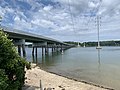
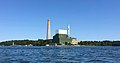 Wyman Power Station.jpg 3,132 × 1,657; 928 KB
-
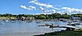
 Yarmouth Harbor, Yarmouth, Maine 2.jpg 4,002 × 1,655; 1.48 MB
-
 Yarmouth Harbor, Yarmouth, Maine.jpg 4,032 × 1,796; 1.57 MB
-
 Yarmouth harbor.jpg 2,454 × 930; 529 KB


