Category:Bodicote
Jump to navigation
Jump to search
village and civil parish in Cherwell district, Oxfordshire, England  Eglwys Sant Ioan Fedyddiwr, Bodicote | |||||
| Upload media | |||||
| Instance of | |||||
|---|---|---|---|---|---|
| Location | Cherwell, Oxfordshire, South East England, England | ||||
| Population |
| ||||
| Area |
| ||||
| official website | |||||
 | |||||
Main Wikipedia article: Bodicote.
Subcategories
This category has the following 4 subcategories, out of 4 total.
Media in category "Bodicote"
The following 122 files are in this category, out of 122 total.
-
 'Ivy Cottage', aka ^32 High Street - geograph.org.uk - 3723559.jpg 1,024 × 683; 170 KB
-
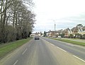 A4260 north of Bodicote - geograph.org.uk - 3403236.jpg 3,325 × 2,563; 1.41 MB
-
-
 A4260 west of Bodicote Park - geograph.org.uk - 3403215.jpg 3,648 × 2,736; 1.48 MB
-
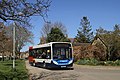 AlexanderDennis Dart Enviro200 EU08 FHC Bodicote.jpg 938 × 626; 578 KB
-
 Back of ^10 Walton Close - geograph.org.uk - 3723133.jpg 1,024 × 683; 249 KB
-
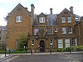 Banbury Registry Office, Bodicote - geograph.org.uk - 1890093.jpg 3,296 × 2,472; 1.9 MB
-
 Banbury Road at Bodicote - geograph.org.uk - 2836478.jpg 640 × 481; 54 KB
-
 Banbury Road into Bodicote - geograph.org.uk - 4065500.jpg 1,500 × 999; 181 KB
-
 Banbury Road looking north - geograph.org.uk - 4065502.jpg 1,500 × 999; 128 KB
-
 Bench in the Park, Bodicote - geograph.org.uk - 6006010.jpg 5,152 × 3,864; 3.57 MB
-
 Benchmark on Bodicote Mill House - geograph.org.uk - 3723301.jpg 683 × 1,024; 227 KB
-
 Benchmark on Cotefield House, Banbury Road - geograph.org.uk - 3721380.jpg 683 × 1,024; 266 KB
-
 Benchmark on Draycott House, East Street - geograph.org.uk - 3723164.jpg 683 × 1,024; 285 KB
-
-
 Benchmark on Sorbrook Mill - geograph.org.uk - 3723537.jpg 683 × 1,024; 247 KB
-

-
 Benchmark on ^1 Woodlands, Weeping Cross - geograph.org.uk - 3723075.jpg 683 × 1,024; 188 KB
-
 Benchmark on ^10 Walton Close - geograph.org.uk - 3723119.jpg 683 × 1,024; 212 KB
-
 Benchmark on ^65 Oxford Road - geograph.org.uk - 3723633.jpg 683 × 1,024; 169 KB
-
 Bloxham Grove Farm Mill - geograph.org.uk - 264381.jpg 640 × 420; 81 KB
-
 Grants Lock on the Southern Oxford Canal - geograph.org.uk - 30776.jpg 640 × 480; 100 KB
-
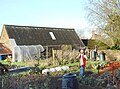
 Bodicote allotments - geograph.org.uk - 150182.jpg 640 × 480; 158 KB
-
 Bodicote cemetery - geograph.org.uk - 150940.jpg 640 × 480; 151 KB
-
 Bodicote Cemetery - geograph.org.uk - 2540739.jpg 2,000 × 1,494; 352 KB
-
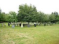 Bodicote Cemetery - geograph.org.uk - 4594206.jpg 640 × 480; 85 KB
-
 Bodicote Cemetery, mid November 2017 - geograph.org.uk - 5619029.jpg 640 × 480; 97 KB
-
 Bodicote Church - geograph.org.uk - 4766727.jpg 1,600 × 1,200; 544 KB
-
 Bodicote Church House - geograph.org.uk - 6004695.jpg 5,152 × 3,864; 2.89 MB
-
 Bodicote Horse&Jockey.jpg 1,280 × 852; 625 KB
-
 Bodicote Mill House - geograph.org.uk - 3723449.jpg 683 × 1,024; 271 KB
-
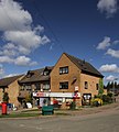 Bodicote MolyneuxDrive shop SE.jpg 887 × 985; 593 KB
-
 Bodicote MolyneuxDrive shop south.jpg 932 × 1,035; 594 KB
-

-
 Bodicote, St John the Baptist - geograph.org.uk - 3960783.jpg 4,320 × 3,240; 5.56 MB
-
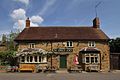
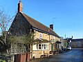
 Bodicote, The Horse and Jockey - geograph.org.uk - 4594159.jpg 640 × 479; 63 KB
-
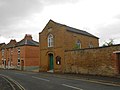 Bodicote, The Methodist Church - geograph.org.uk - 4594110.jpg 640 × 481; 49 KB
-
 Bodicote, The Plough - geograph.org.uk - 4594129.jpg 640 × 490; 66 KB
-
 Bodicote-East Street - geograph.org.uk - 4766722.jpg 1,600 × 1,200; 350 KB
-
 Canal Lane - geograph.org.uk - 4351673.jpg 640 × 480; 73 KB
-
 Chapel Lane from East Street - geograph.org.uk - 3723177.jpg 683 × 1,024; 203 KB
-
 Chapel Lane, Bodicote - geograph.org.uk - 6004700.jpg 3,864 × 5,152; 2.51 MB
-
 Church Street, Bodicote - geograph.org.uk - 1893418.jpg 1,600 × 1,200; 1.04 MB
-

-
 Cotefield Garden Centre at Bodicote - geograph.org.uk - 1391459.jpg 640 × 427; 67 KB
-
 Cotefield House, Banbury Road - geograph.org.uk - 3721409.jpg 1,024 × 683; 168 KB
-

-
 Field next to allotments near Bodicote - geograph.org.uk - 2540753.jpg 2,000 × 1,498; 400 KB
-
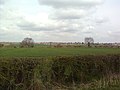
 Fields near Bodicote - geograph.org.uk - 6004721.jpg 4,635 × 3,273; 2.67 MB
-
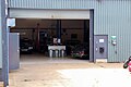 Garage at Jensen International Limited, Bodicote, Banbury.jpg 5,929 × 3,953; 9.49 MB
-

-

-
 Health Club and Spa, Bodicote - geograph.org.uk - 6281207.jpg 800 × 535; 85 KB
-
 Houses on Oxford Road, Bodicote - geograph.org.uk - 6281196.jpg 800 × 600; 123 KB
-
 Houses on Oxford Road, Bodicote - geograph.org.uk - 6281200.jpg 800 × 502; 92 KB
-

-
-

-
-

-

-

-
 Junction of Broad Gap and High Street - geograph.org.uk - 6004702.jpg 4,253 × 3,166; 1.76 MB
-
 Lane from Bodicote Mill towards the Church - geograph.org.uk - 3723498.jpg 1,024 × 683; 248 KB
-
 Looking south across the Sor Brook - geograph.org.uk - 2906669.jpg 1,600 × 1,200; 465 KB
-
 Looking towards Bloxham from Bloxham Grove Road - geograph.org.uk - 2906612.jpg 1,600 × 1,200; 450 KB
-
 Lower Grove Mill - geograph.org.uk - 3721430.jpg 1,024 × 683; 152 KB
-
 Metal pallets near Twyford - geograph.org.uk - 1325106.jpg 640 × 427; 86 KB
-
 New Bodicote House.jpg 4,080 × 3,060; 4.42 MB
-
 Old Bodicote House.jpg 4,080 × 3,060; 3.08 MB
-
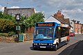 Optare Solo OU10GFG Bodicote.jpg 1,280 × 851; 620 KB
-
 Over the Churchyard Wall - geograph.org.uk - 6004714.jpg 4,831 × 2,966; 1.98 MB
-
 Banbury-Bodicote- Oxford Road - geograph.org.uk - 287042.jpg 640 × 480; 94 KB
-
 Oxford Road - geograph.org.uk - 1340996.jpg 640 × 457; 313 KB
-
 Oxford Road - geograph.org.uk - 1341003.jpg 640 × 457; 288 KB
-
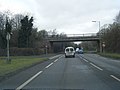
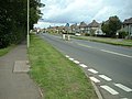
 Oxford Road at Bodicote - geograph.org.uk - 4499285.jpg 1,024 × 686; 243 KB
-
 Oxford Road, Bodicote - geograph.org.uk - 6062059.jpg 1,888 × 1,228; 1.68 MB
-
 Oxford Road, Bodicote - geograph.org.uk - 6062060.jpg 1,920 × 1,280; 1.62 MB
-
 Oxford Road, Bodicote - geograph.org.uk - 6281198.jpg 800 × 600; 110 KB
-
 Oxford Road, Bodicote - geograph.org.uk - 6281205.jpg 800 × 600; 120 KB
-

-
 Pavilion at Bodicote - geograph.org.uk - 6005998.jpg 3,204 × 1,938; 782 KB
-
 Petrol station on Oxford Road, Banbury - geograph.org.uk - 4499290.jpg 1,024 × 693; 171 KB
-
 Scarecrow in the Vegetable Garden - geograph.org.uk - 6004710.jpg 4,270 × 3,157; 2.65 MB
-
 Service station on Oxford Road, Banbury - geograph.org.uk - 6281193.jpg 800 × 600; 100 KB
-
 Sor Brook, to the west of Lower Grove Mill - geograph.org.uk - 2906639.jpg 1,200 × 1,600; 698 KB
-
 Sorbrook Mill - geograph.org.uk - 3723549.jpg 683 × 1,024; 217 KB
-
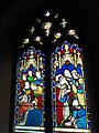
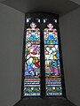
 St John the Baptist church - geograph.org.uk - 3721358.jpg 1,024 × 683; 280 KB
-

-

-

-

-

-

-

-

-

-
-
-

-
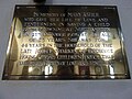
 St John the Baptist, Bodicote, organ - geograph.org.uk - 5619889.jpg 640 × 480; 77 KB
-

-

-

-

-

-
-
-

-

-
 St Mary's Church, Bloxham - geograph.org.uk - 1893097.jpg 1,600 × 1,200; 484 KB
-

-
 The Horse and Jockey - geograph.org.uk - 6004719.jpg 5,152 × 3,864; 2.55 MB
-
 The small reservoir at Lower Grove Mill - geograph.org.uk - 2906656.jpg 1,600 × 1,200; 433 KB
-
 The tower of St John the Baptist's Church - geograph.org.uk - 3723292.jpg 683 × 1,024; 209 KB
-

-
 Tree-lined footpath towards Banbury - geograph.org.uk - 5581872.jpg 1,024 × 684; 317 KB
-
 Walking west out of Bodicote - geograph.org.uk - 2906665.jpg 1,200 × 1,600; 660 KB
-
 Water project - geograph.org.uk - 1341554.jpg 640 × 457; 312 KB
-
 Weir on the Sor Brook at Lower Grove Mill - geograph.org.uk - 2906653.jpg 1,600 × 1,200; 690 KB
-
 Woodlands, Weeping Cross - geograph.org.uk - 3723095.jpg 1,024 × 683; 289 KB
-
 ^65 Oxford Road, 'Glenmore' - geograph.org.uk - 3723655.jpg 1,024 × 683; 140 KB


_-_geograph.org.uk_-_5619166.jpg)
_-_geograph.org.uk_-_5619168.jpg)
_-_geograph.org.uk_-_5619200.jpg)
_-_geograph.org.uk_-_5619857.jpg)
_-_geograph.org.uk_-_5619859.jpg)
_-_geograph.org.uk_-_5619862.jpg)
_-_geograph.org.uk_-_5619864.jpg)


_-_geograph.org.uk_-_5619161.jpg)
_-_geograph.org.uk_-_5619164.jpg)

_-_geograph.org.uk_-_5619881.jpg)
_-_geograph.org.uk_-_5619883.jpg)
_-_geograph.org.uk_-_5619887.jpg)
_-_geograph.org.uk_-_5619896.jpg)
_-_geograph.org.uk_-_5619900.jpg)
_-_geograph.org.uk_-_5619902.jpg)
_-_geograph.org.uk_-_5619903.jpg)


_-_geograph.org.uk_-_5619866.jpg)
_-_geograph.org.uk_-_5619868.jpg)
_-_geograph.org.uk_-_5619869.jpg)
_-_geograph.org.uk_-_5619871.jpg)
_-_geograph.org.uk_-_5619874.jpg)
_-_geograph.org.uk_-_5619877.jpg)
_-_geograph.org.uk_-_5619878.jpg)
_-_geograph.org.uk_-_5619879.jpg)


