Category:Blymhill and Weston-under-Lizard
Jump to navigation
Jump to search
English: Blymhill and Weston-under-Lizard is a civil parish in the South Staffordshire district, in the county of Staffordshire, England.
civil parish in Staffordshire, England, UK  | |||||
| Upload media | |||||
| Instance of | |||||
|---|---|---|---|---|---|
| Named after | |||||
| Location | South Staffordshire, Staffordshire, West Midlands, England | ||||
| Population |
| ||||
 | |||||
Subcategories
This category has the following 6 subcategories, out of 6 total.
Media in category "Blymhill and Weston-under-Lizard"
The following 200 files are in this category, out of 274 total.
(previous page) (next page)-
 "No Tipping", it says.... - geograph.org.uk - 1942795.jpg 717 × 538; 194 KB
-
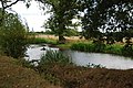
 A fishing pool at Lucknow Farm - geograph.org.uk - 2949542.jpg 1,142 × 857; 403 KB
-
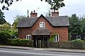
 A house near Merry Hill - geograph.org.uk - 2725932.jpg 800 × 600; 210 KB
-
 A Long Narrow Lane - geograph.org.uk - 2570819.jpg 428 × 640; 91 KB
-
 A narrow lane - geograph.org.uk - 2034258.jpg 640 × 480; 143 KB
-
 A5 at Staffordshire border - geograph.org.uk - 3518852.jpg 640 × 400; 67 KB
-
 A5 at Weston Park east entrance - geograph.org.uk - 3518883.jpg 640 × 423; 137 KB
-
 A5 through Weston under Lizard - geograph.org.uk - 3518866.jpg 640 × 451; 80 KB
-
 A5, Weston under Lizard - geograph.org.uk - 6157126.jpg 800 × 600; 121 KB
-
 Access to a field near Lodge Farm - geograph.org.uk - 2031169.jpg 640 × 480; 108 KB
-
 Along King Street - geograph.org.uk - 3402937.jpg 1,142 × 857; 309 KB
-
 Another Country Lane - geograph.org.uk - 2570274.jpg 640 × 428; 98 KB
-
 Another Crop Gathered In - geograph.org.uk - 2570835.jpg 640 × 428; 84 KB
-
 Approaching the A5 - geograph.org.uk - 2570841.jpg 640 × 428; 69 KB
-

-
 B5314 towards the A41 - geograph.org.uk - 6157112.jpg 800 × 600; 135 KB
-
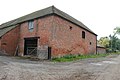
 Barn at Cross Roads Farm - geograph.org.uk - 3674830.jpg 1,600 × 1,064; 560 KB
-
 Barn, Grove Farm, Blymhill - geograph.org.uk - 6237177.jpg 800 × 600; 101 KB
-
 Barns on Brockhurst Lane - geograph.org.uk - 4899065.jpg 1,200 × 799; 326 KB
-
 Beighterton crossroads - geograph.org.uk - 1939327.jpg 819 × 614; 201 KB
-
 Beighterton Farm - geograph.org.uk - 1938727.jpg 922 × 691; 186 KB
-
 Beighterton Lane - geograph.org.uk - 2725912.jpg 800 × 600; 250 KB
-
 Beighterton Lane from Hatch Lane - geograph.org.uk - 4898840.jpg 1,200 × 787; 398 KB
-

-
 Bend on Back Lane, Blymhill Common - geograph.org.uk - 6237011.jpg 800 × 600; 155 KB
-
 Birchmoor Lane leaves King Street - geograph.org.uk - 3402942.jpg 1,142 × 857; 341 KB
-
 Border country - geograph.org.uk - 2119547.jpg 640 × 480; 87 KB
-
 Bradford Arms, Ivetsey Bank.jpg 1,024 × 768; 232 KB
-
 Bridleway at Coneygreaves - geograph.org.uk - 2462600.jpg 1,101 × 826; 325 KB
-
 Bridleway to Brockton Grange - geograph.org.uk - 3674700.jpg 1,600 × 1,064; 368 KB
-
 Bridleway To Wheaton Aston - geograph.org.uk - 2323910.jpg 1,496 × 1,122; 784 KB
-
 Bridleway towards Walton - geograph.org.uk - 2969781.jpg 1,044 × 783; 333 KB
-
 Brineton Grange - geograph.org.uk - 2570755.jpg 640 × 428; 72 KB
-
 Brockhurst Lane towards the A5 - geograph.org.uk - 4899051.jpg 1,200 × 799; 340 KB
-
 Brockhurst Lane, Blymhill - geograph.org.uk - 6237178.jpg 800 × 600; 112 KB
-
 Brockhurst Lane, Blymhill - geograph.org.uk - 6237226.jpg 800 × 600; 96 KB
-
 Brockhurst Road - geograph.org.uk - 6237297.jpg 800 × 600; 167 KB
-
 Brockhurst Road - geograph.org.uk - 6237302.jpg 800 × 600; 146 KB
-

-
 Caravan Club site at Wyndford Mill farm - geograph.org.uk - 2969752.jpg 1,142 × 857; 354 KB
-
 Caravan in Field Near White Sitch - geograph.org.uk - 2588879.jpg 640 × 428; 81 KB
-
 Cereal crop near Lower Brockhurst Farm - geograph.org.uk - 6237291.jpg 800 × 600; 102 KB
-
 Cereal crop near Wrestlers Farm - geograph.org.uk - 6237299.jpg 800 × 600; 109 KB
-

-
 Chatwell Lane, Cross Roads - geograph.org.uk - 6237204.jpg 2,848 × 2,136; 1.38 MB
-
 Chatwell Park Farm - geograph.org.uk - 2462656.jpg 1,152 × 864; 279 KB
-

-
 Cottage at Ivetsey Bank - geograph.org.uk - 1942788.jpg 819 × 614; 185 KB
-
 Cottage on Brockhurst Lane, Blymhill - geograph.org.uk - 6237180.jpg 800 × 600; 163 KB
-
 Cottages, Weston under Lizard - geograph.org.uk - 6157113.jpg 800 × 549; 74 KB
-
 Country Crossroads - geograph.org.uk - 2565485.jpg 640 × 428; 65 KB
-
 Cow pasture at High Hall Farm - geograph.org.uk - 3674650.jpg 1,600 × 1,064; 323 KB
-
 Crop field beside the A41 - geograph.org.uk - 6157101.jpg 640 × 480; 65 KB
-
 Crop field off the B5314 - geograph.org.uk - 6157111.jpg 800 × 600; 95 KB
-

-
 Crossroads at Ivetsey Bank - geograph.org.uk - 3518889.jpg 640 × 462; 90 KB
-
 Crossroads of estate tracks - geograph.org.uk - 1942141.jpg 870 × 653; 185 KB
-
 Cycling home - geograph.org.uk - 2031419.jpg 640 × 480; 106 KB
-
 Derelict Barn and Calves - geograph.org.uk - 2565459.jpg 640 × 428; 90 KB
-
 Disused postbox at Blymhill - geograph.org.uk - 4899045.jpg 799 × 1,200; 442 KB
-
 Drain off King Street - geograph.org.uk - 6237309.jpg 640 × 480; 120 KB
-
 Dried pond in Burnt Withy copse - geograph.org.uk - 2740967.jpg 979 × 734; 387 KB
-
 East end of Weston under Lizard - geograph.org.uk - 3518872.jpg 640 × 476; 103 KB
-
 Elizabeth II postbox on Brockhurst Lane, Blymhill - geograph.org.uk - 6237220.jpg 2,136 × 2,848; 1.2 MB
-
 Elizabeth II postbox on Watling Street, Weston-under-Lizard - geograph.org.uk - 6159155.jpg 4,554 × 3,379; 2.96 MB
-
 Entering Staffordshire - geograph.org.uk - 6237002.jpg 800 × 511; 114 KB
-
 Entrance to a Farm - geograph.org.uk - 2570808.jpg 640 × 428; 79 KB
-
 Entrance to Beighterton House Farm - geograph.org.uk - 2588973.jpg 640 × 428; 117 KB
-
 Entrance to Grange Barn, Blymhill - geograph.org.uk - 4899047.jpg 1,200 × 799; 553 KB
-
 Entrance to Orslow Manor Farm - geograph.org.uk - 2565466.jpg 640 × 428; 82 KB
-
 Entrance to The Old Rectory - geograph.org.uk - 2585917.jpg 640 × 428; 99 KB
-
 Entrance to the Old Rectory, Blymhill - geograph.org.uk - 4898995.jpg 1,200 × 846; 487 KB
-
 Entrance to Tong Lodge from Mill Lane - geograph.org.uk - 4898821.jpg 1,200 × 799; 521 KB
-
 Entrance to Weston Hall - geograph.org.uk - 3518859.jpg 640 × 386; 70 KB
-
 Estate Cottages - geograph.org.uk - 3674615.jpg 1,600 × 1,064; 533 KB
-
 Farm building, Blymhill Lawn - geograph.org.uk - 6237285.jpg 800 × 600; 119 KB
-
 Farm buildings, High Hall Farm - geograph.org.uk - 6237181.jpg 800 × 600; 96 KB
-
 Farm pool in the corner of a field - geograph.org.uk - 2969757.jpg 1,077 × 808; 365 KB
-
 Farm track across Guy's Bank - geograph.org.uk - 2462227.jpg 1,152 × 864; 320 KB
-
 Farm Track Between Fields - geograph.org.uk - 2570760.jpg 640 × 428; 90 KB
-
 Farm track off Brockhurst Lane, Blymhill - geograph.org.uk - 6237225.jpg 800 × 600; 133 KB
-
 Farming activity - geograph.org.uk - 5869387.jpg 1,024 × 680; 197 KB
-
 Farmland at Beighterton crossroads - geograph.org.uk - 3674688.jpg 1,600 × 1,064; 413 KB
-
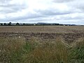
 Farmland near Weston-under-Lizard - geograph.org.uk - 5869380.jpg 1,024 × 680; 235 KB
-
 Farmland opposite High Hall - geograph.org.uk - 5869393.jpg 1,024 × 680; 183 KB
-
 Field entrance off Gatherwynd Lane - geograph.org.uk - 6237017.jpg 800 × 600; 130 KB
-
 Field on the side of the B5314 - geograph.org.uk - 2588895.jpg 640 × 428; 75 KB
-
 Footpath Junction At Ivetsey Bank - geograph.org.uk - 2322825.jpg 1,496 × 1,122; 718 KB
-
 Footpath Near Ivetsey Bank - geograph.org.uk - 2322834.jpg 1,496 × 1,122; 603 KB
-
 Footpath off School Lane, Blymhill - geograph.org.uk - 4899007.jpg 1,200 × 799; 420 KB
-
 Footpath on a Tee Junction - geograph.org.uk - 2570823.jpg 640 × 428; 94 KB
-
 Footpath to Bithams Plantation and Orslow - geograph.org.uk - 2969755.jpg 1,044 × 783; 375 KB
-
 Footpath To Blymhill Lawns - geograph.org.uk - 2322841.jpg 1,496 × 1,122; 739 KB
-
 Footpath To Blymhill Lawns - geograph.org.uk - 2323868.jpg 1,496 × 1,122; 887 KB
-
 Footpath To Ivetsey Bank - geograph.org.uk - 2322830.jpg 1,496 × 1,122; 925 KB
-
 Footpath To Ivetsey Bank - geograph.org.uk - 2323876.jpg 1,496 × 1,122; 1.08 MB
-
 Footpath To Wheaton Aston - geograph.org.uk - 2323922.jpg 1,496 × 1,122; 727 KB
-
 Footpath To Wheaton Aston - geograph.org.uk - 2323930.jpg 1,496 × 1,122; 776 KB
-

-
 Former Village School, Blymhill - geograph.org.uk - 4899003.jpg 1,200 × 799; 328 KB
-
 Former Village School, Blymhill - geograph.org.uk - 4899024.jpg 1,200 × 799; 374 KB
-
 Former Village School, Blymhill - geograph.org.uk - 4899041.jpg 1,200 × 799; 536 KB
-
 Gate to a footpath - geograph.org.uk - 2031591.jpg 640 × 480; 168 KB
-
 Gatherwynd Lane, Gatherwynd - geograph.org.uk - 6237016.jpg 800 × 600; 142 KB
-
 Grazing near Blymhill Marsh - geograph.org.uk - 6237167.jpg 640 × 480; 50 KB
-
 Grazing near High Hall Farm, Blymhill - geograph.org.uk - 6237224.jpg 800 × 600; 128 KB
-
 Grazing near Wrestlers Farm - geograph.org.uk - 6237294.jpg 800 × 600; 89 KB
-
 Grazing off King Street - geograph.org.uk - 6237310.jpg 800 × 600; 120 KB
-
 Grazing, Blymhill - geograph.org.uk - 6237176.jpg 800 × 600; 95 KB
-
 Grazing, Blymhill Common - geograph.org.uk - 6237005.jpg 800 × 615; 98 KB
-
 Grazing, Blymhill Lawn - geograph.org.uk - 6237287.jpg 800 × 600; 91 KB
-
 Grove Farm, Blymhill - geograph.org.uk - 6237175.jpg 800 × 600; 78 KB
-
 Hatch Lane at Beighterton Lane - geograph.org.uk - 2725911.jpg 800 × 600; 295 KB
-
 Hatch Lane towards Blymill - geograph.org.uk - 4898847.jpg 1,200 × 817; 475 KB
-
 Hatch Lane, Blymhill - geograph.org.uk - 4898992.jpg 1,200 × 815; 423 KB
-
 Hole in the Hedge, A5 - geograph.org.uk - 2588945.jpg 640 × 428; 96 KB
-
 House being renovated, Blymhill Common - geograph.org.uk - 6237008.jpg 800 × 600; 132 KB
-
 House on Back Lane, Blymhill Common - geograph.org.uk - 6237009.jpg 800 × 600; 125 KB
-
 House on Brockhurst Lane, Blymhill Lawn - geograph.org.uk - 6237213.jpg 2,136 × 2,848; 1.22 MB
-
 House on Chatwell Lane - geograph.org.uk - 2462658.jpg 896 × 672; 340 KB
-
 House on School Lane, Blymhill - geograph.org.uk - 6237173.jpg 640 × 480; 59 KB
-
 Houses on Brockhurst Lane - geograph.org.uk - 4899056.jpg 1,200 × 799; 409 KB
-
 Houses on Brockhurst Lane - geograph.org.uk - 4899068.jpg 1,200 × 908; 332 KB
-
 Houses on Brockhurst Lane, Blymhill - geograph.org.uk - 6237221.jpg 2,848 × 2,136; 1.49 MB
-
 Houses on the horizon - geograph.org.uk - 832672.jpg 640 × 480; 50 KB
-
 Houses, Gatherwynd - geograph.org.uk - 6237015.jpg 800 × 600; 138 KB
-
 In need of some TLC - geograph.org.uk - 697309.jpg 640 × 480; 57 KB
-
 Irrigation equipment at PDM salads - geograph.org.uk - 3674783.jpg 1,600 × 1,064; 368 KB
-
 Ivetsey Bank Farm - geograph.org.uk - 2467169.jpg 640 × 428; 70 KB
-
 Jubilee Grove - geograph.org.uk - 3685076.jpg 1,600 × 1,064; 458 KB
-
 Just a narrow lane, with a bend or two - geograph.org.uk - 1938723.jpg 691 × 518; 215 KB
-
 Just another tree-lined lane - geograph.org.uk - 832663.jpg 640 × 480; 115 KB
-
 King Street towards Marston - geograph.org.uk - 6237312.jpg 800 × 600; 127 KB
-
 Lane at High Hall summit - geograph.org.uk - 2031443.jpg 640 × 480; 91 KB
-
 Lay by near Brickyard Plantation - geograph.org.uk - 3518876.jpg 640 × 483; 63 KB
-
 Lower Beighterton Cottage - geograph.org.uk - 2725919.jpg 800 × 600; 311 KB
-
 Lower Beighterton Farm - geograph.org.uk - 2725922.jpg 800 × 600; 346 KB
-
 Mill Lane at Woodlands Lodge - geograph.org.uk - 2725904.jpg 800 × 600; 260 KB
-

-
 Minor road junction on Gatherwynd Lane - geograph.org.uk - 6237020.jpg 800 × 600; 193 KB
-
 Minor road junction, Blymhill Common - geograph.org.uk - 6237006.jpg 800 × 600; 157 KB
-
 Minor road near Blymhill Marsh - geograph.org.uk - 6237169.jpg 800 × 600; 131 KB
-
 Minor road near New House Farm - geograph.org.uk - 6237304.jpg 800 × 600; 100 KB
-
-
 Narrow Country Lane - geograph.org.uk - 2586033.jpg 640 × 428; 97 KB
-
 Narrow country road - geograph.org.uk - 5869415.jpg 680 × 1,024; 291 KB
-
 New House Farm - geograph.org.uk - 6237303.jpg 800 × 600; 85 KB
-
 New House Farm from the north - geograph.org.uk - 2969762.jpg 1,142 × 857; 358 KB
-
 New Village Hall - geograph.org.uk - 3674676.jpg 1,600 × 1,200; 360 KB
-
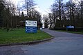
 No entry to Weston Park - geograph.org.uk - 3594467.jpg 1,024 × 891; 196 KB
-
 No overtaking on Watling Street (A5) - geograph.org.uk - 6157108.jpg 800 × 600; 196 KB
-

-
 Oilseed rape crop, Weston under Lizard - geograph.org.uk - 6157128.jpg 800 × 600; 105 KB
-
 Oilseed rape towards The Mount woodland - geograph.org.uk - 6157110.jpg 800 × 600; 167 KB
-
 Old Schoolhouse - geograph.org.uk - 3674671.jpg 1,600 × 1,200; 396 KB
-
 Old shop ^ Post Office - geograph.org.uk - 2031575.jpg 640 × 480; 111 KB
-
 OS benchmark - Cow Hey Wood, boundary wall - geograph.org.uk - 4432653.jpg 857 × 1,142; 568 KB
-
 OS benchmark - entrance to Weston Park - geograph.org.uk - 4429428.jpg 857 × 1,142; 564 KB
-
 OS benchmark - Weston Park boundary wall - geograph.org.uk - 4648916.jpg 857 × 1,142; 526 KB
-
 OS benchmark - Weston Park eastern entrance - geograph.org.uk - 4572863.jpg 857 × 1,142; 585 KB
-
 OS benchmark - Weston Park roadside wall - geograph.org.uk - 4648911.jpg 857 × 1,142; 569 KB
-
 OS benchmark - Weston Park roadside wall - geograph.org.uk - 4648914.jpg 857 × 1,142; 556 KB
-
 OS benchmark - Weston-under-Lizard, east end - geograph.org.uk - 4572177.jpg 857 × 1,142; 509 KB
-
 OS benchmark - Woodlands Lodge - geograph.org.uk - 4429444.jpg 857 × 1,142; 573 KB
-
 OS Flush Bracket 2488 - Peartree Cottage - geograph.org.uk - 4092575.jpg 857 × 1,142; 524 KB
-
 OS Flush Bracket 2490 - Merry Hill - geograph.org.uk - 3563275.jpg 734 × 979; 436 KB
-
 Out on the open road - geograph.org.uk - 2565814.jpg 640 × 428; 65 KB
-
 Over the Farm Gate - geograph.org.uk - 2570813.jpg 640 × 428; 92 KB
-
 Park Oak Farm, Bishops Wood - geograph.org.uk - 1942805.jpg 870 × 653; 181 KB
-
 Past Houses to Road Junction - geograph.org.uk - 2588578.jpg 640 × 428; 61 KB
-
 PDM Salads - geograph.org.uk - 3674771.jpg 1,600 × 1,064; 318 KB
-
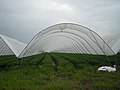 Polytunnels at New House Farm - geograph.org.uk - 832694.jpg 640 × 480; 61 KB
-
 Polytunnels in fields north of New House Farm - geograph.org.uk - 2969759.jpg 1,142 × 857; 368 KB
-
 Pool at Blymhill Common - geograph.org.uk - 3675471.jpg 1,600 × 1,200; 546 KB
-
 Prospect of Weston Park - geograph.org.uk - 4245238.jpg 3,264 × 1,578; 1.62 MB
-
 Red Brick Barn - geograph.org.uk - 2586003.jpg 640 × 428; 74 KB
-
 Red Brick Storage Barn on T Junction - geograph.org.uk - 2586018.jpg 640 × 428; 87 KB
-
 Remains of a pond in Picmoor Wood - geograph.org.uk - 1811223.jpg 640 × 480; 207 KB
-
 Road junction at Wollary House - geograph.org.uk - 3518887.jpg 640 × 390; 45 KB
-
 Road to Blymhil - geograph.org.uk - 5869379.jpg 1,024 × 680; 187 KB
-
 Roadside Pool - geograph.org.uk - 2565823.jpg 640 × 428; 112 KB
-
 Shrewsbury Gate, Weston Park - geograph.org.uk - 4898823.jpg 1,200 × 799; 488 KB
-
 Small Estate Cottages - geograph.org.uk - 3674623.jpg 1,600 × 1,064; 441 KB
-
 Southeast across fields to Bishops Wood - geograph.org.uk - 1942800.jpg 819 × 614; 202 KB
-
 Springtime colour - geograph.org.uk - 2927628.jpg 1,024 × 683; 309 KB
-
 St Mary's Church, Blymhill - geograph.org.uk - 4899015.jpg 1,200 × 799; 385 KB
-
 St Mary's Church, Blymhill - geograph.org.uk - 4899019.jpg 1,200 × 799; 318 KB
-
 Staffordshire farmland - geograph.org.uk - 2969767.jpg 1,306 × 979; 311 KB
-
 Stubble field near New House Farm - geograph.org.uk - 6237308.jpg 800 × 600; 114 KB
-
 Sundial at St Mary's Church, Blymhill - geograph.org.uk - 4899034.jpg 1,200 × 799; 609 KB
-
 The lane towards Blymhill Lawns - geograph.org.uk - 1939330.jpg 819 × 614; 199 KB
-
 The Marston Brook - geograph.org.uk - 3402951.jpg 734 × 979; 434 KB
-
 The Old Post Office on School Lane, Blymhill - geograph.org.uk - 4899044.jpg 1,200 × 799; 417 KB
-
 The Orslow Brook at Coneygreaves - geograph.org.uk - 2462234.jpg 1,152 × 864; 294 KB
-
 The Pheasantry - geograph.org.uk - 2969787.jpg 1,142 × 857; 387 KB
-
 The Red Lion PH - geograph.org.uk - 3674714.jpg 1,600 × 1,064; 312 KB
-
 The Red Lion pub - geograph.org.uk - 2462199.jpg 1,229 × 922; 322 KB
-
 The Red Lion, Great Chatwell - geograph.org.uk - 5235506.jpg 480 × 640; 62 KB
-
 The Road to Orslow - geograph.org.uk - 2565443.jpg 640 × 428; 69 KB
-
 The southern end of Park Pool - geograph.org.uk - 1940928.jpg 819 × 614; 194 KB


_-_geograph.org.uk_-_6157107.jpg)


_-_geograph.org.uk_-_6157104.jpg)


_near_Wrestlers_Farm_-_geograph.org.uk_-_6237295.jpg)


_-_geograph.org.uk_-_6157108.jpg)


